
Warm and wet replacing 'cold' and wet over NSW
Winter felt cold in NSW. And June was cold compared to long-term averages. July and August daytime temperatures were actually pretty close to average. But recent warm winters have de-climatised us to cold and, also, the number of rain days this July and August was unusually high with the cloudy, dreary conditions making it feel colder than it actually was a lot of the time.
As an example, Sydney totalled 33 rain days during July and August, the most since 1934. Away from the coast, Condobolin also had 33 rain days during this period, the most since records began in 1994. Cobar had 27, the most since records began in 1962.
It was a similar story in many other areas of NSW and resulted in the wettest July on record for parts of eastern NSW, and the wettest August on record for many central and western areas.
Now, September to date has also been wet. And is about to get wetter.
A trough and cold front brought widespread rainfall of 20-60mm about the central and western slopes and Tablelands on Thursday and Friday. Many coastal areas from Sydney northwards also picked up more than 15mm. Many parts of the state are now sitting at above average rainfall for September and it's only halfway through the month.
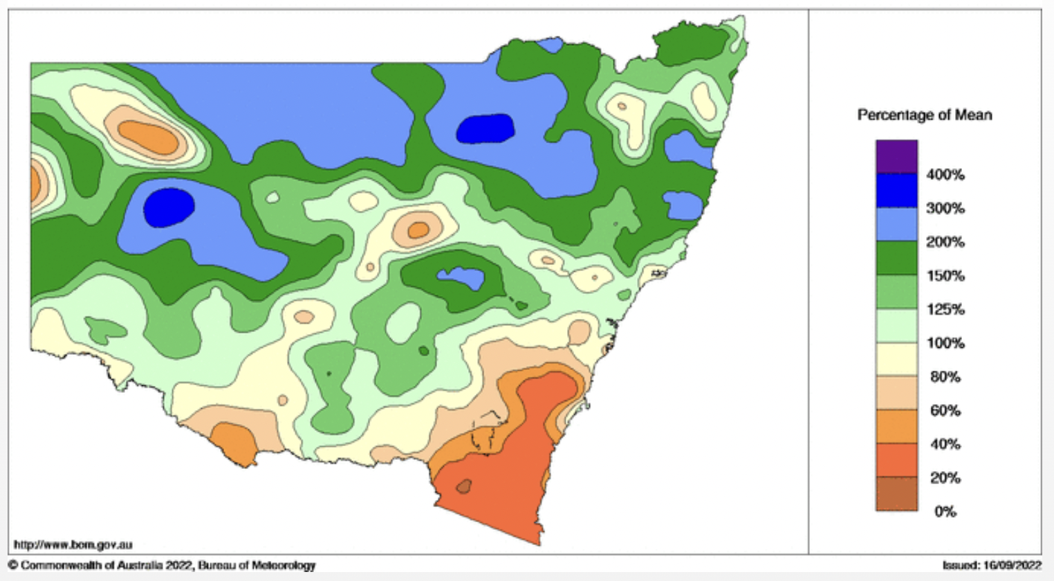
Image: Month to date rainfall percentages (relative to long-term averages) over NSW. Courtesy of bom.gov.au.
At least it's also warming up in line with the season. On Friday, coastal areas, including Sydney, Gosford and Coffs Harbour, recorded their warmest day since April or May, reaching the mid-twenties. Sydney also had an unseasonably warm night, with winds and high cloud keeping it above 16oC until it just dropped to 15.9oC soon after sunrise.
This warm pattern is set to continue for the coast over the weekend as dry (finally!) westerly winds warm over the Great Divide.
Further west, it's a different story. A series of cold fronts and troughs are pushing cloud and showers up against the ranges, bringing a cold, blustery weekend with significant alpine snow. The westerly airstream with embedded fronts is a classic set-up for stark weather differences between the coast and inland but has been unusually absent during this year's cool season.
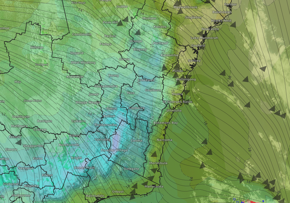
Image: Satellite picture with overlaid temperature and wind streamlines, showing the difference in temperature between the coast and tablelands/western slopes on Saturday.
Back to the forecast rain. A deep trough will cross the state between Tuesday and Thursday, bringing widespread rain and storms. Amounts are, as ever, subject to change, but it's likely at least 30mm will fall over large parts of the central west and northwest slopes and nearby tablelands, with isolated heavier falls and lesser amounts over the west.
Once the trough reaches the coast, there are early indications of a low forming that will funnel deep, moist northeast winds and heavy rain over near-coastal areas of the state.
Keep up to date with forecasts and warnings here: