
Warm and humid May breaks records
With the welcoming of a new month as well as a new season, we reminisce on the weather that made May so significant.
In literally every far-reaching corner of the country, notable highs and lows in moisture and temperature were observed for as long as records have been around.
- At Sydney Airport, May 2024 was the most humid May since records began in 2005 (2.3ºC average dewpoint departure from temperature).
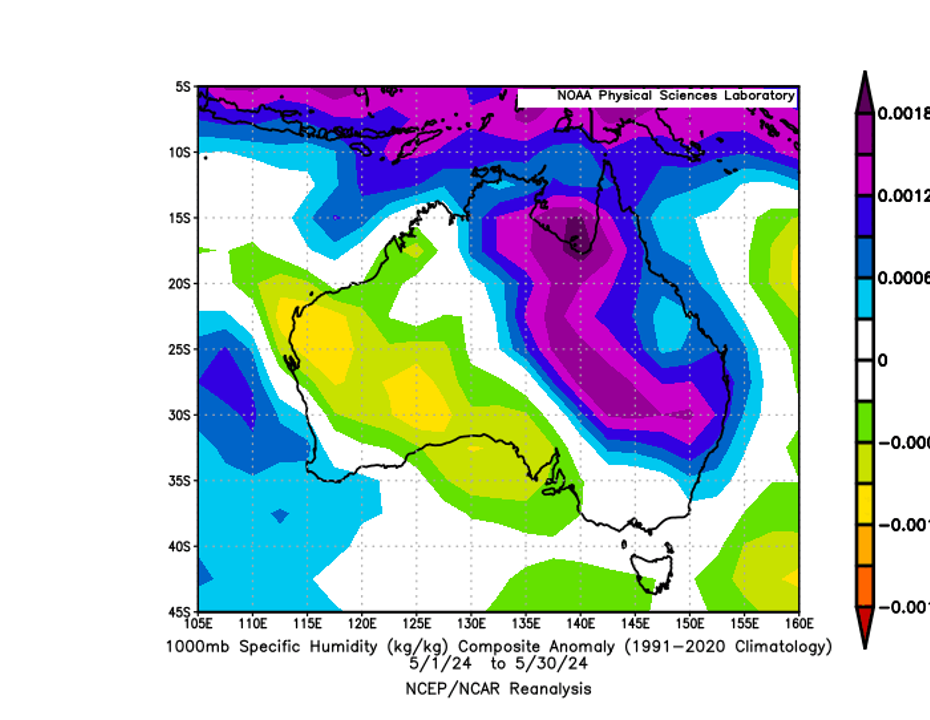
Figure 1: NOAA NCEP/NCAR Reanalysis showing the specific humidity anomaly over Australia for May 2024. Much of the east was exceptionally humid, whilst the west and south were drier.
- At Adelaide Airport, May 2024 was the 4th driest May (9.4mm over 3 rain days), as well as the 4th coolest average minimum May temperature since records began in 1955 (7.9ºC average).
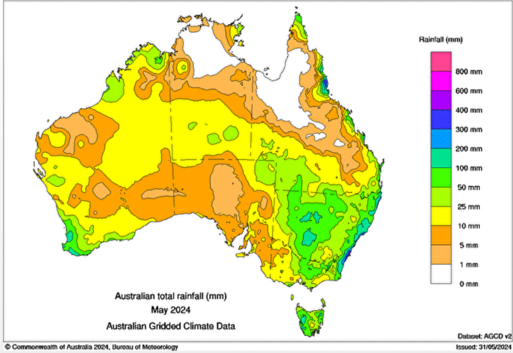
Figure 2: Total Australian rainfall in May 2024 (Bureau of Meteorology). South Australia has notably received minimal rainfall, whilst coastal New South Wales received a substantial amount.
- At Perth Airport, May 2024 saw the warmest average May temperature (19.2ºC) and the warmest average maximum May temperature (25.4ºC) since records began in 1944.
- At Darwin Airport, May 2024 was the 3rd warmest average May temperature (28.7ºC) and had warmest average maximum (33.7ºC) since records began in 1944.
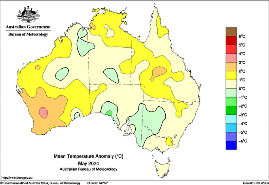
Figure 3: Mean temperature anomaly (ºC) across Australia during May 2024. Southwest WA and the NT's Top End stood out as warm areas during this time. Parts of South Australia have a signficant negative anomaly.
Moving into the month of June, we can expect the continuation of near-neutral El Nino Southern Oscillation conditions, a neutral Indian Ocean dipole, and a weak Madden-Julian Oscillation away from Australian waters.
Keep up to date with the latest forecasts on our website.