
Wall of cloud hits San Antonio, Chile
Residents of San Antonio were caught by surprise as a towering roll cloud charged up the west coast of Chile on Thursday afternoon.
The passage of a low pressure trough ahead of an approaching cold front caused a series of roll clouds to develop near Chile's west coast on Thursday.
San antonio city pic.twitter.com/EYsnJPkYDg
— Kathy😎 (@katamonsalve81) May 27, 2021
Satellite images showed the thin, parallel bands of cloud as they marched their way up the coast. These roll clouds were a type of undular bore that is similar to the Morning Glory cloud that’s regularly seen near the Gulf of Carpentaria in northern Australia.
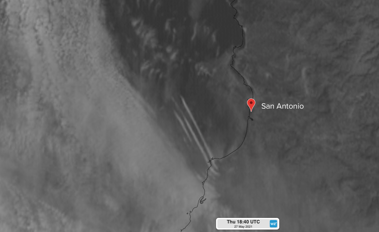
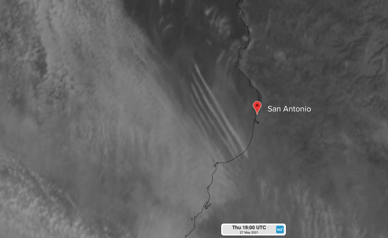
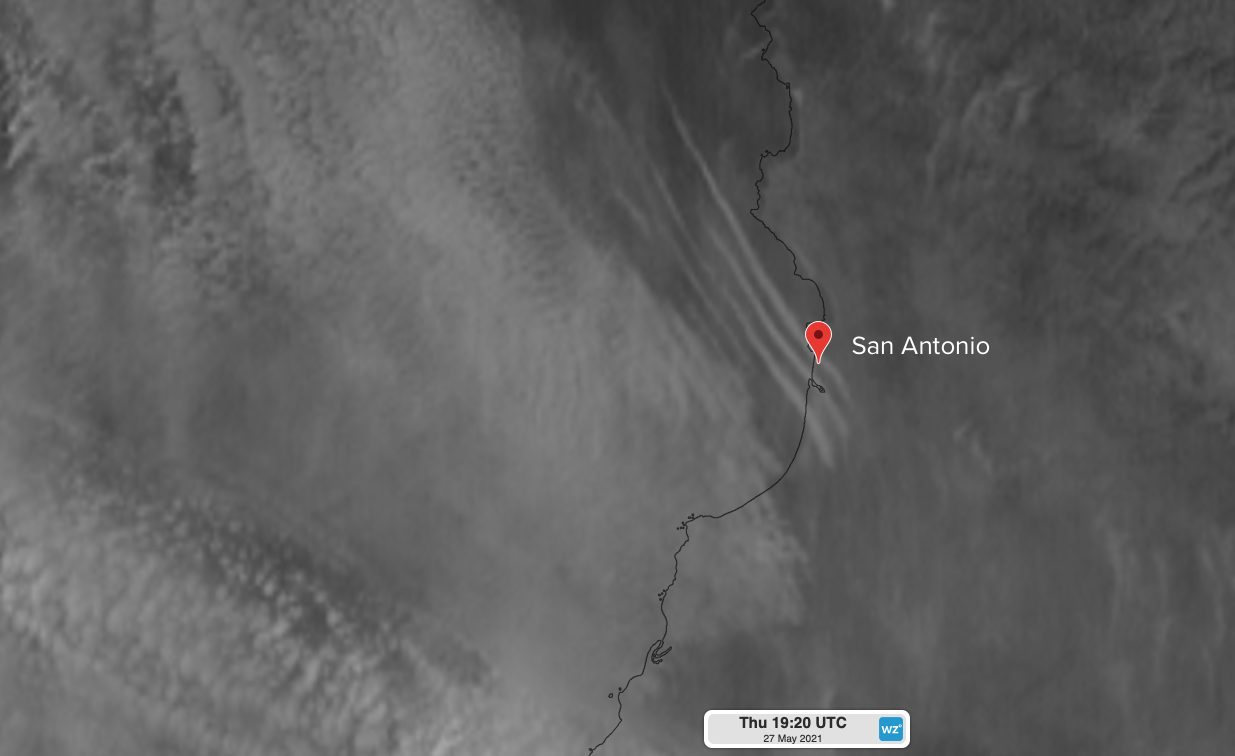
Images: Visible satellite images showing the roll clouds approaching and reaching San Antonio, Chile on Thursday afternoon. These images were each captured 20 minutes apart.
Roll clouds like this one are also common along Australia's east coast when cold fronts move across the Tasman Sea.
Roll clouds may look ominous, but they generally don't cause severe weather and often bring no rain. However, air rising at their leading edge and sinking on their backside can make it dangerous to fly near these mesmerising clouds.