
WA braces for more wet weather
A cold front will cross southwest Western Australia on Tuesday, bringing severe thunderstorms, showers, and locally heavy rainfall, followed by a cold airmass. Accumulating rainfall should reach 50-80mm in the South West and 20-40 mm over the Central and Lower West (including Perth) between Tuesday and Wednesday.
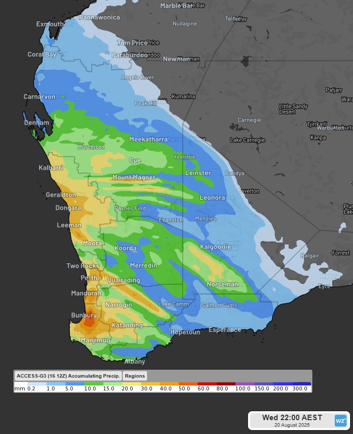
Image: Predicted accumulated rainfall to Wednesday 20th evening in the southwest WA, according to the ACCESS-G model. Source - Weatherzone
Perth should see another month of above average rainfall, making it the third month in a row to achieve this, as Anthony Sharwood wrote here. So far this month, Perth has received 110.8mm of rainfall, and with this front, the total accumulations may exceed the August long-term average (122.7mm).
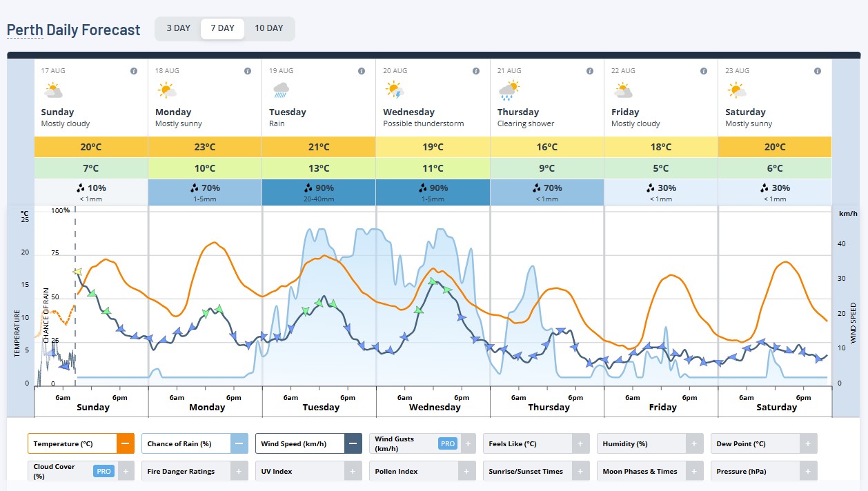
Image: Perth Daily Forecast. Source - Weatherzone
This system will also bring colder days later in the week, mainly on Wednesday. A cold airmass associated with a high pressure system will ease the showers from Thursday and bring chilly mornings late next week.
Check the forecast and the latest warning in your region here.