
Volatile weather returning to Australia's southeast and southwest next week
A change in the weather pattern over Australia will cause a dynamic mix of weather in the country’s southeast and southwest next week, with rain, thunderstorms, snow and potentially damaging winds on the cards.
Over the last few days, large areas of Australia have experienced benign weather under the influence of a large and slow-moving high pressure system. This high has acted like a shield in the atmosphere, keeping strong cold fronts and low pressure systems away from Australia.
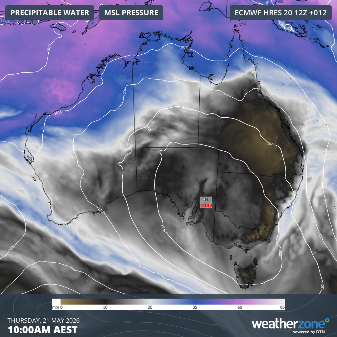
Image: Mean sea level pressure and precipitable water over Australia on Thursday morning this week, showing a large high pressure system centred over the country’s south and southeast. Source: Weatherzone.
This pattern is set to change in the coming days as the high moves out over the southern Tasman Sea, making way for more volatile weather over parts of Australia.
Upper-level cold pools arriving
The driving-force behind the impending wet and stormy weather will be two upper-level pools of cold air passing over southern Australia.
The first upper cold pool will move over southern WA and SA between Thursday and Sunday this week, before passing over southeastern Australia early-to-mid next week.
A second upper-level system will then reach the country’s southwest in the middle of next week, most likely around Wednesday or Thursday.
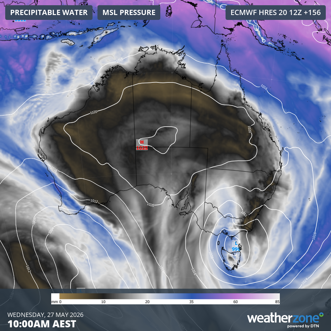
Image: Mean sea level pressure and precipitable water over Australia on Wednesday morning next week, showing a low pressure system over the country’s southeast and a cold front over the southwest. Source: Weatherzone.
While rain won’t be too heavy as the first system crosses WA and SA later this week, there is potential for heavy rain and severe weather over southeastern Australia next week as it causes a low pressure system to develop.
Being more than five days away, there is still a lot of uncertainty regarding the development of the low and its impacts next week. However, some forecast models predict that heavy rain could develop over parts of Tasmania, Victoria and New South Wales, most likely around Tuesday and Wednesday. In addition to rain, some areas could also see thunderstorms, snow and blustery winds.
The other upper-level cold pool could also bring a burst of rain, wind and storms to the southwest of Australia around Wednesday and Thursday next week. Again, there is uncertainty around the timing and strength of this system.
Anyone living in southeastern or southwestern Australia should monitor the latest forecasts and warnings over the coming week to stay up to date with the most accurate information on these developing systems. The Bureau of Meteorology will issue warnings if severe weather or severe thunderstorms are expected to occur.