
Vigorous cold front to rattle the southeast
A strong cold front will cross southeast Australia on Monday 16 June and Tuesday 17 June, generating gusty winds, widespread showers & a burst of fresh alpine snow as it pushes east across SA, Vic, Tas and southeast NSW.
On Monday the strongest winds will target SA, with Adelaide & the Mount Lofty Ranges likely to record gusts of 50–75 km/h as the front sweeps through. Vic can expect 70–85 km/h, with peaks near 90 km/h possible over the higher terrain in both Vic & Tas, while Melbourne may see 60–75 km/h. The blustery conditions will linger into Tuesday across Vic, Tas & parts of southeast NSW, where alpine areas could still register gusts approaching 85 km/h. Showers will sweep through most districts, and a few isolated thunderstorms may briefly push local totals to 20-50 mm, especially along coastal stretches and range country on the north and west coasts of Tas.
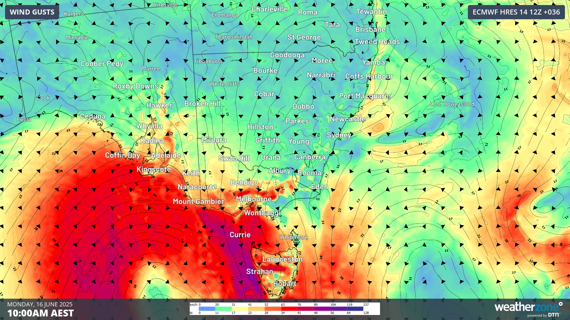
Image: 2m wind gust forecast across south east Australia, 10 am AEST Monday 16 June (ECMWF).
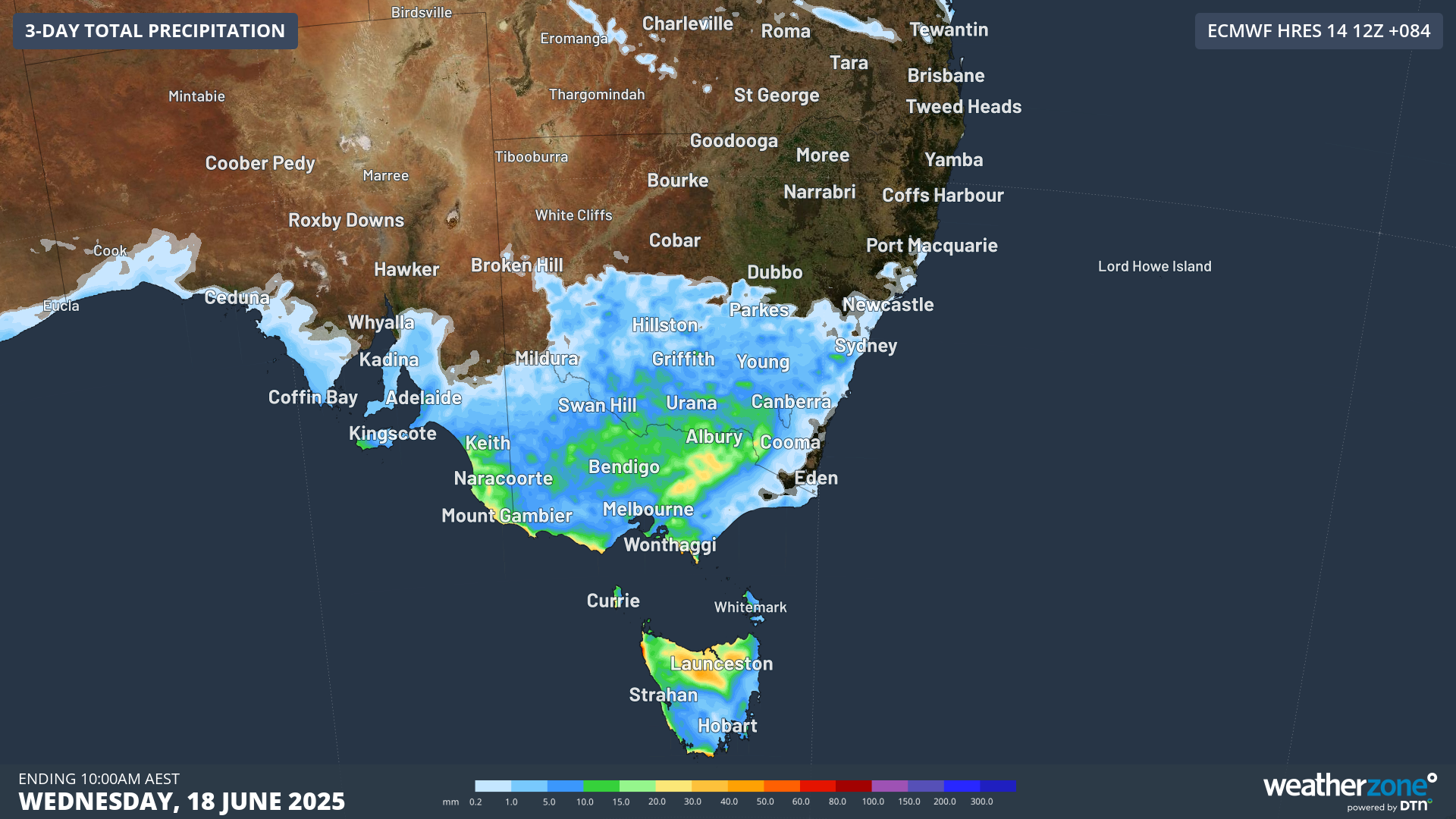
Image: Accumulated precipitation across south east Australia to 10 am AEST Wednesday 18 June (ECMWF).
Snow is expected to reach the Alps late Monday night, laying down another 10-15 cm by late Tuesday or early Wednesday. Those winds could stir up short-lived white-out conditions and poor visibility, so it may not be the most comfortable day on the slopes, though the fresh fall will help preserve a firm base for the resorts.
From mid-week a ridge of high pressure will slip in from the west, steadily easing the wind and allowing sunnier, calmer days to take hold through to Saturday—ideal for making the most of the new snow once conditions settle.