
Vast northwest cloudband to fuel cool, rainy weather
Like a huge sash across the chest of mainland Australia, a vast northwest cloudband stretching from the Indian Ocean to New South Wales is the dominant feature of Wednesday’s satellite image.
What is a northwest cloudband?
Northwest cloudbands form when warm, humid tropical air over the Indian Ocean passes over Australia. This airmass rises over cooler mid-latitude air and produces clouds as it moves towards the southeast.
These striking meteorological features mostly occur during the cooler months from April to September, and while they don’t always deliver heavy or widespread rain, their potential to deliver significant rainfall is enhanced by warm water off northwestern Australia.
Currently, Indian Ocean sea surface temperatures off northwestern Australia are warmer than usual for this time of year, especially in Indonesian waters.
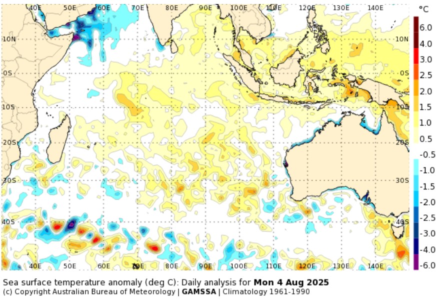
Image: Indian Ocean sea surface temperature anomalies on August 4, 2025. The thin strip of relatively cool water near the Australian coast (blue on the map) is too narrow to make a difference to the overall pattern of unseasonable warmth. Source: BoM.
How will this northwest cloudband affect Australia’s weather this week?
As we head towards the end of the working week and into the weekend, we can expect two main effects.
Cooler daytime temperatures at many inland locations due to cloud cover preventing daytime warming (even if little or no rain falls). For example:
- Yulara, near Uluru, was just 14.2°C at 12:30pm (ACST) this Wednesday under a thick cloud cover, and is looking likely to fall many degrees short of its average August maximum of 24°C both today and on Thursday.
- Alice Springs is expecting a maximum of just 17°C on Thursday, around six degrees below its average August maximum of 22.9°C.
- Thargomindah in the Channel Country of far SW Queensland will likely struggle to reach the BoM's predicted maximum of just 18°C on Friday, which is around five degrees below its average August maximum of 23.1°C.
- Tibooburra in the far NW corner of NSW can expected four days of maximums in the teens from this Wednesday through to Saturday, in a month when its average maximum is 21°C.
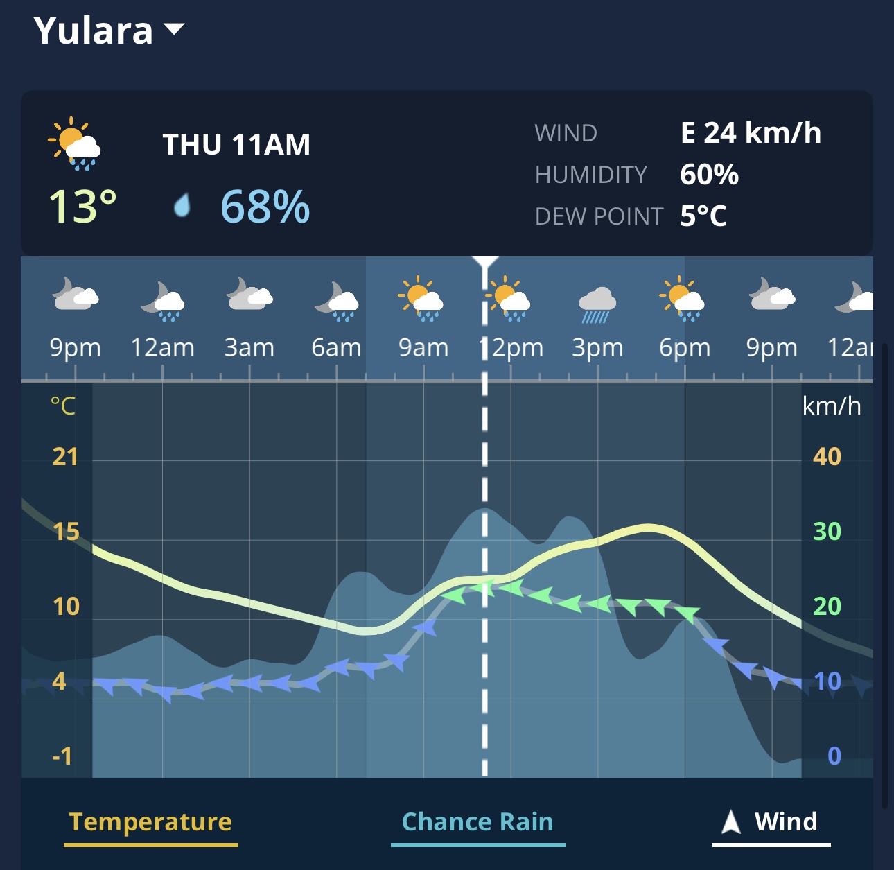
Image: Live temperatures and other weather data at Yulara on the Weatherzone app.
Enhanced rainfall potential is the other likely effect. As the stream of tropical moisture that's causing today's northwest cloudband shifts further east later this week, it will fuel rainfall over parts of Queensland and NSW.
An injection of moisture from the Coral Sea will also contribute to the rain in eastern Australia, with another multi-day burst of persistent showers on its way for the east coast.
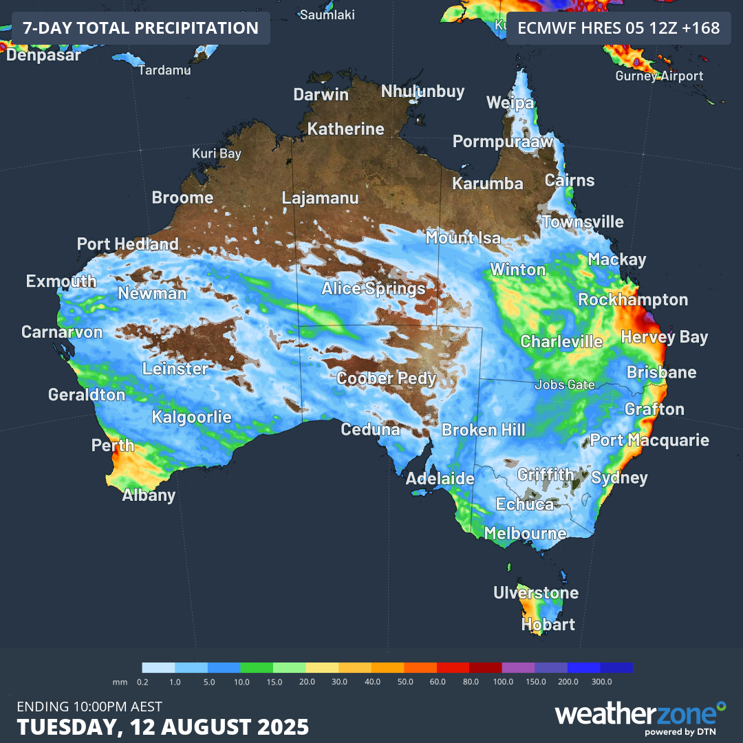
Image: predicted rainfall accumulation by late Tuesday, August 12, according to the ECMWF model. Rainfall in southwest WA and western Tas will be caused by Southern Ocean cold fronts whereas tropical moisture will be the primary fuel for east coast rain.