
Vast cloudband producing showers from Queensland to Tasmania
Showers are soaking large parts of eastern Australia on this unseasonably warm winter Wednesday, as a cloudband stretching from Queensland to well south of Tasmania crosses the continent.
In the 24 hours to 9am, handy rainfall totals were recorded in parts of Queensland where you wouldn’t normally expect more than a few drops in June – including 42 mm at Congie, a weather station in far southwest Queensland’s Channel Country near the town of Quilpie, which received 27mm.
There were also numerous readings between about 10 mm and 30 mm in southern NSW and northern Victoria.
Image: Combined satellite and radar loop for the four hours to 11:30am (AEST) on Wednesday, June 10, 2026. Source: Weatherzone.
Unwelcome rain in the snowfields
The highest 24-hour totals in the NSW/Vic border region were 33.6mm at Thredbo (NSW) and 41.2 mm at Mt Hotham (Vic). Both of these weather stations are within their respective ski resort boundaries, and unfortunately, the precipitation was rain, not snow, with this week’s unusually mild June conditions.
After up to 20 centimetres of snow fell last week, Australia’s mainland ski resorts will now have to pretty much start again with their natural snow base. The photo below shows the Merritts area of Thredbo on Monday afternoon.
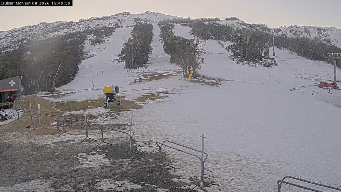
Image: The Merritts area at Thredbo on Monday, June 8. Source: ski.com.au.
The next image shows the same scene on Wednesday morning, with notable snow loss. Expect further erosion of the white areas throughout this week.
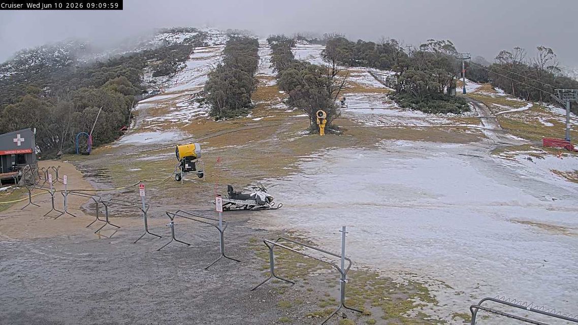
Image: The Merritts area at Thredbo on the morning of Wednesday, June 10, 2026 after heavy overnight rain. Source: ski.com.au.
Mild temperatures across a wide area
It’s not just wet out there, but decidedly un-wintry. Here are just three examples of Wednesday’s unseasonably mild temperatures:
It was a mild night in Melbourne, where the minimum of 13°C was a full six degrees above the June average.
The mercury in Hobart had already climbed to 17.4°C at 11 am this Wednesday, on its way to a forecast top of 18°C. Hobart’s average June maximum is 12.1°C but the four days from Saturday to Tuesday peaked at 15°C, 18.1°C, 17.1°C and 16.9°C respectively.
At 7am, it was 4.2°C at Thredbo Top Station, which is Australia’s highest weather station. Given that the average June maximum is 1.8°C, it was an exceptionally warm start to the day. Having said that, winds are gusting to 115 km/h this morning, making for "feels like" temperatures well below -10°C.
Why such mild midweek temperatures in southeastern Australia?
As mentioned in our story on Tuesday, a slow-moving high pressure centred over the Tasman Sea is shunting cold fronts south of Australia, preventing influxes of cooler air while dragging mild air from the continent’s interior southwards.
This pattern will continue for at least the next few days, with a fresh band of rain and showers associated with a relatively weak cold front expected to arrive over the weekend.
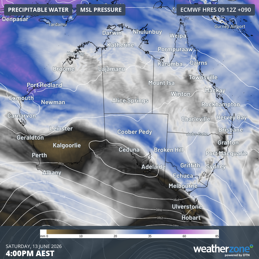
Image: Forecast precipitable water and mean sea level pressure for 4pm on Saturday, June 13, 2026, according to the ECMWF model.