
US Hurricane Season Outlook 2025
The 2025 US hurricane season is shaping up to be more active than usual as abnormally warm ocean temperatures provide plenty of fuel for hurricane development.
Last year’s Atlantic hurricane season was the third most costly on record for the US, causing damage estimated at $129.7 billion. It was also more active than an average season, featuring 18 named storms, 11 hurricanes and 5 major hurricanes.
But what does this season have in store and are how can people prepare now for the main threats of the upcoming season?
When is the US hurricane season?
The US region is affected by hurricane activity in the Atlantic and Eastern Pacific Ocean basins. However, the contiguous United States is primarily impacted by hurricanes originating in the North Atlantic Ocean, including the Caribbean and the Gulf of Mexico (Gulf of America).
The Atlantic hurricane officially season runs from June 1 to November 30, although hurricanes can develop outside these dates. In an average Atlantic hurricane season, we usually see about 14 named storms, 7 hurricanes and 3 major hurricanes.
Hurricane fuel
The main requirements for hurricane development are warm seas (80°F and above), plentiful moisture from the surface to the mid-levels of the atmosphere and low wind shear (no strong changes of wind speed or direction with altitude). Hurricanes also need some sort of initial disturbance like a thunderstorm complex that can develop into a tropical wave.
State of the Atlantic
Although sea surface temperatures averaged across the North Atlantic Ocean are not as high as last year, they are still above normal and expected to remain that way this season. That includes the strip of ocean just north of the equator known as the Main Development Region (MDR), so there should be plenty of energy to power up any developments. In addition, the Gulf should stay much warmer than normal, providing fuel for ‘home-grown’ tropical storms.

Image: Sea surface temperature anomalies in mid-May 2025, showing widespread warmer than average water to the south and east of the US. Source: NOAA
El Niño and La Niña
The equatorial Pacific also has an influence on hurricane development, depending on whether it’s in an El Niño or La Niña phase. El Niño tends to cause an increase in wind shear over the North Atlantic (and a decrease for the North Pacific), while the opposite is true of La Niña. A weak La Niña episode that occurred in late winter and early spring has now dissipated, leaving an ‘ENSO neutral’ state, which is expected to persist into the Northern Hemisphere summer, with a possible trend toward La Niña again in the fall.
Wind shear should be less inhibiting than usual to hurricane development this year, with this season’s ENSO-neutral conditions likely having impacts closer to La Niña than El Niño. Climatologically, La Niña and ENSO neutral years have an average since 1995 of about 17 named storms and 8 hurricanes.
Expectations for 2025
The forecast for the 2025 hurricane season is for a slightly more active season than average. The outlook calls for a total of about 18 named storms, 9 hurricanes and 4 major hurricanes.
The primary threats associated with hurricanes this season will be wind damage, heavy rain and storm-surge threats at landfall. However, hurricanes also pose dangers as they move inland and start to weaken.
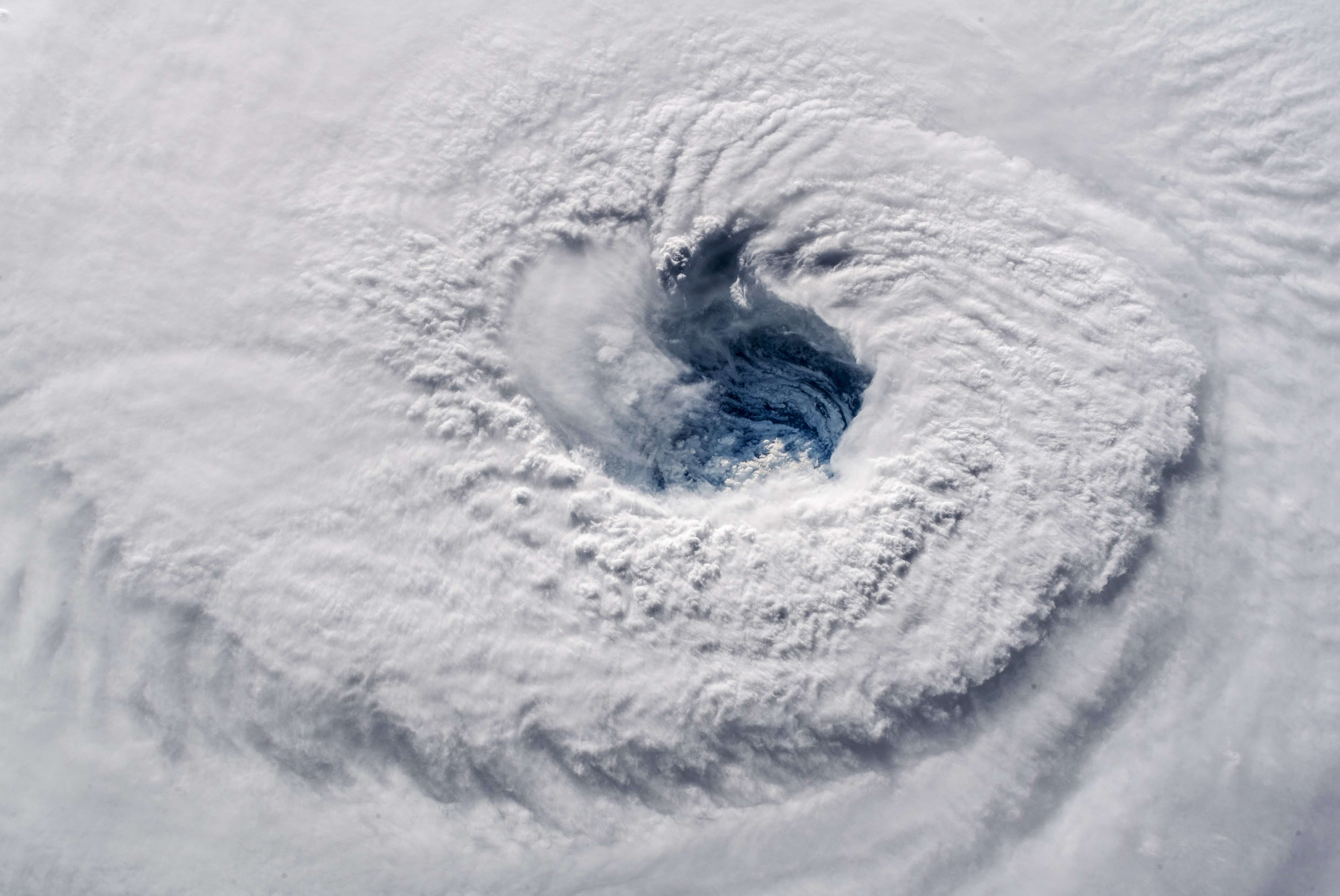
Image: Eye of Hurricane Florence on September 12, 2018. Source: ISS, Alex Gerst, European Space Agency/NASA
Hurricanes can spawn severe thunderstorms and tornadoes, cause lengthy power outages, and dump heavy rainfall over large areas, leading to flash flooding. Late September 2024 is a prime example, when ex-Hurricane Helene brought historic and disastrous flooding to the Appalachians.
Anyone in hurricane-prone areas of the US this season should keep an eye on the National Hurricane Center website for the latest details on active tropical systems. Weather warnings and advisories related to hurricanes will also be available on the National Weather Service website.