
Unusually wet and cold May weather in Queensland

Record-breaking May rainfall has inundated parts of Queensland's North Tropical Coast during the last 48 hours, prompting flood warnings in some rivers.
A deep layer of moisture-laden air over northern Queensland interacting with a low pressure trough near the state's North Tropical Coast has produced exceptionally heavy rain during the last two days.
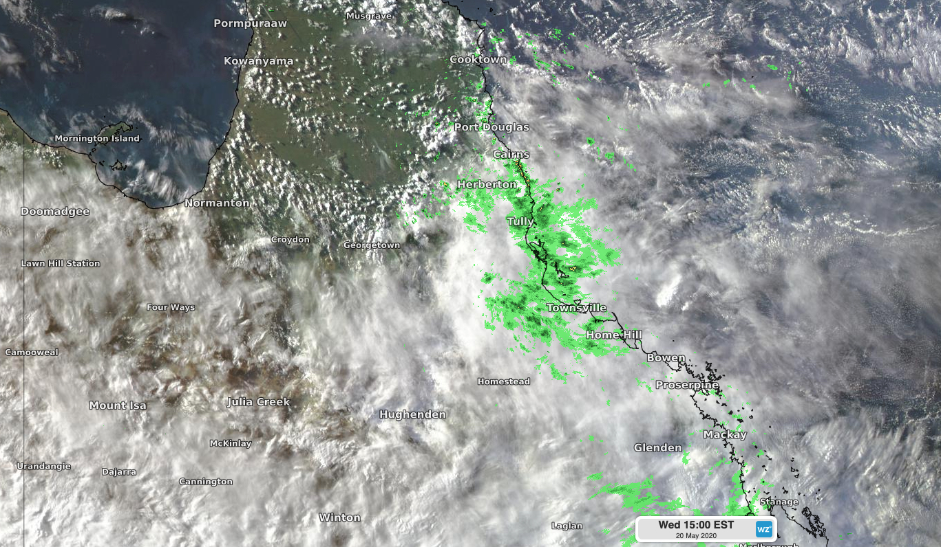
Image: Cloud and rain over Queensland's North Tropical Coast on Wednesday afternoon.
Some rain gauges in the region received more than half a metre of rain during the 48 hours to 9am on Thursday, including 524mm at Bulgan Creek, near Tully. Bingil Bay's 454mm during this period was its highest two day total in 29 years and its highest on record during May, with data going back to 1926. This two-day deluge included 302mm in 24 hours, which is also a new record for May.
As of 10am AEST on Thursday, flood warnings had been issued for the Mulgrave, Russell and Tully Rivers.
More rain will fall over Queensland's North Tropical Coast between Thursday and Sunday, although falls won't be as heavy as the last two days.

Image: A blanket of cloud covers Queensland on Thursday morning.
Away from the sodden North Tropical Coast, cloud and rain will also be widespread across Queensland from now until Saturday. This cloud will keep a lid on daytime temperatures in the coming days, with some places forecast to stay more than 10 degrees below average for this time of year, possibly challenging their low maximum temperature records for May.