
Typhoon Mitag heading for Taiwan
Typhoon Mitag is will cause flooding rain and damaging winds as it passes close to northern Taiwan on Monday night.
Mitag has gradually gained strength during the last couple of days as it travelled over warm water in the Philippine Sea. At 2pm China Standard Time on Monday, Typhoon Mitag was located roughly 150km off the east coast of Taiwan. Wind gusts at the time were reaching about 160km/h according to Taiwan's Central Weather Bureau, making it equivalent to a strong category two tropical cyclone on the Australian scale.
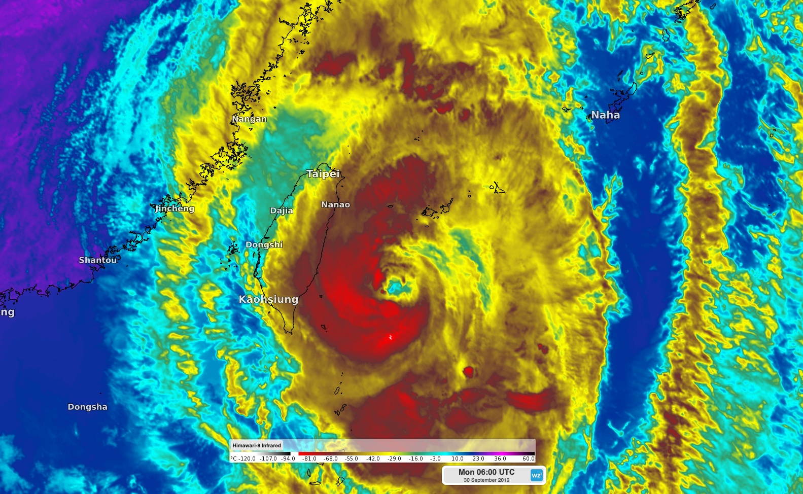
Image: Enhanced infrared satellite image of Typhoon Mitag on Monday afternoon.
While the worst of the weather is yet to come, moisture-laden winds ahead of the approaching typhoon have already caused days of heavy rain in parts of Taiwan. Some areas near Taipei had registered more than 350mm of rain between Saturday morning and 3pm local time on Monday. A few areas in northeastern Taiwan had received more than 500mm during this time.
Typhoon Mitag is expected to pass close to or over northern Taiwan on Monday night, causing more heavy rain in northern, eastern and central parts of the country. Some areas that have already seen 200-300mm could pick up another 100-200mm during the next 24 hours.
In addition to the rain, parts of northern Taiwan will also be exposed to the destructive winds near Mitag's core on Monday night. The Central Weather Bureau has issued typhoon warnings for numerous areas in Taiwan, including Taipei, Taichung and Taoyuan.
Typhoon Mitag is expected to move north of Taiwan on Tuesday, allowing it to bring dangerous wind and rain to parts of China's central coast.