
Typhoon Bavi to pass by Taiwan, bear down on China
Typhoon Bavi is nearing major population centres this weekend, having travelled across the Western Pacific in the last week.
Crossing Japan’s Sakishima Islands east of Taiwan on Saturday morning, Bavi will then pass to the north of Taiwan, before making landfall along China’s east coast by late Saturday night.
According to the Japan Meteorological Association (JMA), Bavi is currently generating winds of approximately 140km/h, gusting to about 200km/h as it crosses the southern Okinawa Islands. The JMA has ongoing warnings in place with these winds expected to continue into Saturday afternoon. In addition, it is forecasting waves as high as 12m near the islands as Bavi passes through.
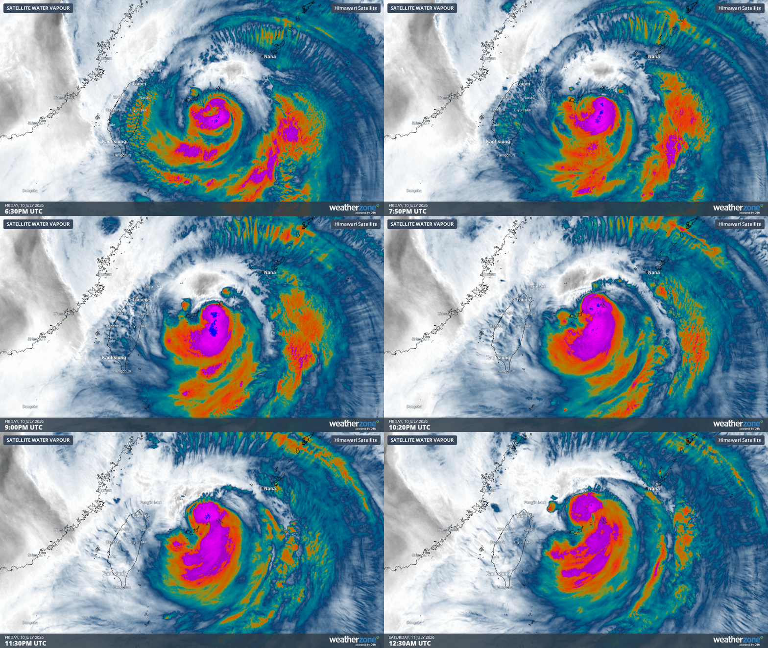
Gif: Water vapour imagery of Typhoon Bavi as it approaches and crosses the Sakishima Islands on Saturday morning. Source: Weatherzone.
Weather stations across the region have so far recorded wind speeds of 95km/h and gusts as high as 150km/h during Saturday morning. Meanwhile, 24 hour rainfall totals to Saturday morning have exceeded 150mm across the region with further rainfall expected as rainbands move across the islands behind the eye of Bavi.
The highest rainfall totals of this system so far have been observed across northern parts of Taiwan. In some areas, rainfall totals have reached 250-300mm since midnight local time (as of 10:30am), including 6 hourly totals exceeding 150mm and hourly rainfall totals approaching 60mm.
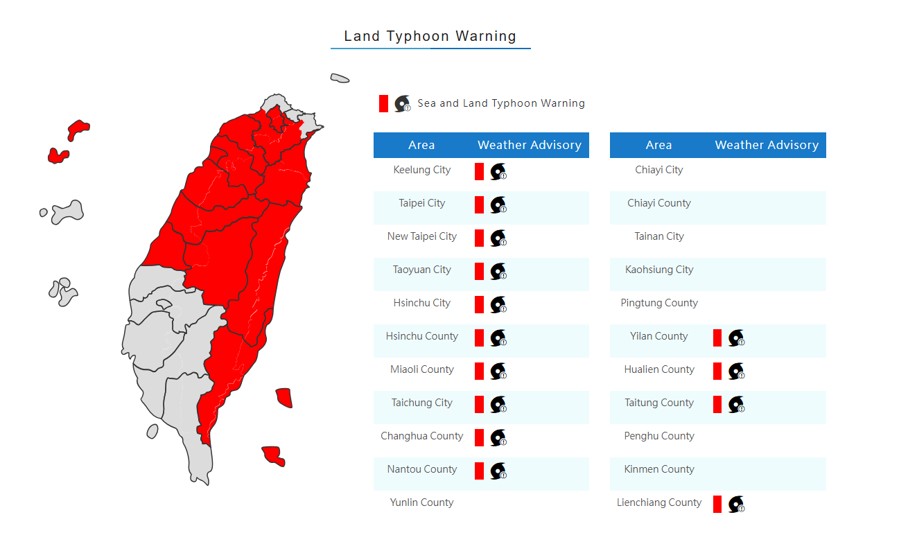
Image: Areas of Taiwan covered by a Typhoon Warning on Saturday morning. Source: Central Weather Administration https://www.cwa.gov.tw/V8/E/P/Typhoon/TY_WARN.html
Taiwan’s Central Weather Administration is maintaining a Typhoon Warning that covers most of the island. In addition, a warning for extremely torrential rain (exceeding 500mm/24h) is in place for mountainous areas. Rainfall could also exceed 300mm/24h for northern parts of the island, leading to widespread flooding as well as a risk of landslides through the mountainous terrain.
In the coming hours and days, the JMA is expecting Bavi to approach, then make landfall along China’s east coast, and is expected to be already weakening by this point. The most likely site of landfall looks to be in the vicinity of Wenzhou, about 350km south of Shanghai. Following landfall, model guidance is indicating that Bavi will continue to weaken while making its way north through eastern China, inland from Shanghai, then veer northeast towards the Korean Peninsula early next week.
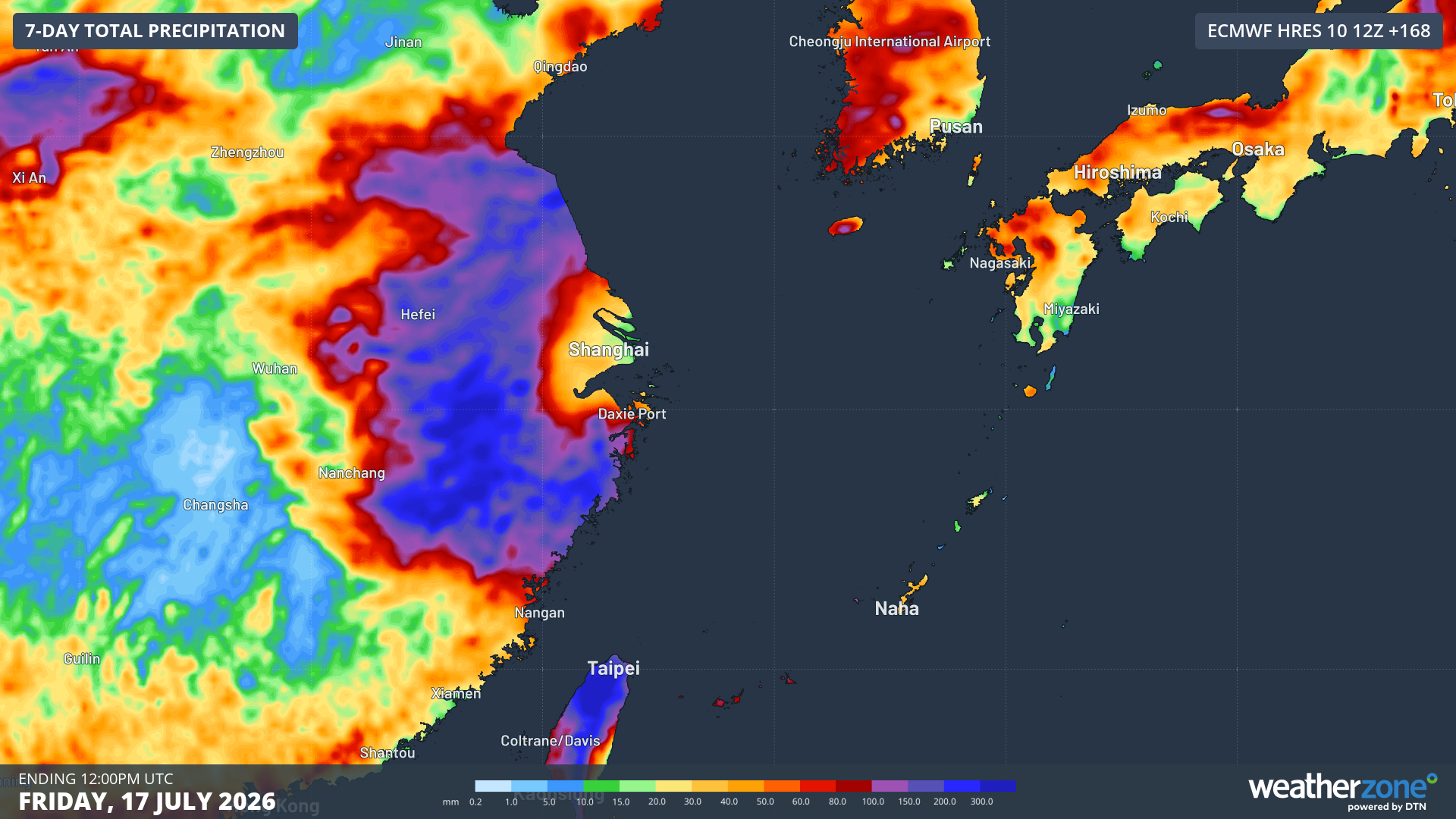
Image: Forecast accumulated rainfall in the week to Friday, July 17, 2026. Source: Weatherzone.
While impacts over the mainland are not expected to be as severe as for the islands, rainfall is still expected to reach 200-400mm in widespread areas in the coming days. Damaging to possibly destructive winds as well as a storm surge are also likely along coastal areas near where Bavi makes landfall.