
Two spectacular cloud formations over Australia
Thursday morning’s satellite image over Australia revealed two spectacular cloud formations – one on a vast scale, the other localised but just as striking when viewed at closer range.
The main cloud feature is the narrow, curved cloudband trailing thousands of kilometres across Queensland and the eastern NT behind a broad mass of cloud near the centre of a low pressure system over the Tasman Sea.
The less obvious feature is a series of roll clouds over the waters of the Gulf of Carpentaria between western Cape York and Arnhem Land in the Northern Territory.
Let’s look at these two cloud patterns separately and briefly discuss how they formed.
Vast curved cloudband from the Tasman Sea to the eastern NT
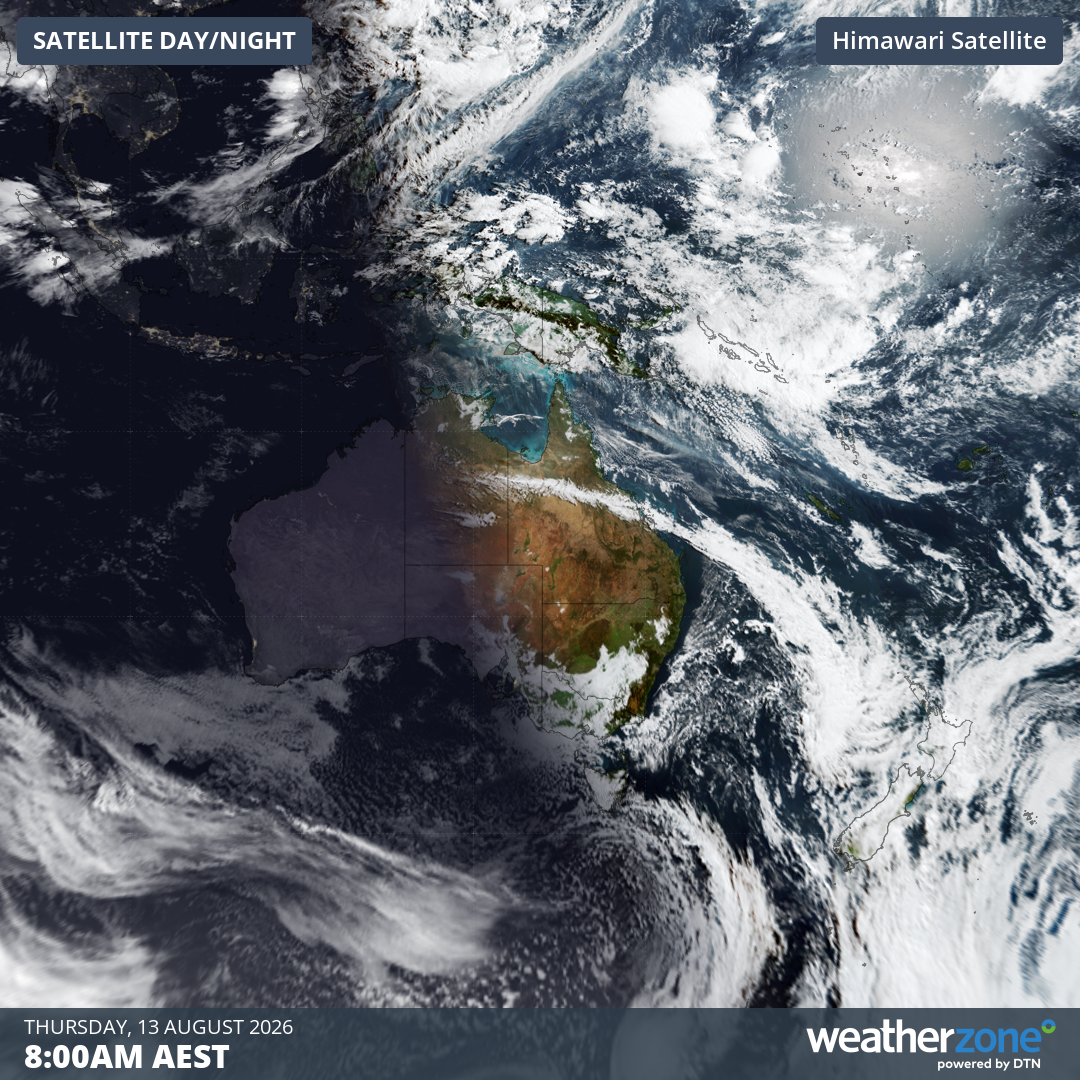
Image: The vast arc of the cloudband clearly visible over NE Australia at 8 am (AEST) on Thursday, August 13, 2026. Source: Weatherzone.
The long cloudband was caused by the decaying cold front that passed through southeastern Australia on Wednesday.
The cloudband marks the boundary between warm air and relatively cooler air. When the cooler, more dense air wedges underneath the warmer air ahead of it, it causes the warm air to rise, cool and condense into clouds.
But why is it curved?
It’s all to do with the Coriolis force, an effect caused by the fact that Earth rotates faster at the equator than it does at the poles.
The Coriolis force is an apparent deflection of moving objects which are not firmly connected to the ground – such as wind, cloud and ocean currents – to the right in the Northern Hemisphere and to the left in the Southern Hemisphere.
As Weatherzone meteorologist Joel Pippard explains:
"If air moves from the South Pole toward the equator, it starts with a slow eastward speed. The ground underneath it starts spinning faster to the east, making the object fall behind and curve to the left.
“Since the cold front came from the south (closer to the poles) it was rotating around the earth slower than if it was near the equator. As the front pushed north, it moved slower than the earth underneath it. That meant that the cloud furthest north travelled to the east slower than the cloud further south, creating the arc shape.”
Roll clouds in the Gulf of Carpentaria
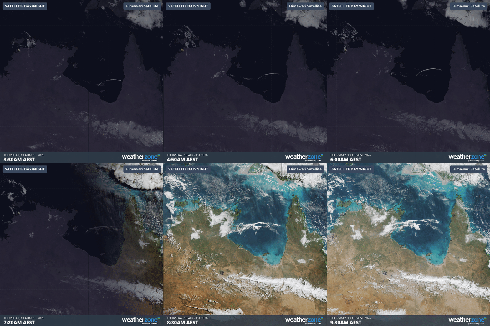
Image: Satellite loop over the Gulf of Carpentaria and nearby parts of northern Australia, showing roll clouds moving NW across the gulf in the six hours to 9:30 am (AEST) on Thursday, August 13, 2026. Source: Weatherzone.
A series of roll clouds developed in the very early hours of Thursday morning over the Gulf of Carpentaria.
As Weatherzone meteorologist Ben Domensino explains, the distinctive, pipe-shaped cloud formations were caused by atmospheric gravity waves that formed over far western Queensland on Wednesday.
"Atmospheric gravity waves act like ripples on the surface of a lake, with air rising and sinking as the waves propagate through the atmosphere," Domensino explains.
"When air reaches the top of each wave crest, it cools to form cloud through condensation. When the air sinks again into the wave trough, the air becomes warmer and dries out. This rising and sinking pattern causes parallel rows of tube-shaped clouds along the gravity waves. These are roll clouds."
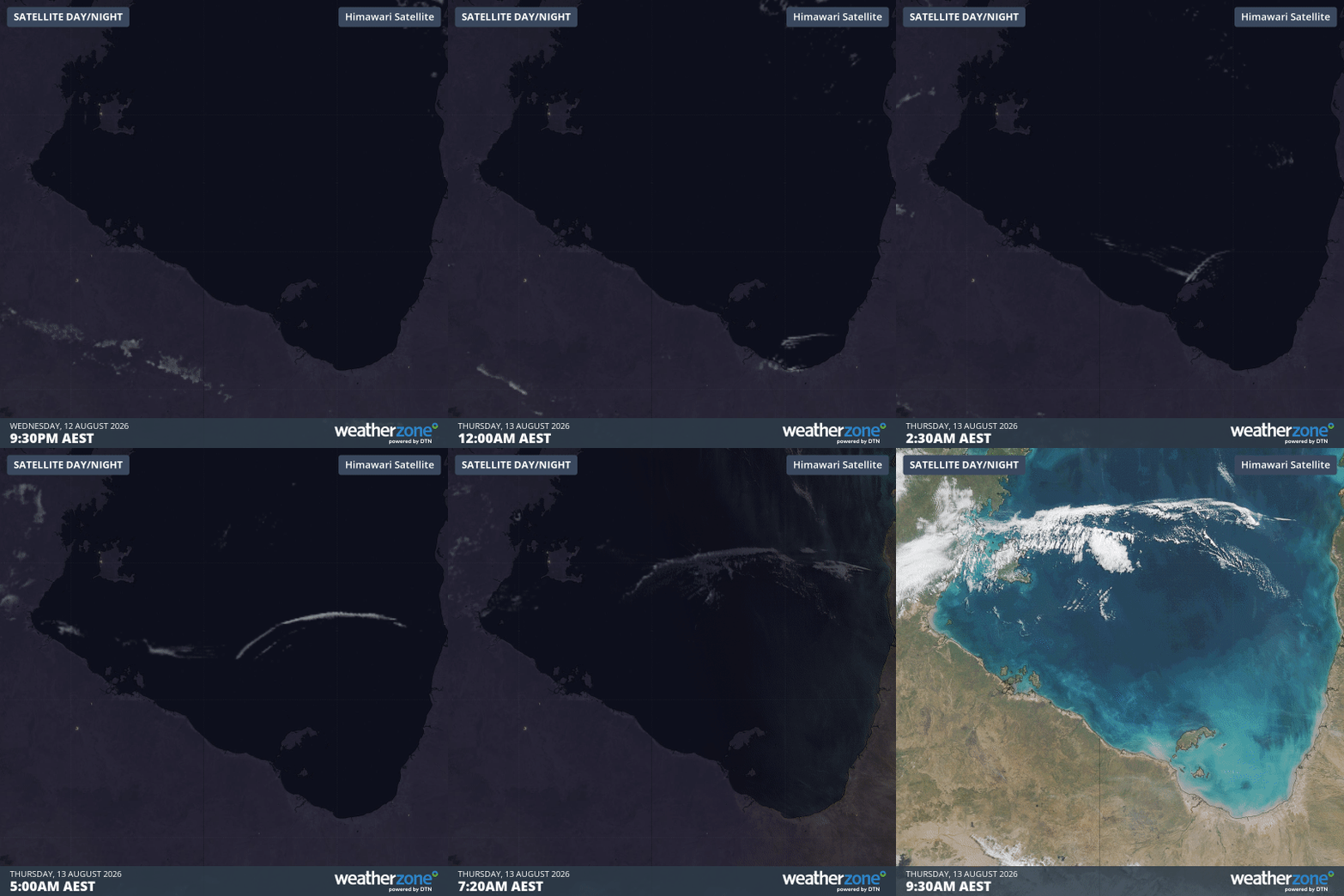
Image: Closer view of the development of the roll clouds over a 12-hour timeframe from 9:30 pm (AEST) on Wednesday, August 12 to 9:30 am (AEST) on Thursday, August 13, 2026. Source: Weatherzone.
Nowhere else on Earth do roll clouds occur with such consistency as over the Gulf of Carpentaria. For that, we can largely thank the Cape York Peninsula.
During the daytime heating that occurs over the tropical peninsula, westerly sea breezes from the Gulf of Carpentaria and easterly sea breezes from the Coral Sea clash during the evening, forcing air upwards. Gravity then pulls the dense air back down, fuelling the atmospheric gravity waves.