
Twin cyclone threat for Australia this weekend
Two tropical low pressure systems currently spinning near northern Australia have the potential to become tropical cyclones this weekend.
The satellite animation below shows blobs of tropical cloud near Australia, one to the northwest of WA, and another near the NT’s Top End. Both cloud masses are being produced by tropical lows.
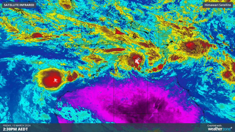
Video: Enhanced infrared satellite images captured on Friday, March 15, 2024.
The low to the northwest of WA, Tropical Low 08U, was located just under 400 km to the north northwest of Karratha at 2pm AWST on Friday.
This low is currently moving towards WA but should turn towards the west from Friday night and then travel in a more westerly direction over the weekend, roughly parallel to the Pilbara coastline.
While there is a high chance that Tropical Low 08U will develop into a tropical cyclone from Sunday, it is currently expected to remain off the WA coast. Most forecast models expect this system to travel out into the Indian Ocean early next week, taking the risk of severe weather away from Australia.
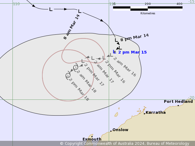
Image: Forecast track map for Tropical Low 08U, issued on Friday afternoon. A more recent track map may be available. Source: Bureau of Meteorology
Meanwhile, Tropical Low 09U is located over the Gulf of Carpentaria just east of the Top End. At 3:30 pm ACST on Friday, the low was located about 90 kilometres south of Nhulunbuy.
Tropical Low 09U is expected to gain strength over the Gulf’s warm waters this weekend. It should become a tropical cyclone on Saturday and may reach category two strength by Sunday or Monday as it moves further south. At this stage, the system is expected to make landfall over the southwest coast of the Gulf of Carpentaria late Sunday or on Monday, although this forecast is prone to change.
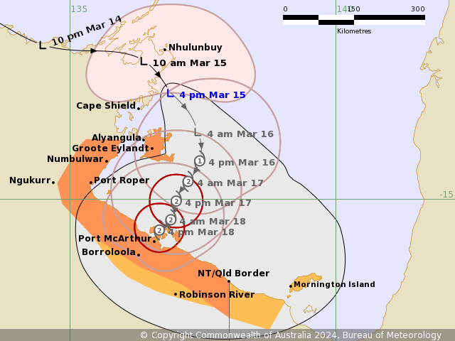
Image: Forecast track map for Tropical Low 09U, issued on Friday afternoon. A more recent track map may be available. Source: Bureau of Meteorology
The next two tropical cyclones that form in Australia’s area of responsibility will be named Megan and Neville, respectively.
You can keep up to date with the latest tropical cyclone advisories here.