
Tropical Storm Nari threatens Tokyo and northern Japan
Tropical Storm Nari, the fifth tropical cyclone of the western Pacific typhoon season formed over the weekend, and is tracking close to Tokyo and northern Japan on Monday.
As seen in the satellite imagery below, Nari tracked north rapidly on Monday morning, coming within 250 kilometres of Tokyo around midday.
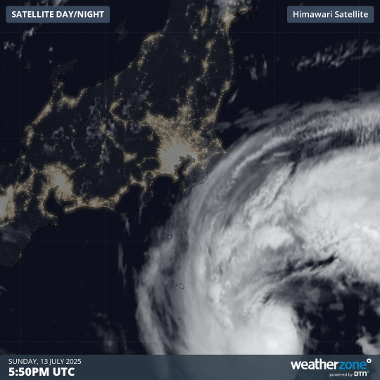
Image: Satellite imagery of Tropical Storm Nari on Monday morning, July 14, 2025.
Powerful winds reaching 40-45 knots (75-85 km/h) are expected within proximity to the centre of the system, with a broader area of gales extending across the eastern flanks of the low.
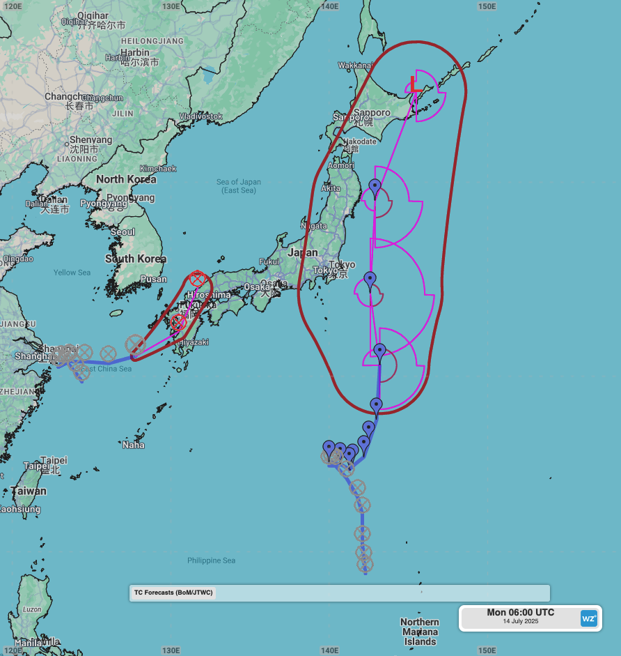
Image: Forecast track of Tropical Storm Nari with areas of gales (above 34 knots) and the forecast position uncertainty.
Coastal parts of the Kantō, Tōhoku and Hokkaidō prefectures can expect gusty winds on Monday and Tuesday as the storm tracks parallel to the coastline. Strong southerly winds may persist into Wednesday as Nari crosses Hokkaidō into the Sea of Okhotsk and over the Kuril Islands.
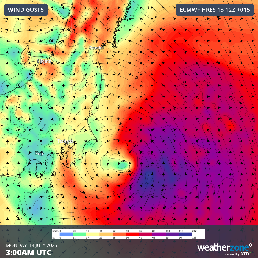
Image: Forecast 10m wind gusts at 12pm JST on Monday, July 14, 2025.
The strong winds around this system will also generate large waves battering into the eastern Honshu and Hokkaidō coastline until Wednesday.
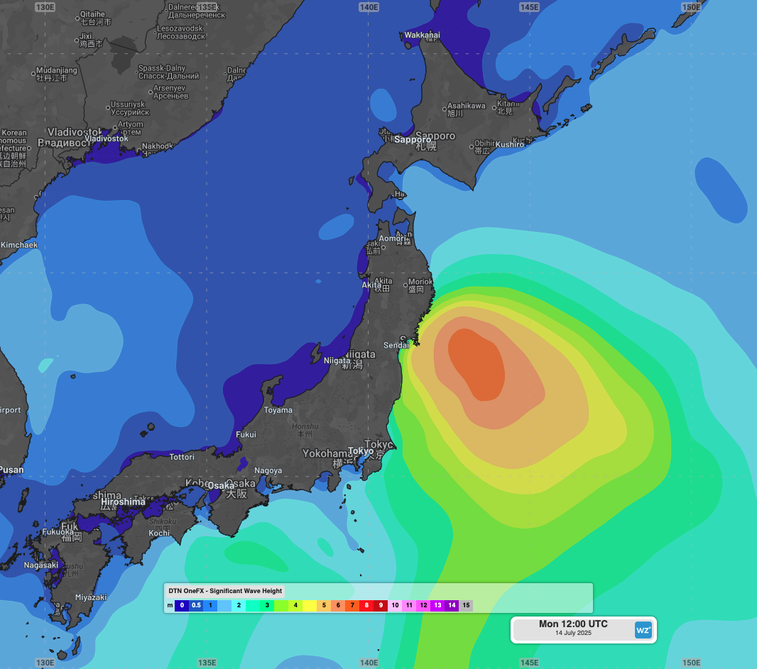
Image: OneFX forecast significant wave heights at 9pm JST on Monday, July 14, 2025.
Some heavy rainfalls are expected on Monday, but a deep stream of moist southerly winds will feed intense and flooding rainfall into Shikoku and southern and central parts of Honshu, including Tokyo, between Tuesday and Thursday. Widespread falls of 150-300mm are expected over these regions.
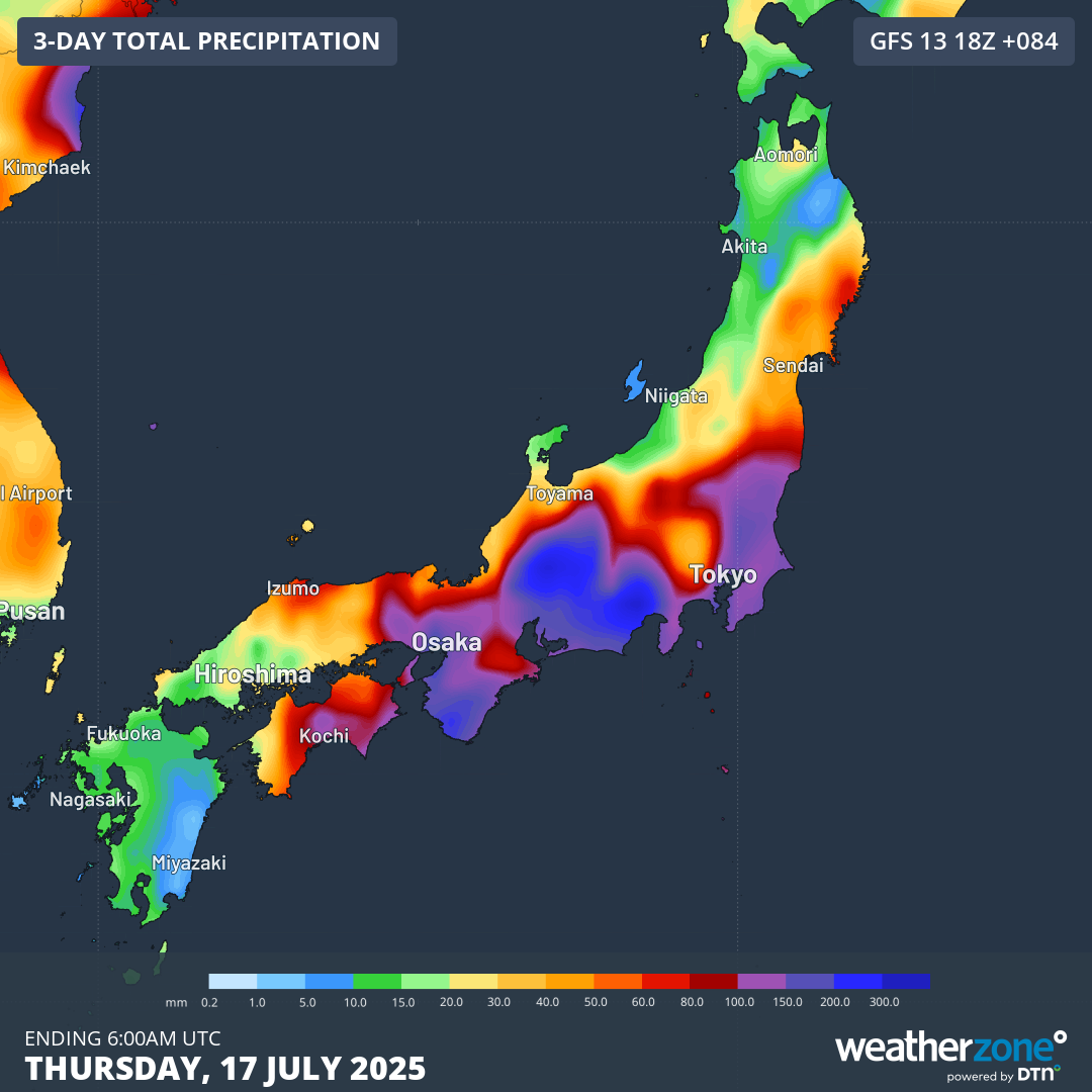
Image: Forecast rainfall to 3pm JST on Thursday, July 17, 2025.
Rainfall will contract west on Thursday, with some heavy falls persisting over Shikoku and Kyushu islands on Friday. Much more stable conditions are expected over the coming weekend as a high pressure ridge strengthens over the Japan region, extending into next week.
Video: Tropical Storm Nari seen on the Radar of the Weatherzone app near Tokyo, Japan, on July 14, 2025.