Tropical Storm Gaemi (Carina) could become the second Typhoon this season
Tropical Storm Gaemi (named Carina by the Philippine Atmospheric, Geophysical and Astronomical Services Administration (PAGASA)) is the fourth tropical storm (TS)/typhoon to be named in the northern hemisphere’s typhoon season. The previous three being:
- Typhoon Ewiniar/Aghon, which formed on May 21st,
- Tropical storm Maliksi, which formed on May 29th
- Tropical storm Butchoy, which formed last week on the 15th of July.
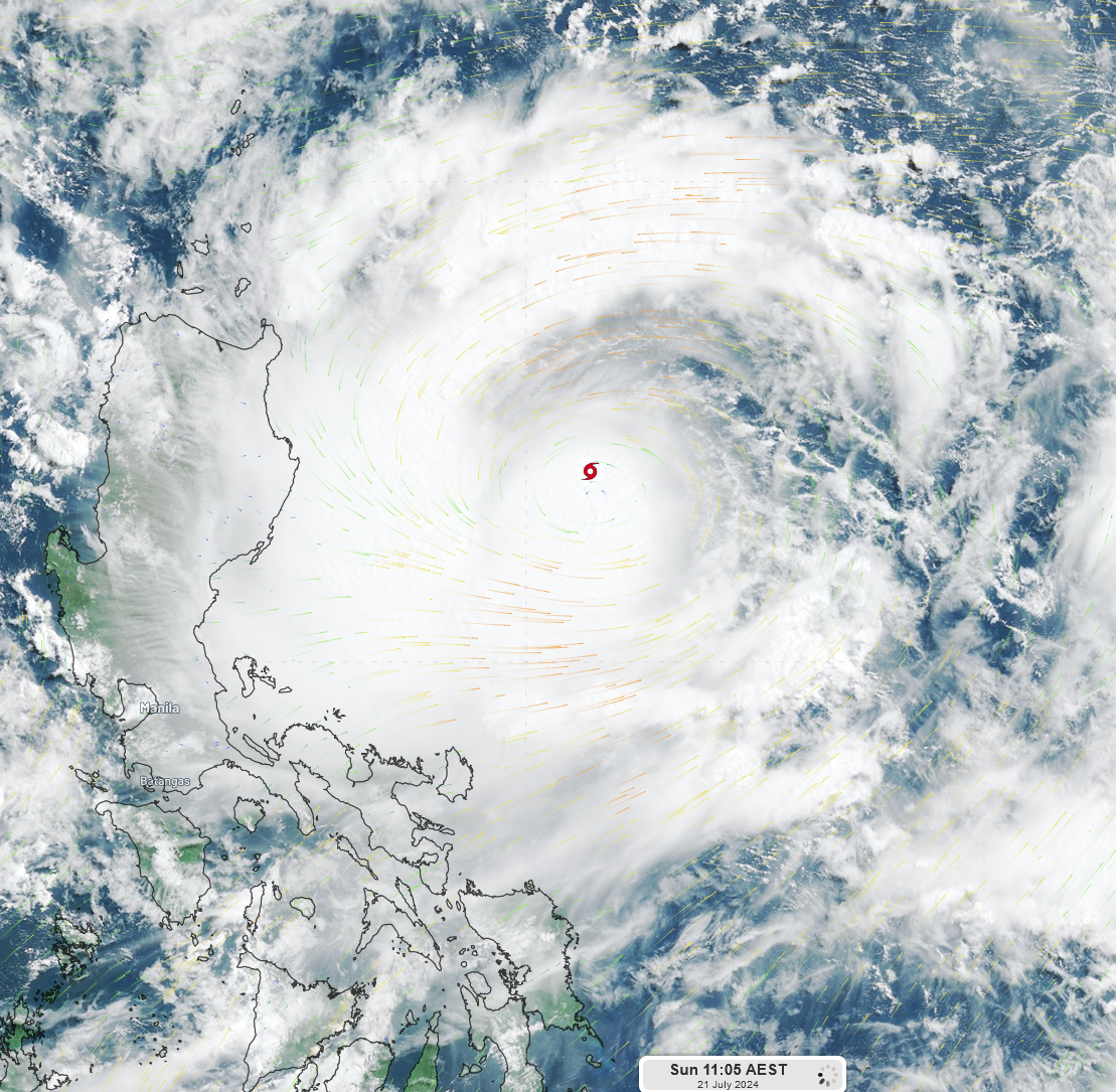
Tropical Storm Gaemi is currently located 346 kilometers off the east coast of Luzon, the northern island of the Philippines, with wind speeds reaching 80 km/h.

Fig. 1) Satellite image of Tropical Storm Gaemi at 11:05 Sun 21st AEST
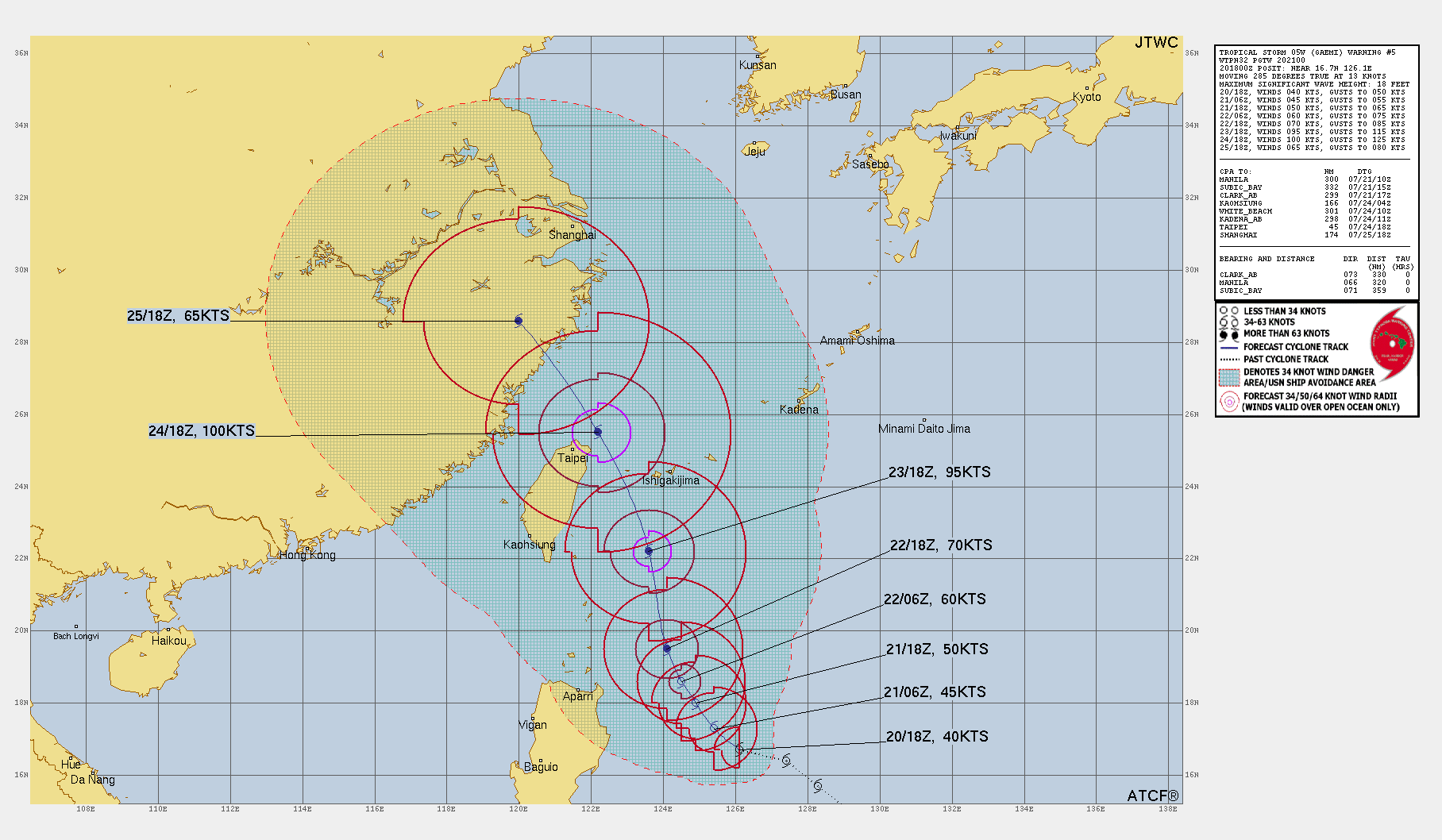
Atmospheric and oceanic conditions appear to favour the storms development, and TS Gaemi is expected to intensify into a typhoon (the equivalent of a category 1 tropical cyclone) by Tuesday 23rd of July. Now models vary regarding the peak intensity TS Gaemi could reach if it develops into a Typhoon, but the Joint Typhoon Warning Centre (JTWC) suggests that TS Gaemi could become a very strong typhoon (equivalent to a Category 3 tropical cyclone) with wind speeds peaking at 185km/h, gusting to 232km/h on Wednesday. If this comes to fruition, Gaemi would be stronger than Typhoon Ewiniar/Aghon which formed earlier this year.

Fig. 2) Plot of the predicted trajectory and development of TS Gaemi issued by the JTWC at 2100Z
TS Gaemi is expected to move north then turn northwesterly, passing north of Taiwan and making landfall along the Zhejiang province of China at the end of the week. For updates on the development and movement of TS Gaemi, see the JTWC site, the Cooperative Institute of Meteorological Satellite Studies site, or the PAGASA site.