
Tropical lows linger northwest of Australia
Two tropical low pressure systems were spinning off Australia's northwest coast on Friday morning, with both still threatening to become tropical cyclones and one on track to make landfall.
At 5am AWST on Friday, one of the lows was located about 295 km north northeast of Port Hedland, moving south at about 15 km/h while strengthening. This low could become a tropical cyclone later today, before making landfall somewhere around WA's Eighty Mile Beach tonight or tomorrow morning. At this stage, landfall will most likely be as a category one tropical cyclone.
Earlier in the week, it was looking like this system could have become a severe tropical cyclone before reaching the WA coastline. However, wind shear - a change in wind speed and direction with height - has been hindering the low's development.
Despite not being as strong as previously thought, this system is still likely to cause heavy rain over parts of the Pilbara, Kimberley and Interior of WA from today into the weekend. Gale force winds could also affect parts of the east Pilbara and west Kimberley districts today and tomorrow.
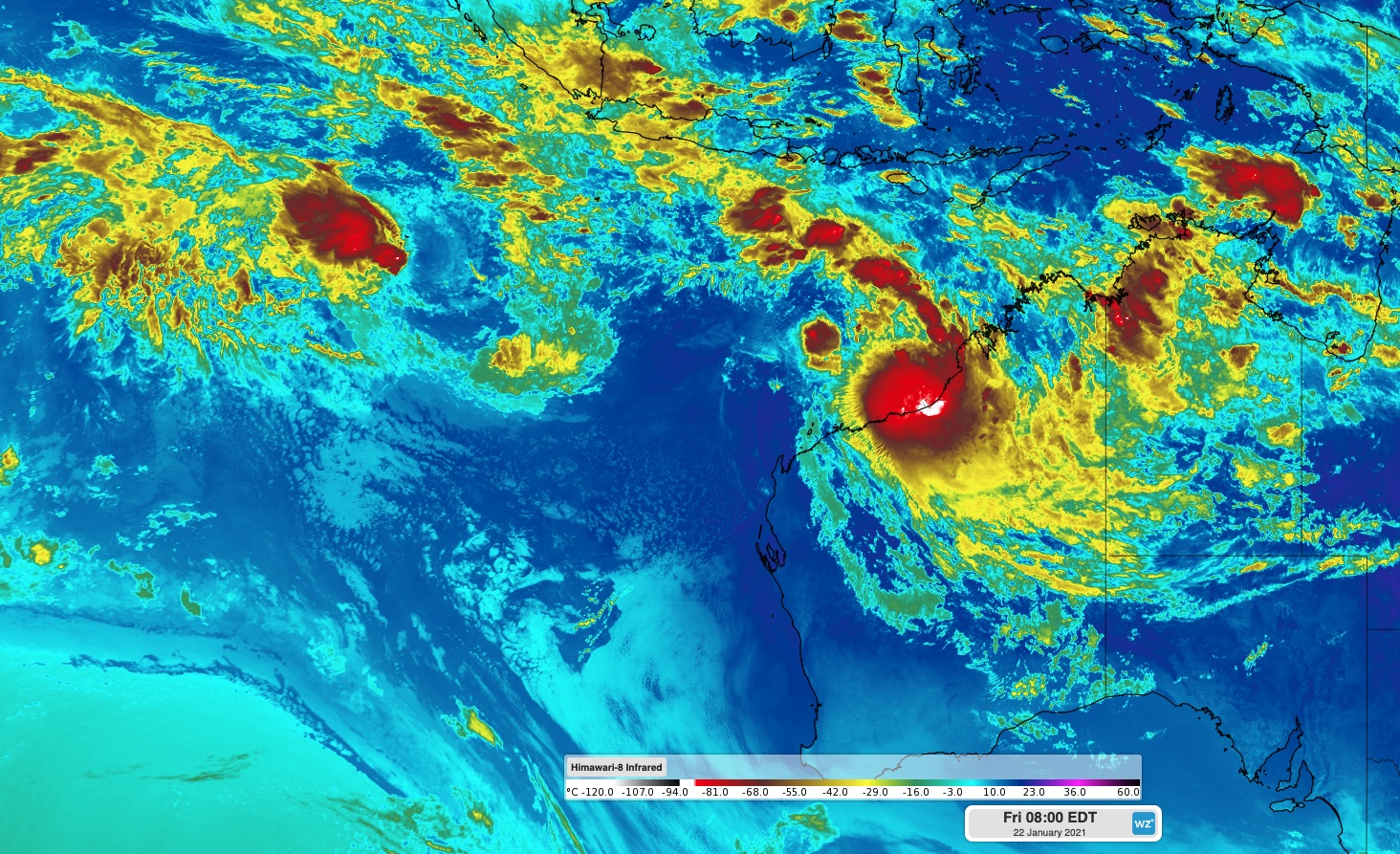
Image: Enhanced infrered satellite image showing two tropical lows to the northwest of Australia on Friday morning.
The other tropical low pressure system is much further away from the Australian mainland. At 5am AWST on Friday, the low was located about 130 km southeast of the Cocos (Keeling) Islands, moving towards the south.
This system could continue to cause rain and gale force winds on the islands today, although this dangerous weather should ease into the afternoon as the low moves further south.
This system has also been hindered by wind shear and is struggling to gain strength. At this stage, it's not likely to become a tropical cyclone until at least Sunday, at which point it should be a few hundred kilometres south of the Cocos (Keeling) Islands. This should spare the islands from any further damaging winds after today, although showers and thunderstorms could continue into the weekend.
If these lows do become tropical cyclones, the first to form will be named Lucas and the next will be Marian.