
Tropical lows, heavy rainfall and earthquakes impacting Indonesia and the South Pacific
Tropical lows, monsoonal winds, heavy rainfall and earthquakes are affecting areas around Australia, bringing weather much more typical to the wet season.
Tropical Lows 33U and 34U
Tropical lows and cyclones can form at any time of year but become much less frequent over the Australian region during the Southern Hemisphere winter. This is due to the northward expansion of the subtropical ridge and cooler sea surface temperatures.
The map below shows two areas of low pressure being monitored for tropical cyclone intensification.
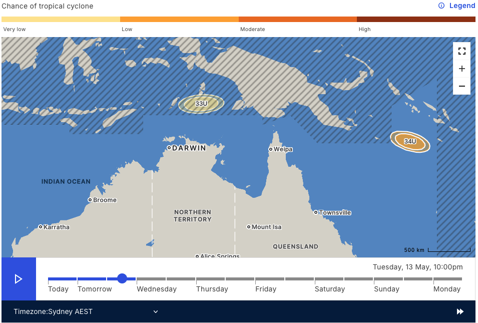
Image: Chances of tropical cyclone development of Tropical Lows 33U and 34U on Tuesday, May 13. Source: BoM
Tropical Low 33U has a very small chance of developing into a tropical cyclone today (Monday, May 12) or tomorrow over the northern Arafura Sea, near West Papua. Movement over a less favourable atmospheric environment from tomorrow will cause the system to weaken. Impacts over the Australian mainland are unlikely, however southern parts of West Papua can expect periods of heavy rain to start off the week.
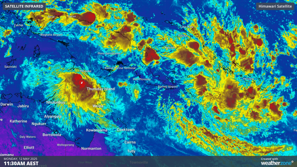
Image: Satellite loop showing Tropical Lows 33U and 34U over the northern Arafura Sea, and Solomon Sea, respectively, on Monday, May 12.
Tropical Low 34U is located in the Solomon Sea and will have the greatest chances (about 25%) of developing into a tropical cyclone around Wednesday, May 14. The system is expected to take a slow-moving track towards the southeast, with direct impacts unlikely for the Australian mainland. Parts of the Solomon Islands can expect a very wet week as moisture streams into the low, with the heaviest falls coming for the rest of Monday and into Tuesday.
Trade winds missing from northern and central Indonesia
The northward progression of the southeasterly trade winds over Indonesia marks the return of the dry season. Frequent and heavy rainfall and thunderstorms throughout the wet season cause transport disruptions through flooding and rainfall, so the switch from westerly to easterly winds brings more predictable and settled days.
This year, the moist westerly winds are still being experienced well into May as far south as western parts of the Indonesian island of Java, on which the capital of Jakarta is located. As seen in the image below, easterly trade winds have moved over eastern parts of Java and Bali, but moist westerlies remain across Sumatra and western Java.
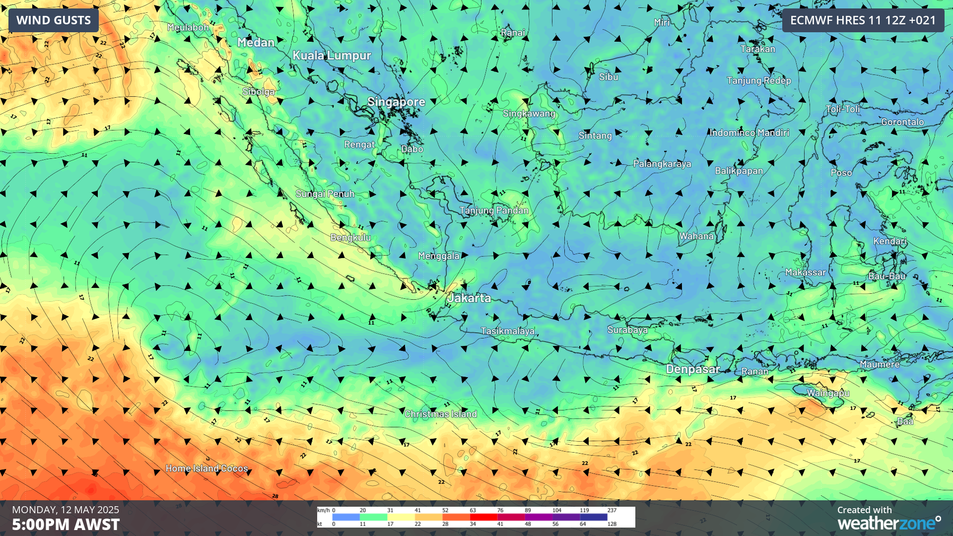
Image: 10m wind gusts at 5pm AWST on Monday, May 12, over Sumatra and Indonesia.
Heavy rainfall will continue to affect parts of Indonesia over the coming week as moist westerlies converge into the incoming easterly trades, especially over parts of Java. Weekly rainfall accumulations of 100-200mm are likely in some areas, as seen in the image below.
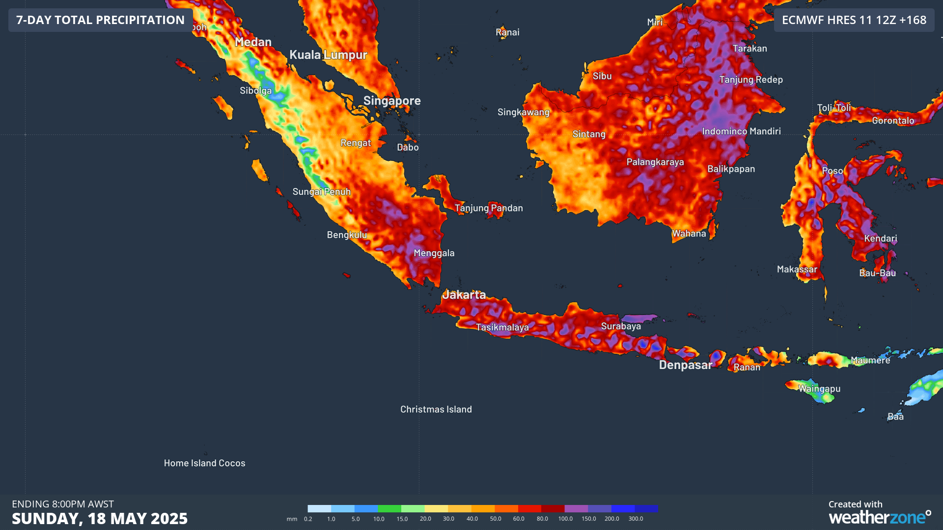
Image: rainfall accumulations to Sunday, May 18, over Indonesia.
Earthquakes affecting parts of Asia and the Pacific
Along with the wet season weather affecting these regions, increased earthquake activity has also been registered. Within the past 24 hours, significant earthquakes reported by Geoscience Australia include:
- 5.8 magnitude in Aceh, Indonesia
- 5.8 magnitude near Port Vila, Vanuatu
- 5.5 magnitude near Tonga
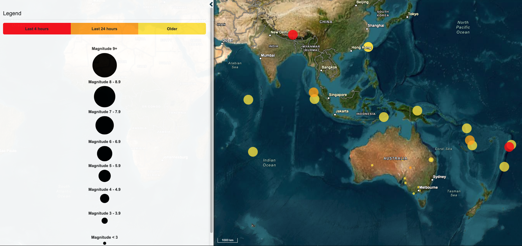
Image: recent earthquake activity across Australia, the south Pacific and Asia. Source: Geoscience Australia
No tsunami warning is currently active across Australia or the Indian Ocean as a result of these earthquakes, according to the Joint Australian Tsunami Warning Centre. Indonesia's Aceh province was devastatingly affected by the 2004 Boxing Day Tsunami, with the earthquake epicentre just 200 kilometres off the west coast of Aceh. The magnitude of the 2004 earthquake had been estimated around 9, releasing nearly 50,000 times the energy of the recent earthquake.