
Tropical cyclone threat looms for Coral Sea

A tropical cyclone could be spinning off Queensland's eastern tropical coast later this week.
A tropical low pressure system is likely to move over the Gulf of Carpentaria during the first half of this week as a monsoon trough deepens over northeastern Australia.

Image: Monsoon clouds building over northern Australia on Monday morning.
A number of forecast models indicate that this low could cross Cape York Peninsula and move over the western Coral Sea by Thursday. If this happens, the low will draw energy from unusually warm waters off the east coast of Queensland, increasing the likelihood of it deepening into a tropical cyclone.
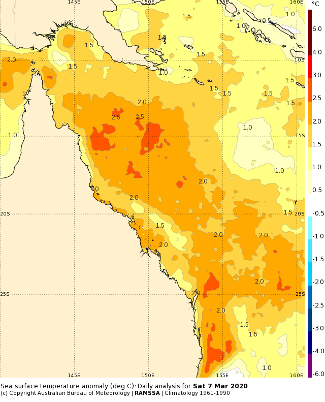
Image: Sea surface temperature anomalies over the Coral Sea on Saturday, March 7th. Source: Bureau of Meteorology.
It's too far away to know where this system will move into the second half of this week with much confidence. Some models suggest that it could stay close to Queensland's eastern tropical coast while intensifying, while others predict it will move out into the Coral Sea, away from Queensland.

Image: Forecast mean sea level pressure and 24-hour accumulated rain this Thursday night, according to the ECMWF-HRES model.

Image: Forecast mean sea level pressure and 24-hour accumulated rain this Thursday night, according to the ACCESS-G model.
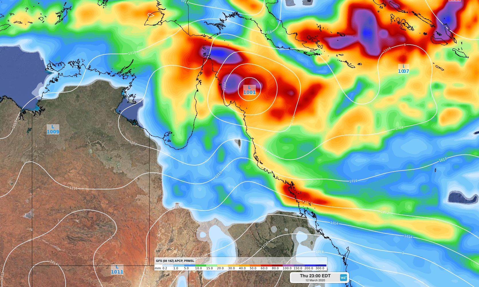
Image: Forecast mean sea level pressure and 24-hour accumulated rain on Thursday night, according to the GFS model.
In any case, rain and thunderstorms are likely to be active over northern and eastern Queensland in the coming days. This activity could intensify over tropical eastern Queensland during the second half of the week, although the strength and position of the tropical low/cyclone will ultimately decide where and how much this happens.
Meanwhile, another tropical low could form to the south of Indonesia on Monday or Tuesday, within an active monsoon trough. This low is expected to drift south as the week unfolds and possibly approach the Pilbara Coast on Thursday or Friday. At this stage, the system should remain a low pressure system or low-end tropical cyclone as it approaches northwestern Australia later in the week, meaning significant impacts are unlikely.
The next two tropical cyclones to form in Australia's area of responsibility will be Gretel and Harold.