
Tropical cyclone risk increasing this weekend
A tropical low that is expected to develop over the Arafura Sea on Friday could become a tropical cyclone near northern Australia as early as this weekend.
A relatively weak area of circulation has been detected in a mass of clouds and thunderstorms over the northern Arafura Sea, to the north of the NT's Top End.
While this mass of storms is not posing any direct threat to Australia at the moment, it has the potential to build into something more dangerous in a few days' time.
The weak circulation is expected to move further south and develop into a tropical low on Friday or Saturday morning. This southward-moving low will cause rain and thunderstorms to increase over northern parts of the Top End on Christmas Eve and Christmas Day.
What happens after Christmas is hard to predict because computer models are struggling to agree on the future movement and strength of this developing low pressure system.
As of Thursday afternoon, most forecast models suggest the low will pass over the Top End this weekend before tracking further east and passing over the Gulf of Carpentaria early next week. Under this scenario, the low may struggle to develop into a tropical cyclone before reaching the Gulf. However, it would still cause widespread and heavy rain over the Top End.
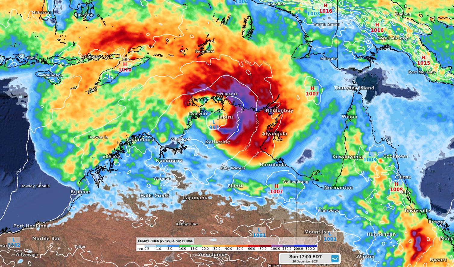
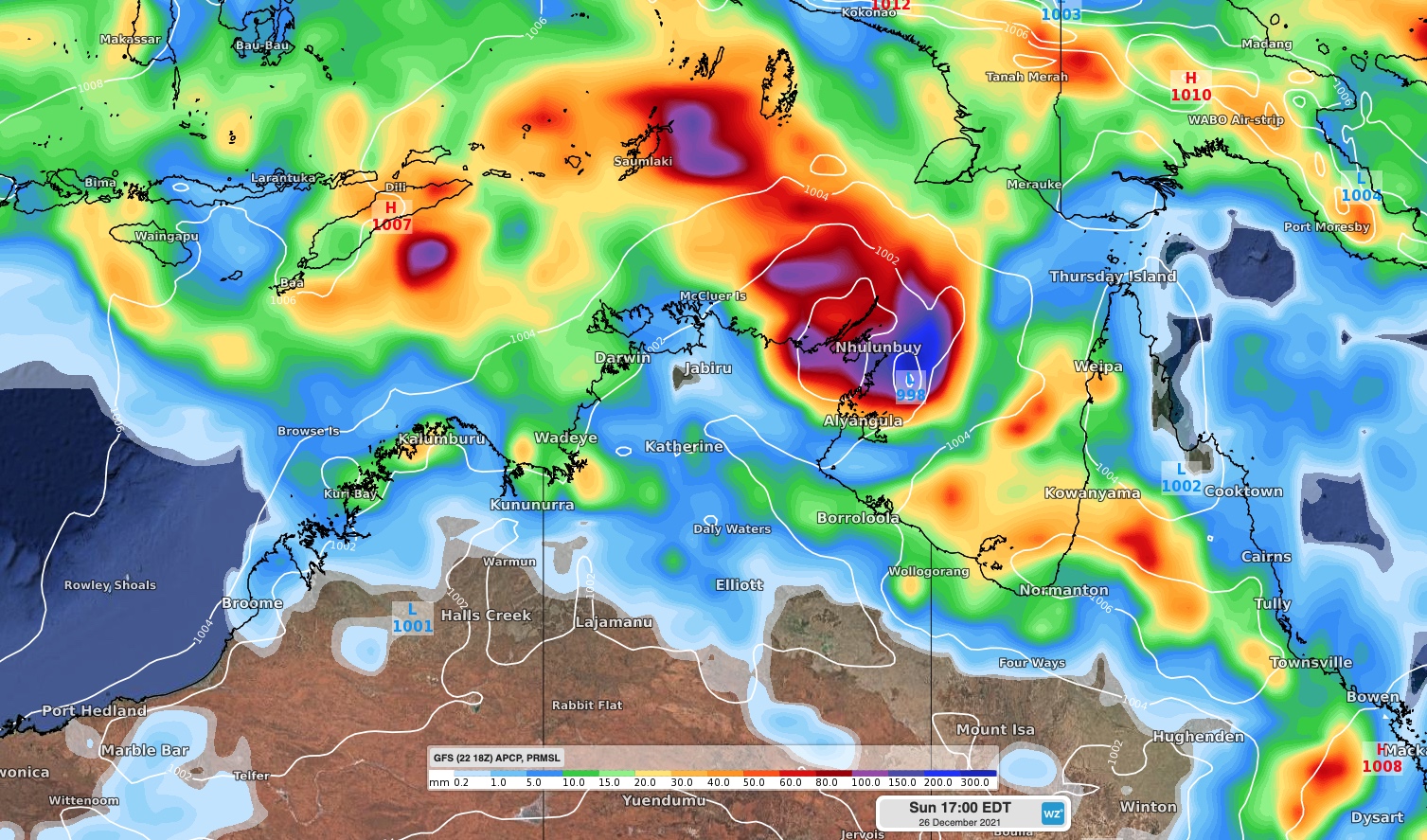
Image: Forecast accumulated 24-hour rain and mean sea level pressure (MSLP) at 5pm AEDT on Sunday, December 26, according to the ECMWF model (top) and GFS model (bottom).
Some forecast models, including Australia's ACCESS-G model, predict that the low will move towards the southwest on the weekend and track over the Timor Sea, possibly passing close to Darwin. If the low takes this path and remains over open water, it may develop into a tropical cyclone late on Christmas Day or on Boxing Day.
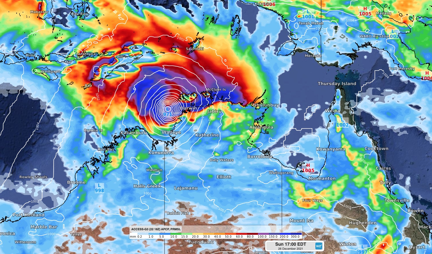
Image: Forecast accumulated 24-hour rain and mean sea level pressure (MSLP) at 5pm AEDT on Sunday, December 26, according to the ACCESS-G model.
According to the Bureau of Meteorology, there is a 20 to 50 percent chance that a tropical cyclone will develop over waters off the Top End or northern Kimberley on Sunday.
There is still a fair amount of uncertainty regarding the future development of this system. Anyone living in the Top End, Kimberley or around the Gulf of Carpentaria should closely monitor the latest forecasts and tropical cyclone advisories in the coming days.