
Tropical cyclone potential picking up

The first tropical cyclone of the season could develop over Australian waters as early as next week.
Despite a quiet start to Australia's 2019/20 tropical cyclone season and the northern wet season in general, things could pick up as we move into the new year.
Forecast models suggest that a low pressure trough could deepen off Australia's northwest coast early next week. There are indications that this could be the first appearance of the monsoon trough near Australia so far this season.
A number of models hint at the development of a low pressure system within this trough, raising the likelihood that a tropical cyclone could develop at some stage next week.
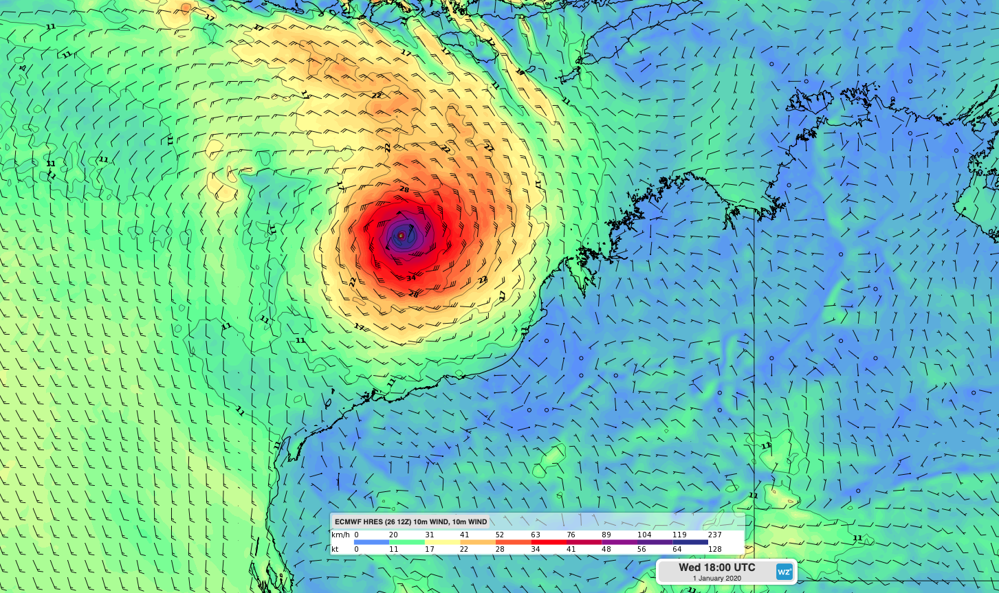
Image: Forecast surface wind in the middle of next week according to the ECMWF-HRES model. This is the projection from one global NWP forecast model and some other models are showing vastly different scenarios, so uncertainty around this system is high.
It's still too early to know if a tropical cyclone will form. However, this is the first real sign that the tropics are starting to wake up from a long dry season.
If a tropical cyclone does form in Australian waters next week it will be named Blake.
Communities in cyclone-prone areas of the NT and WA should keep an eye on this system over the next week.