
Tropical Cyclone potential increasing this week

The likelihood of tropical cyclone development will increase later this week as the monsoon trough descends over northern Australia.
After an unusually dry start to the wet season, the monsoon trough formed to the north of Australia on Monday. As it drifts south this week, this trough will bring widespread rain and thunderstorms to northern parts of the country.
While monsoon cloud and rain will bring relief from heat that's been gripping Australia's western tropics recently, it's also likely to increase the risk of tropical cyclone development.
On Monday afternoon, two weak tropical lows were located within the monsoon trough, one near Torres Strait and another over the Arafura Sea, well north of the Top End.
While the future of these two lows is far from certain, both are expected to move into environments that could help them intensify over the coming days.
The Arafura Sea low is expected to gain strength as it moves towards the southwest this week, possibly developing into a tropical cyclone somewhere to the north of WA. According to the Bureau of Meteorology, this low has a moderate (20-50 percent) chance of developing into a tropical cyclone from Thursday.
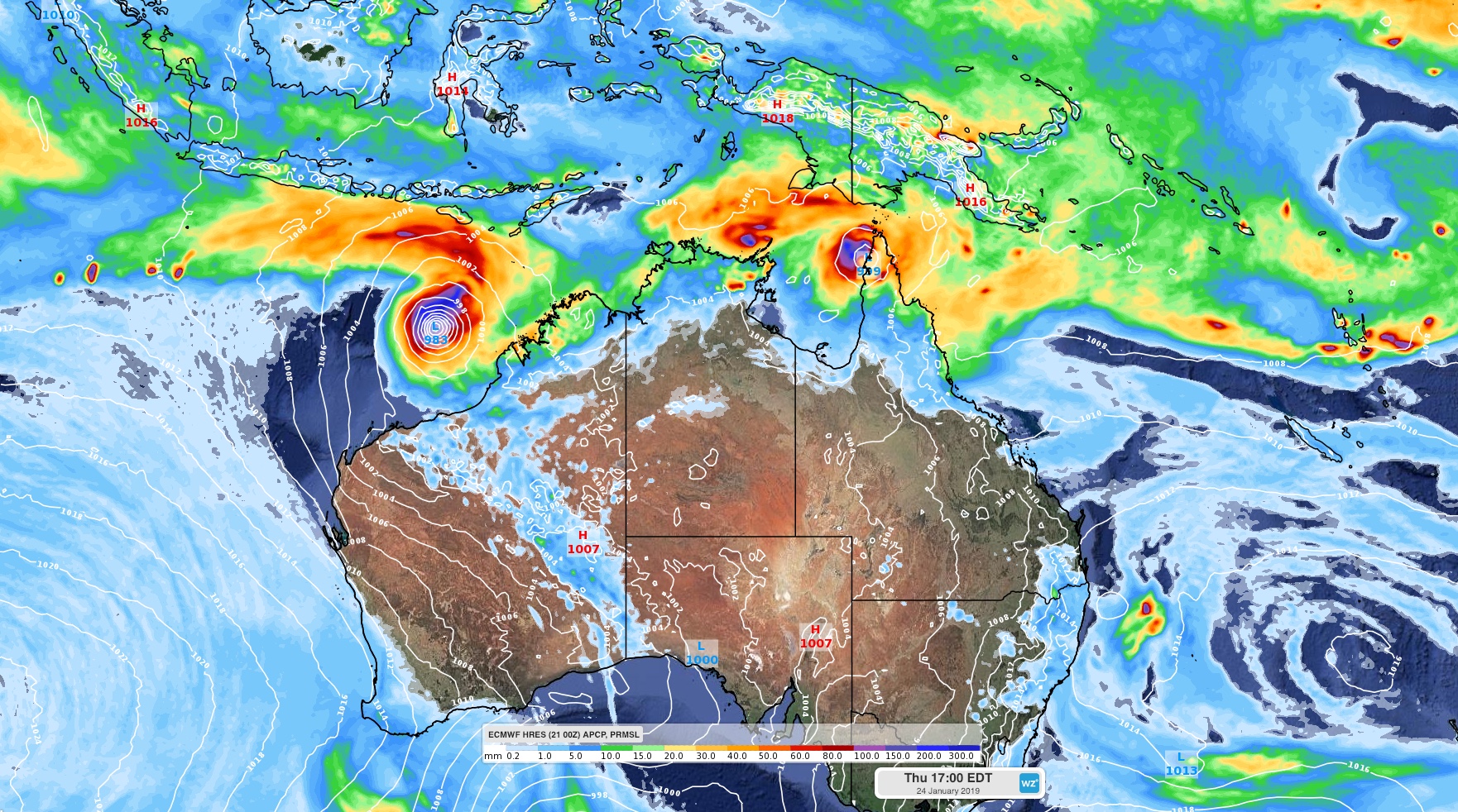
Image: ECMWF-HRES prediction of where two tropical lows or cyclones may be located on Thursday this week.
It's too early to know where this system will move if it does become a tropical cyclone, although a number of computer models indicate that it could move near the Pilbara coast towards the end of the week.
The tropical low near Torres Strait should also move south with the monsoon trough this week, although it's uncertain whether this low will enter Cape York Peninsula or head into the Coral Sea. Either way, the chance of it becoming a tropical cyclone will also increase during the second half of the week. On Monday, the Bureau rated this system as a low (5-20 percent) chance of reaching tropical cyclone intensity on Thursday, although this may increase later in the week.
The next tropical cyclone to form in Australian waters will be named Riley.