
Tropical Cyclone Oma lingers offshore

A short-lived tropical cyclone watch was cancelled in southeast Queensland on Friday morning, although the state isn't in the clear just yet.
Oma has been a slow moving and unpredictable system during the last week. After travelling from waters near Vanuatu and New Caledonia, the category one tropical cyclone was located over the Coral Sea, about 700km to the northeast of Brisbane at 4am on Friday.
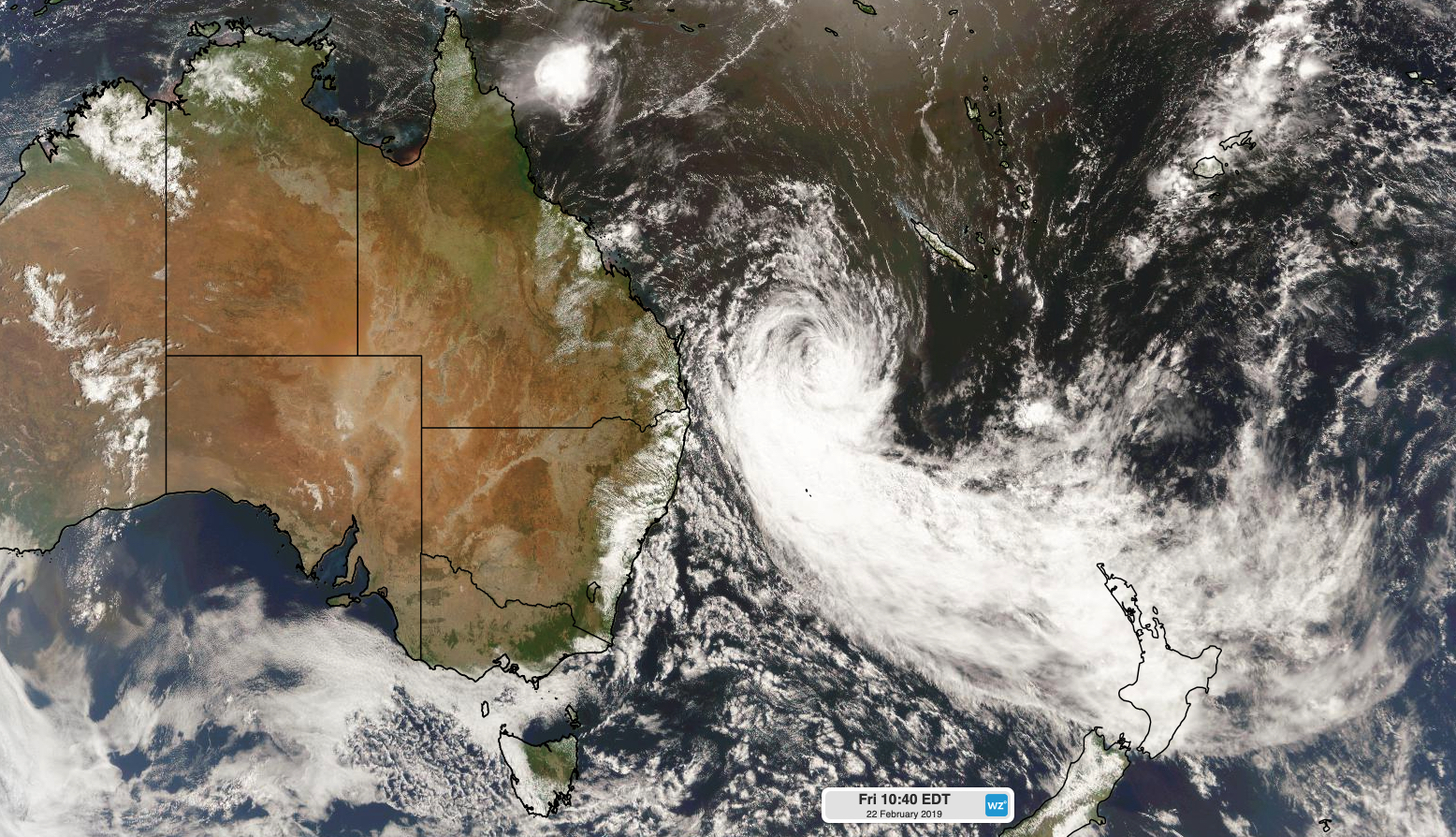
Image: Tropical Cyclone Oma over the Coral Sea on Friday morning.
While some computer models had previously hinted that Cyclone Oma could approach Queensland's southeast coast over the weekend, this scenario now looks unlikely. Oma is expected to reach within 600km of Queensland's southeast coast on Saturday, before weakening and turning towards the north by Sunday.
At this stage, Oma is expected to continue moving towards the north or northwest during the first half of next week, while staying several hundred kilometres off the Queensland's east coast.
While Oma's distance from Queensland caused a cyclone watch to be cancelled this morning, numerous other warnings remain in place.
The most immediate threat from Cyclone Oma is a large and powerful swell that it's sending towards eastern Australia. On Friday morning, maximum wave heights were exceeding 10 metres off southeast Queensland and could get bigger during the next 2-3 days.
A waverider buoy located near North Stradbroke Island's Point Lookout registered a maximum wave height of 10.14 metres at 6am on Friday. The largest wave measured by this buoy was 16.8 metres back on March 4th, 2006. Further south, maximum wave heights were exceeding nine metres off the coast of Byron Bay during Friday morning.
These large waves are combining with some of the highest astronomical tides of the year, which is leading significant beach erosion and coastal inundation in some areas. These hazards are likely to persist into the weekend.
Damaging wind gusts are also likely to affect parts of southeast Queensland and northeast NSW during Friday and Saturday, and possibly on Sunday. These blustery winds are being produced by an increasing pressure gradient between Tropical Cyclone Oma and a high pressure system moving over Tasmania and into the Tasman Sea.
Cyclone Oma's distance from the coast means that heavy rain and flooding are no longer expected on Australia's mainland during the coming days from this system.
Residents living in eastern Queensland should keep an eye on Cyclone Oma's movements in the coming days. There is still some uncertainty regarding where the system will end up during the second half of next week, as Oma continues its lengthy and meandering journey over the Coral Sea.