
Tropical Cyclone Neville finally forms
After spending the last 2 weeks hovering off the northwest shelf of Australia as a tropical low, Tropical Cyclone Neville has finally formed over the Indian Ocean and has already formed an eye.
Neville was named as Australia’s sixth tropical cyclone of the season at 2:50 pm WST on Wednesday. It has since strengthened to a category 3 severe tropical cyclone, with maximum winds gusts up to 165 km/h as of 9am WST on Thursday.
Video: Infrared satellite showing Neville initially forming and the creation of its eye.
The tropical low that would become Neville has hung around off the northwest shelf of Australia for over 2 weeks, with the first advisories for this system issued by the Bureau of Meteorology on March 11, as the system was swiping past the Cocos (Keeling) Islands.
Neville initially struggled to intensify off the northwest shelf due to lack of 2 of the 5 critical conditions needed for tropical cyclone development:
- Low wind shear. Winds can only vary in direction and speed a little with height. Too much, and the system pulls itself into different directions.
- Mid-level moisture. Tropical Cyclones are cloudy systems and need moisture to be able to create the clouds and convection. Without moisture, the system cannot support itself, causing it to become very weak.
From Wednesday morning, the dry air and the wind shear finally dissipated enough for Neville to spin up and become organised. Within hours, it became a tropical cyclone with gales over halfway around the system.
The fortunate news is the Neville is truly in the middle of nowhere over the Indian Ocean, being more than 800km from both Exmouth and Christmas Island. It is currently tracking west away from the Australian mainland, towards the edge of the Western Region. Direct impacts are very unlikely, even for the Indian Ocean Islands.
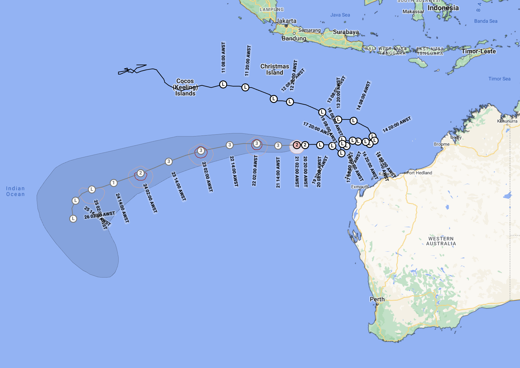
Image: Tropical Cyclone Neville’s observed path and forecast track. Source BoM
Neville will continue out to the middle of the Indian Ocean, leaving Australia’s area of responsibility when crossing 90°E, before being consumed by a cold front to the south over the weekend. The moisture from Neville will cause heavy rain for a few days along that cold front, but very little is likely to be leftover once the front reaches southwestern WA mid next week.
You can see Tropical Cyclone Neville on the Weatherzone Radar.