
Tropical Cyclone Mitchell lashing WA despite weakening near Gascoyne coast
Heavy rain, damaging winds and abnormally high tides are impacting parts of Western Australia’s Pilbara and Gascoyne districts today as Tropical Cyclone Mitchell edges closer to the coast.
At 8am AWST on Monday, February 9, Mitchell was a category one tropical cyclone located roughly 135 km south southwest of Exmouth near the Ningaloo Coast. At that time the system was producing wind gusts around 120 km/h near its core and moving towards the south-southwest, roughly parallel to the coast.
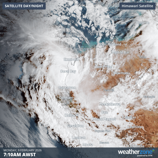
Image: Visible satellite images showing Tropical Cyclone Mitchell located near the Ningaloo Coast on Monday, February 9. Source: Weatherzone.
Mitchell was a powerful category three severe tropical cyclone as it tracked to the north of the Pilbara district over the weekend. However, after weakening to a category two system on Sunday, Mitchell was further downgraded to a category one system on Monday morning.
Mitchell’s declining strength over the past 24 hours has occurred as the tropical cyclone moved closer to land, which allowed friction to slacken its winds and drier air to wrap around its core. It is also now moving over a region of relatively cooler sea surface temperatures compared to the weekend, which will hinder it from re-intensifying on Monday.
The latest forecast track map from the Bureau of Meteorology suggests that Mitchell will move further south on Monday and make landfall somewhere near Cape Cuvier during the afternoon. The system should then weaken further as it tracks inland over the Gascoyne district, likely weakening below tropical cyclone strength overnight.
Despite its weaker strength compared to the weekend, Mitchell is still dangerous and will cause severe weather over parts of WA’s Gascoyne district on Monday and Tuesday. This is likely to include damaging winds, heavy rain, flash flooding and abnormally high tides.
Rain and thunderstorms associated with the remnants of Tropical Cyclone Mitchell could spread inland across the Wheatbelt, Goldfields and parts of the WA’s south coast on Tuesday and Wednesday. Some of this rain could affect the Perth region, although the heaviest falls will be further east. This southward progression of Mitchell’s moisture may cause areas of flooding more than 1000 km away from where it made landfall.
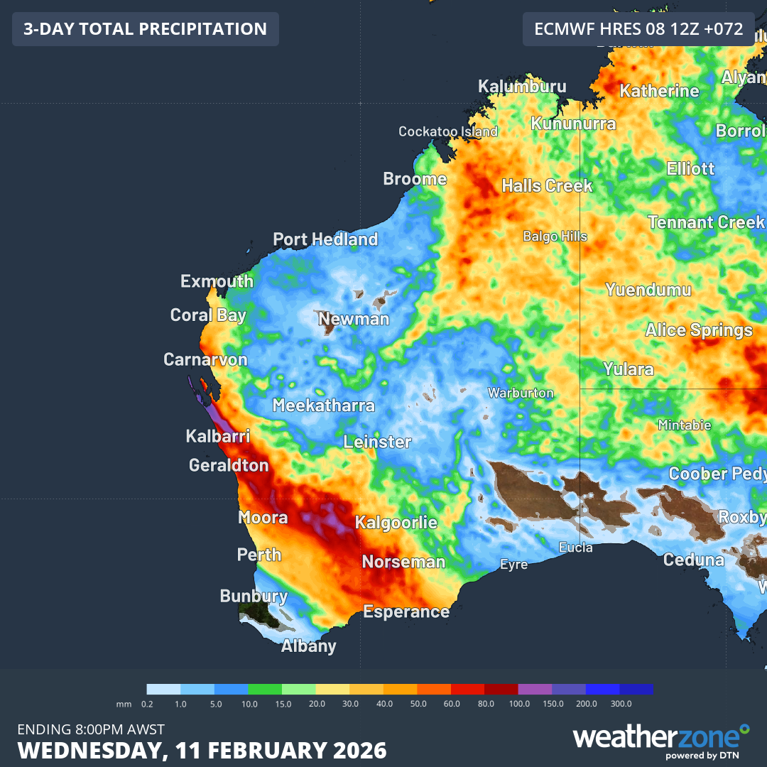
Image: Forecast accumulated rain during the three days ending at 8am AWST on Wednesday, February 11. Source: Weatherzone.
Anyone living in WA should check the latest warnings and tropical cyclone advisories for the most up-to-date information on Mitchell and its associated severe weather.