
Tropical Cyclone Ilsa could make it from WA to Queensland
The immediate threat from Tropical Cyclone Ilsa is the WA coastline and nearby areas in the Kimberley and Pilbara regions, which are set to feel the full force of Ilsa on Thursday intro Friday, according to the latest BoM advice.
But as Ilsa moves inland over the weekend and deteriorates into a tropical low, heavy rain and/or strong winds could make it all the way to western Queensland, affecting places like Birdsville in the far SW of the state.
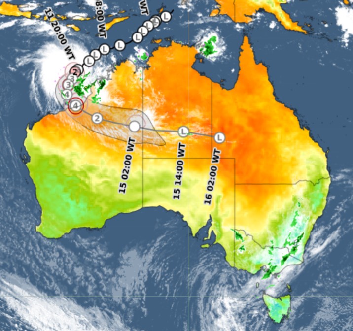
You can see the likely path of TC Ilsa, and the remnants of the cyclone, on the track map above. We’ll talk a little more about the far-reaching impacts of this severe storm system a little lower down.
But first, here's the latest key info on Tropical Cyclone Ilsa.
- Ilsa is currently a Category 2 tropical cyclone, with sustained winds near the centre of 110 km/h and wind gusts to 155 km/h
- As we write this story around 10 am Wednesday AWST (that's midday AEST), Ilsa is currently estimated to be located 355 km NW of Broome and 530 km NE of Port Hedland
- It is currently moving SW at 7 km/h
- Ilsa is expected to intensify into a severe tropical cyclone in the next few hours as it continues to move southwest towards the Pilbara coast (Geoscience Australia defines a severe tropical cyclone as a storm with sustained winds of 118 km/h or higher)
- As mentioned, Ilsa is forecast to track towards the east Pilbara coast on Thursday. The BoM says a severe impact is likely along the coast and adjacent inland parts between Port Hedland and Broome, in the vicinity of Wallal Downs – a cattle station roughly halfway between Port Hedland and Broome
- It is expected to become a Category 4 storm shortly before making landfall
And then?
Ilsa is expected to maintain tropical cyclone intensity as it tracks further inland across WA's Northern Interior forecast district towards the NT border.
Somewhere around the NT border, it is likely to become a tropical low. Cyclones are like a sponge when they're over the ocean, constantly soaking up water. The sponge eventually dries out over land, but in this case, there will be a moisture injection from a trough moving northwards from southern of WA ahead of a cold front.
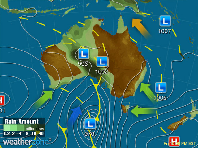
The upshot is that the interaction between these two systems will cause heavy rain in parts of the outback. Extremely arid parts of SA and the southern NT are in line for a good soaking into the weekend.
For visitors to Uluru, that could mean waterfalls on the Rock, with up to 20 mm possible on Friday and 35 mm possible on Saturday.
The Wednesday satellite image below shows water vapour already streaming across the country in the outflow from Ilsa. Most of that is high cloud, but it still illustrates the power and scale of this system.
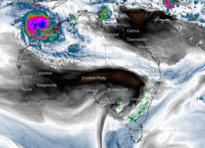
Significant moisture is unlikely to make it north of about Alice Springs from the remnants of Ilsa. So when we say that this storm could make it to Queensland, it'll mostly be a burst a of strong (but not damaging) winds under cloudy skies, but not too much rainfall.
We'll talk more about the potential for rain and wind in Central Australia and western Queensland later this week. For now, the focus is well and truly on northwest WA, where TC Ilsa continues to intensify by the minute.