
Tropical Cyclone Ann approaching Australia

Tropical Cyclone Ann is moving over the Coral Sea towards Australia. While this late-season cyclone should weaken before reaching northern Queensland, it could still cause rain and storms in multiple states and territories later this week.
Tropical Cyclone Ann formed over the eastern Coral Sea early on Sunday morning. By 4am AEST on Monday, Ann had strengthened into a category two tropical cyclone and by 10am, it was located just under 1,000km to the east of Cairns.
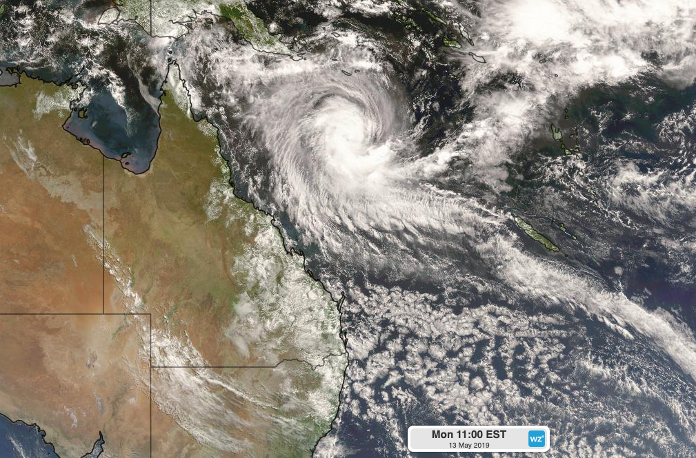
Image: Satellite image of Tropical Cyclone Ann on Monday May 13th, 2019.
It's unusual for tropical cyclones to occur in Australia's area of responsibility this late in the season, but it's not unprecedented.
Tropical Cyclone Pierre formed over the Solomon Sea during the middle of May in 2007. More recently, Tropical Cyclone Greg lasted into the early hours of May 1st, 2017 before being downgraded to a Tropical Low near the Cocos Islands. In 2015, Tropical Cyclone Quang lasted until the first day of May before making landfall near Exmouth below cyclone strength.
Tropical Cyclone Ann is expected to gradually weaken as it moves towards northern Queensland during the next two days.
Ann is currently forecast to reach the eastern side of Cape York Peninsula on Wednesday as a low pressure system. However, landfall as a category one tropical cyclone can't be ruled out, according to a technical bulletin issued by the Bureau of Meteorology on Monday morning.
If Ann makes it to northern Queensland as a category one cyclone, it's likely to cause damaging winds near it's core. However, heavy rain and storms are likely to be a threat regardless of Ann's strength at landfall.
A wave of tropical moisture accompanying the remnants of Cyclone Ann will cause rain and thunderstorms to increase over central and northern Queensland on Tuesday and Wednesday.
This pulse of moisture will continue to drift across the Northern Territory from Thursday, where it could produce widespread showers and storms during the second half of the week.
There are indications that a strong frontal system crossing southern Australia at the end of this week could draw Ann's tropical moisture southwards. If this happens, widespread showers and storms will also affect parts of South Australia, NSW, Victoria and Tasmania towards the end of the week.
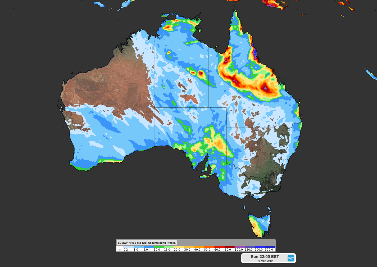
Image: Forecast rain this week according to the ECMWF-HRES model.
It's too early to know how this event will unfold across Australia, because tropical cyclones are unpredictable systems and it will involve the interaction of two separate synoptic systems. As a result, forecasts may change a bit during the coming days as computer models try to figure out what's likely to happen.
Keep an eye on http://www.bom.gov.au/cyclone for the latest tropical cyclone advisories and http://www.weatherzone.com.au/warnings.jsp for all weather-related warnings.