
Trio of lows churning the Tasman Sea
If you live along the southern half of the NSW coast, it's probably worth staying out of the water today.
A complex low pressure system spinning over the Tasman Sea has been sending large waves and blustery showers towards NSW during the last couple of days.
This system has already produced more than 200mm of rain along the state's south coast. One rain gauge at Brogers Creek collected a whopping 303mm during the 48 hours to 9am on Friday. Nearby, Kiama's 94mm during the 24 hours to 9am Friday was its heaviest rain since February last year.
The composite satellite and radar image below shows where showers (shown in green) were occurring this morning. The image also reveals three distinct low pressure centres (circled in blue) surrounded by swirls of cloud.
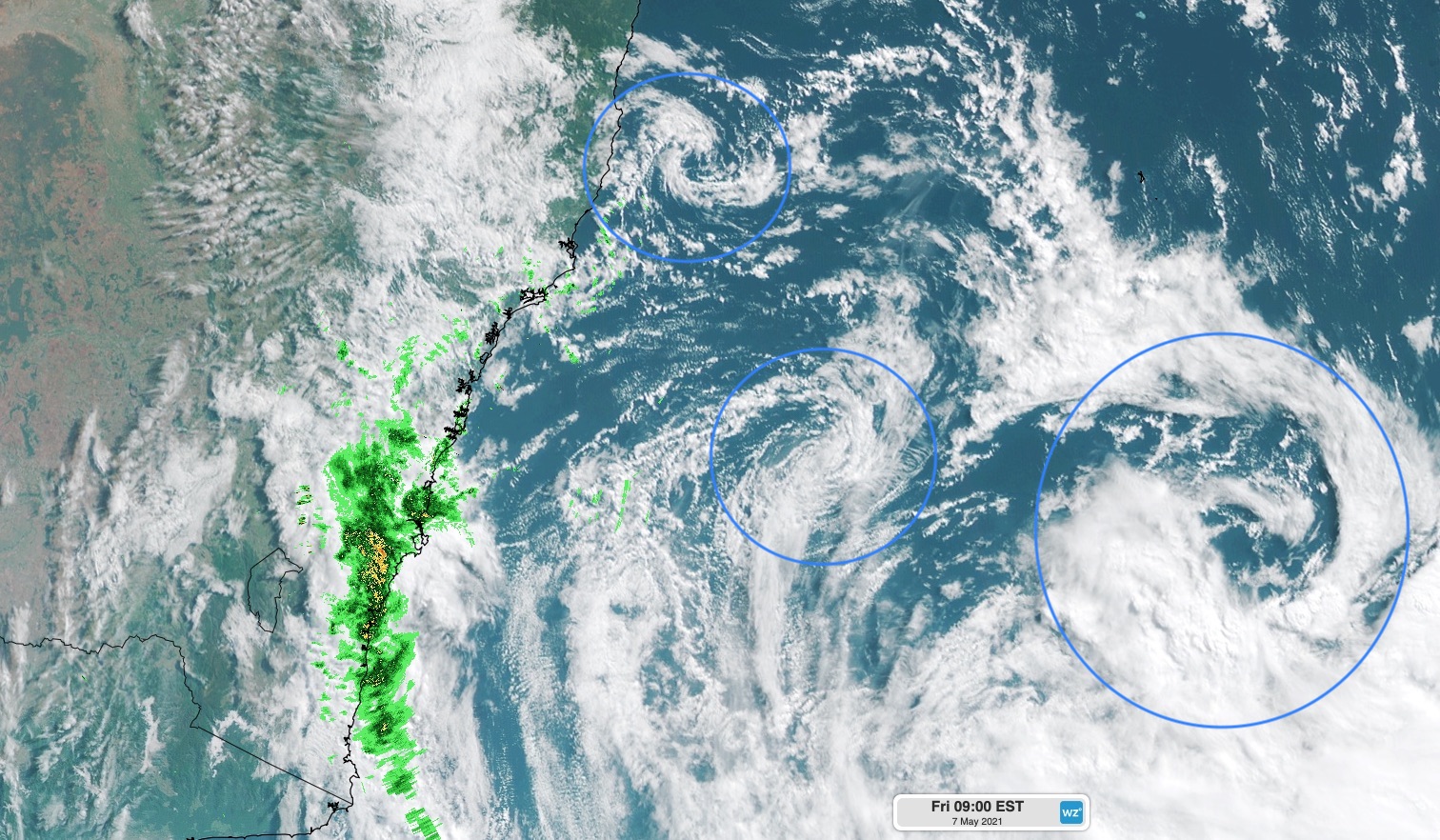
Image: Composite satellite/radar image at 9am AEST on Friday, May 7. The blue circles highlight three distinct low pressure circulations over the Tasman Sea.
In addition to heavy rain, this complex system is also causing blustery winds and big waves.
We reported yesterday that some coastal areas of eastern NSW had clocked wind gusts of over 100km/h. These winds have been churning up the Tasman Sea and driving a large swell into the NSW coast.
A waverider buoy located near Botany Bay registered maximum wave heights over eight metres on Thursday night and Friday morning. Another buoy at Port Kembla measured even larger waves, with max heights hitting 9.39 metres in the early hours of Friday morning.
But while the rain, wind and waves from this system are all impressive, one of the more surprising effects has been near-record overnight warmth in some areas.
The combination of clouds, wind and relatively warm air – which was being driven over the NSW coast by the offshore low – caused unusually high temperatures in eastern NSW last night.
Camden (17.2ºC) and Bankstown (17.9ºC) both registered their highest May minimum temperature in 48 years. Goulburn only dropped to 13.9ºC, which was warmer than any night during April and its highest May minimum in 21 years.
Wind and showers will ease over eastern NSW today as the low moves further offshore. However, hazardous surf will linger for some areas for another day or so.