
Transport chaos as Sydney sees a month's rain in 30 hours
The deluge continues in Sydney and surrounds with a month's worth rain falling in just over a day, causing cancellation and delays across the city.
The video below shows rain coming from two different directions into Sydney on the radar on Friday afternoon.
Image: Radar image 2:35pm on Friday, April 5
This is because the atmosphere is saturated with moisture up to around 12km above the surface over Sydney.
The wind direction varies across distinct levels of the atmosphere, with the rain travelling east to west in the middle layers and north to south in the upper layers of the atmosphere.
The moisture colliding over Sydney and surrounds has led to a month's worth of rainfall falling in some locations since Thursday.
Sydney has eclipsed its April average rainfall of 127mm, with around 132mm falling in just 30 hours to 2:30pm on Friday.
This deluge has caused significant delays across Sydney’s roads, trainlines and airways on Friday and will continue to this evening as the rainfall sets in.
Widespread and locally intense rainfall is expected to continue across the Sydney Metro, Hunter, Blue Mountains, Illawarra, South Coast and Southern Tableland districts this evening into Saturday morning.
The map below shows one model’s predicted accumulated rainfall during the next 18 hours with widespread falls of 50-100mm forecast, with isolated falls of 200-300mm possible across parts of the Illawarra escarpment.
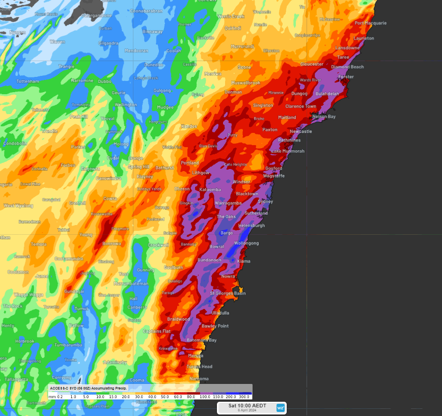
Image: Accumulated forecast rainfall in the 18 hours leading up to 10am AEDT on Saturday, April 6, according to Access-C.
Locally intense rainfall could lead to life-threatening flash flooding in these areas in the next 48 hours.
Unfortunately, this deluge is likely to be accompanied by damaging winds on Friday evening into Saturday morning in the region, with winds averaging around 60 to 70 km/h and gusting up to 90km/h.
The map below shows the fierce winds forecast along the Sydney and Hunter coasts at midnight tonight.
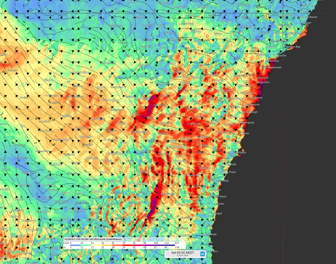
Image: Instantaneous wind gust forecast for midnight AEDT on Friday night, according to ACCESS-C.
The heavy rainfall and fierce winds have the potential to topple trees which could impact transport on Friday evening into Saturday. The strong easterly winds are also likely to force Sydney Airport into single runway operations, reducing the number of flights that can land and take off.
The severe weather is expected to clear the Sydney Metropolitan area on Saturday morning, while Illawarra will see the rainfall clear by the middle of the day and the South Coast during Saturday afternoon.
Please keep an eye out for the latest warnings and updates here as the event unfolds.