
Total Fire Bans issued as heat intensifies over NSW then Qld
The topsy-turvy weather we've experienced this season continues, as we move from a phase where temperatures have been below average to a phase of increased warmth. A deepening heat trough is moving over NSW this weekend, bringing elevated fire danger including Total Fire Bans on Saturday, 15th November. On Monday, the elevated fire danger will extend into southern Qld, with Brisbane expecting its highest maximum so far this month.
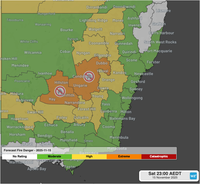
Image: NSW Fire Danger ratings on Saturday, 15th November including Total Fire Bans for the (left to right) Northern Riverina and Lower Central West Plains districts (Bureau of Meteorology).
Hot temperatures peaking in the high-thirties funnelled by a heat trough will spread across central NSW on Saturday, November 15th, and combined with gusty winds is creating elevated fire potential for the Northern Riverina and Lower Central Plains districts. Extreme fire danger ratings and Total Fire Bans have been issued for the first time this season for both districts.

Image: Modelled 12-hour maximum temperatures (GFS Fri 12Z) to 11pm AEDT on Saturday, 15th November 2025. Source: Weatherzone.
From Sunday, High Fire Danger is expected to spread towards the Greater Hunter, Greater Sydney and Illawarra/Shoalhaven districts. Extreme fire danger will remain for the Lower Central West Plains district. Parts of western Sydney are expected to reach the mid-thirties, about 8-10ºC above the monthly average.
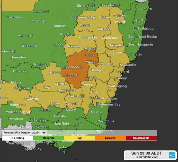
Image: NSW Fire Danger ratings on Sunday, 16th November (Bureau of Meteorology).
Elevated fire danger is expected to continue from the start of the working week, with a broader spread towards Qld as dry westerlies persist in the wake of the trough. The coastal stretch between the Illawarra and Shoalhaven district of NSW right up to the Capricornia district of Qld will be under the influence of warm to hot westerly winds yielding High Fire Danger. Brisbane is expected to reach the mid-thirties on Monday, which would bring the highest temperature of the month so far to the Qld capital.
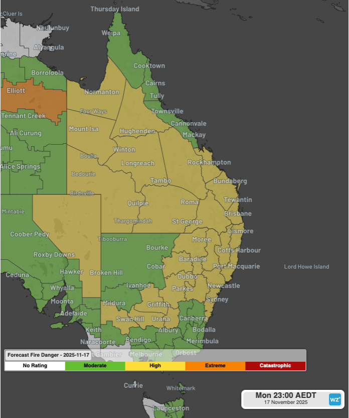
Image: NSW and Qld Fire Danger ratings on Monday, 17th November (Bureau of Meteorology).
Be sure to have your Bushfire Survival Plan prepared for the season ahead. For further updates on the latest warnings, check out our website.