
Tornadic thunderstorm hits Perth as huge rainband builds over Australia
A powerful cold front that produced a tornadic thunderstorm in Perth on Wednesday night is now causing a massive rainband to build over Australia.
Severe storms hit WA
A flurry of intense thunderstorms hit the southwest of WA late on Wednesday as a cold front swept across the region from the Indian Ocean. These storms included a cell that produced a tornado in Perth.
Doppler radar data, which shows wind velocity in thunderstorms, suggests that a tornadic waterspout formed off the coast of Perth on Wednesday evening and then drifted ashore with a line of intense thunderstorms. This violently rotating column of air appears to have caused property damage in the City Beach area of western Perth.
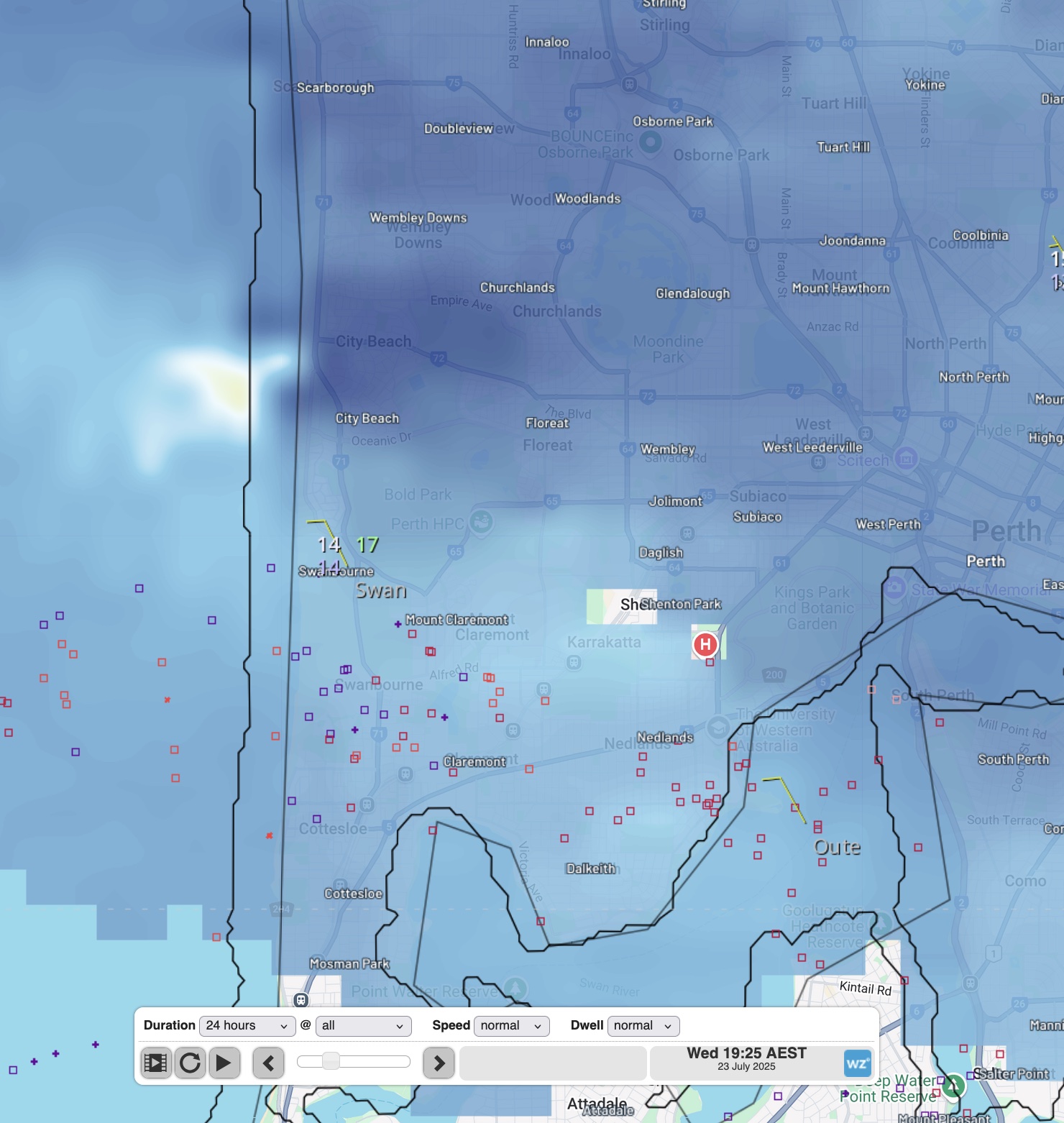
Image: Doppler radar image showing signs of rotation near City Beach on Wednesday evening.
Massive rain band forming
The cold front that caused the severe thunderstorms in the southwest of WA on Wednesday has now moved further east, where it is interacting with a stream of tropical moisture to spawn a large cloudband.
The satellite images below show this developing cloudband sitting over WA and SA on Thursday afternoon.
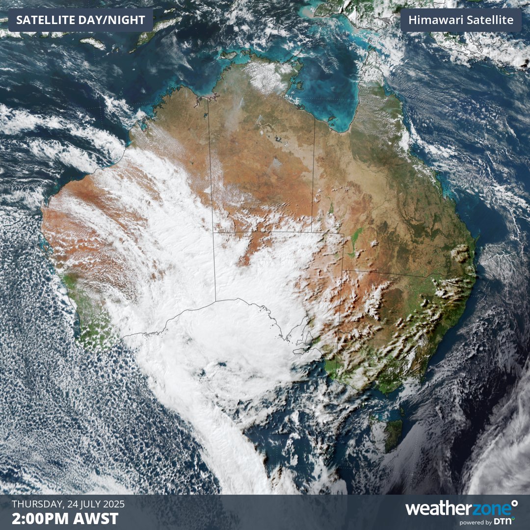
Image: Visible satellite images captured on Thursday, July 24, 2025.
Over the coming days, the cold front will morph into a low pressure system as it tracks towards the east, causing a huge band of cloud and rain to spread across Australia. This rainband will soak part of every state and territory and deliver some of the best rain in years to drought-affected areas in southern Australia.
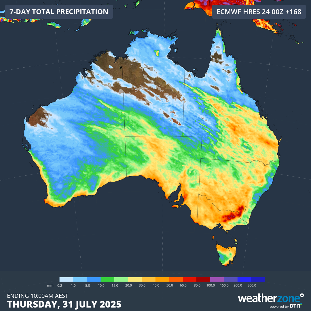
Image: Forecast accumulated rain during the 7 days ending at 10am AEST on Thursday, July 31. 2025.
While rain will be the main feature of this huge weather system, parts of southern and central Australia will also experience damaging winds in the next couple of days. As of 5pm AEST, severe weather warnings were in place for damaging wind gusts in parts of WA, SA, Vic and southwest Qld.
Further warnings are likely to be issued in the coming days as this system spreads rain and wind across the country.