
Top End in the midst of the 'build up'
The months leading up the start of the wet season can be particularly uncomfortable for parts of the tropics, as the higher angle of the sun in the sky, as well as the changing synoptic patterns promote days on end of hot, humid conditions.
For much of the region, and most noticeably for inland towns, the months between September and November feature the hottest days of the year. As dry southeasterly winds weaken, stifling humidity begins to build, occasionally amplified by hot northerly winds, and overnight temperatures also become remarkably warm. This period is generally known as the 'build up’ to the start of wet season, where days become very hot, with tantalising thunderheads building in the sky that rarely deliver. Cooling thunderstorms are few and far between, offering minimal relief from the muggy days.
This can be illustrated quite well when looking at the climate data for Katherine, located nearly 300km southeast of Darwin. High pressure sitting over the continent during the middle of the dry season brings about quite cool nights and generally warm days.
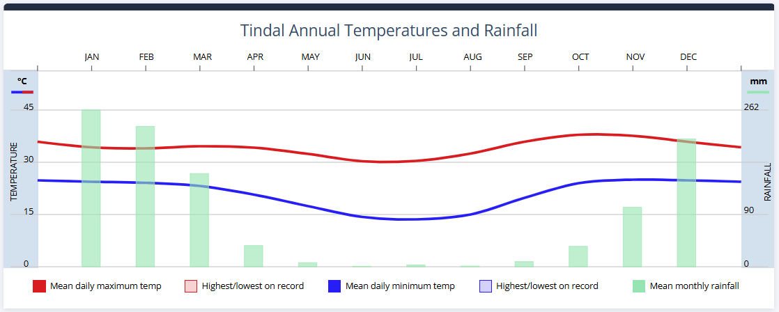
Image: Climate graph for Tindal (near Katherine) depicting maximum and minimum temperatures, as well as rainfall
However, in the months leading up to the northern rainfall onset, high pressure retreats towards the Southern Ocean, rising sea surface temperatures and weakening southeasterly winds inject humidity into the environment. This means that for the later months of the dry season, very warm nights and hot, uncomfortably humid days become the norm.
On average, significant rainfall doesn’t arrive across the Top End before October, while the official Northern rainfall onset – when 50mm has fallen for a particular location since September 1st – doesn’t arrive until late October or November. However there is significant variation year to year and location to location across Australia's tropics.
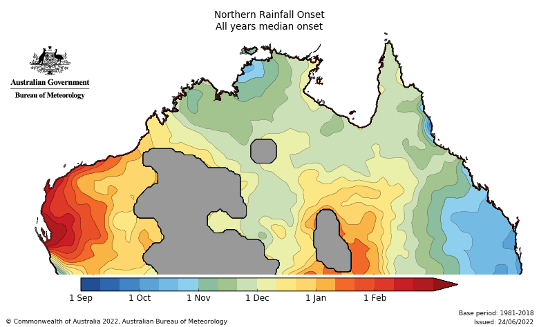
Image: Average date of the Northern Rainfall Onset across all years between 1981 and 2018. Source: BoM
Speaking of rainfall, there will be some on the way for parts of the Top End, including Darwin, as a weak trough over the area starts to pull in moisture. Showers and thunderstorms are chance every day until early next week, but most likely on Sunday and Monday and should bring the first rainfall since May for the NT capital.
While moderate rainfall totals are expected, there is a slight chance that any slow moving thunderstorm over a weather station could bring about the 50mm needed to trigger an early onset of the rainy season. Even if this does eventuate; hot, sunny and humid conditions are expected to return later in the week, cranking up the discomfort for the Top End residents once again.