
Top End cyclone threat
A tropical cyclone could form near the Northern Territory's Top End during the middle of this week.
At 9:30am ACST on Tuesday, a tropical low was located over the Arafura Sea around 195 kilometres north northeast of Nhulunbuy. This low is expected to move towards the west or southwest during Tuesday night and Wednesday, while gradually intensifying.
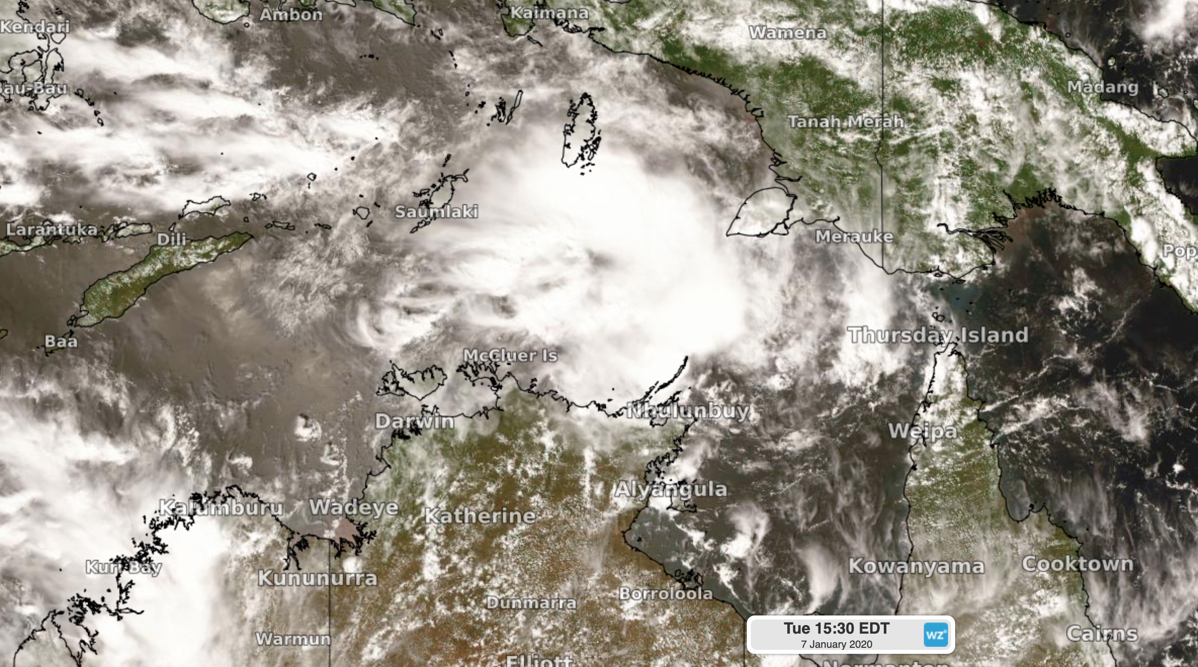
Image: Cloud associated with a tropical low over the Arafura Sea on Tuesday afternoon.
According to the Bureau of Meteorology, the low could develop into a tropical cyclone by Wednesday night before approaching the northern coast of the Top End on Thursday and possibly making landfall on Friday.
After crossing the coast, the system could move further west and affect the western Top End, including Darwin, this weekend.
While there is still a fair bit of uncertainty regarding the future movement and development of this system, there's a good chance that it will become Australia's second tropical cyclone of the 2019/20 season and the second to affect the country in the space of a week.
Further west, Tropical Cyclone Blake is currently causing severe weather over Western Australia's Kimberley and Pilbara Districts.
If the Arafura Sea low pressure system does become a tropical cyclone, it will be named Claudia.