
Thundery Thursday in northeast NSW and southeast Qld
Thunderstorms are developing over northeast NSW and southeast Queensland this afternoon, prompting warnings in some areas.
A low pressure trough interacting with a pool of cold upper-level air is causing storms to develop around the eastern end of the NSW/QLD border.
At 2:30pm, building cumulus clouds were causing showers on both sides of the border, with a few lightning strikes starting to flare up in NSW.
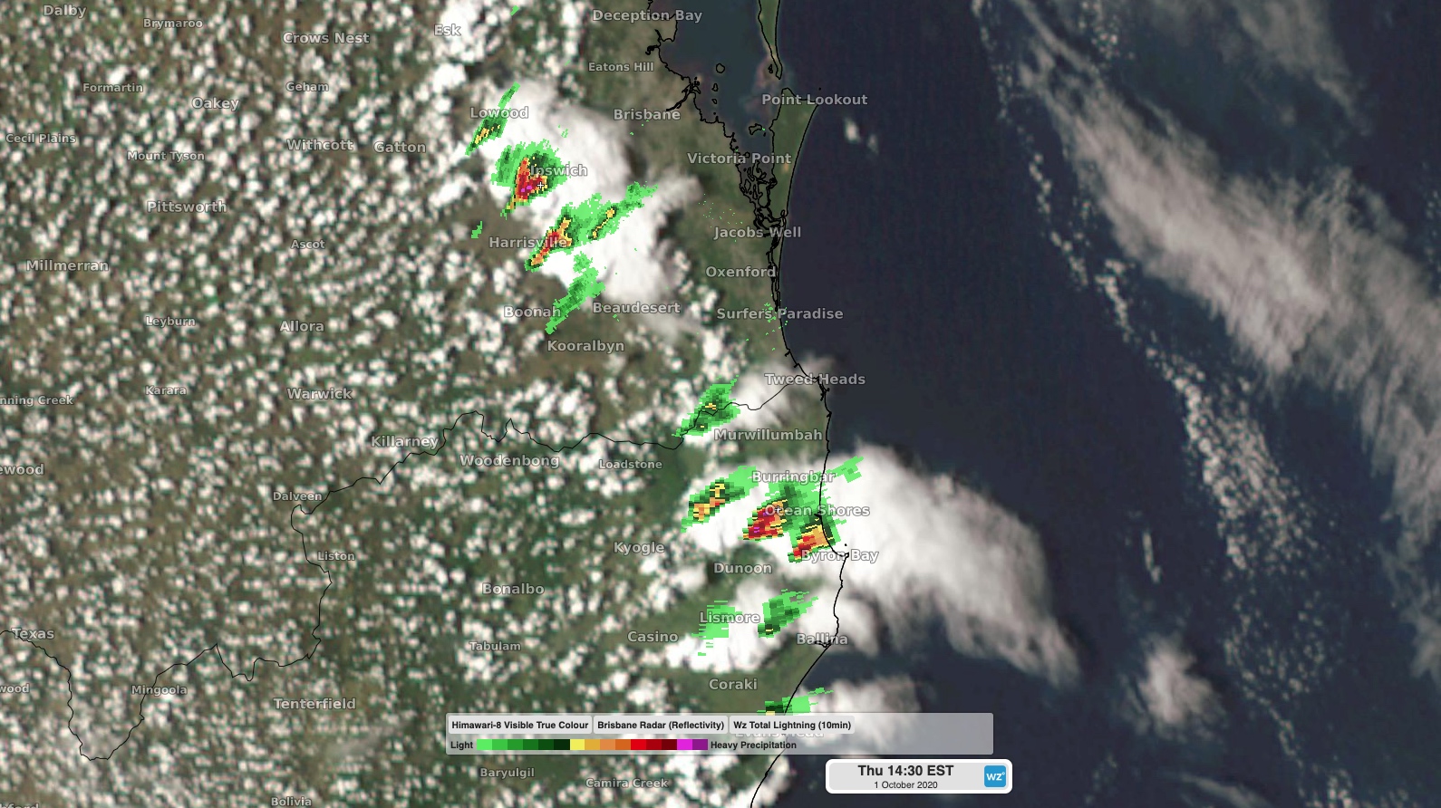
Image: Composite satellite, radar and lightning over northeast NSW and southeast Queensland at 2:30pm on Thursday.
A warning was issued shortly before 2:30pm for large hail and damaging winds in the far northeast corner of NSW, including Lismore, Murwillumbah, Byron Bay, Ballina, Casino, and Kyogle. The storms are developing inland and moving rapidly towards the east.
Today's thunderstorms are not expected to cause much rain, although damaging winds and large hail will remain a threat throughout the afternoon. Warnings may be issued in Queensland in the coming hours if storms start to become more active north of the border.
This situation is developing, so keep up to date with the latest warnings for the most accurate information.