
Thunderstorms light up skies over Queensland
A low pressure trough is continuing to spark thunderstorms over much of Queensland, after a similarly stormy Saturday. Some of these storms are severe, bringing the potential for damaging winds, large hailstones and heavy rainfall.
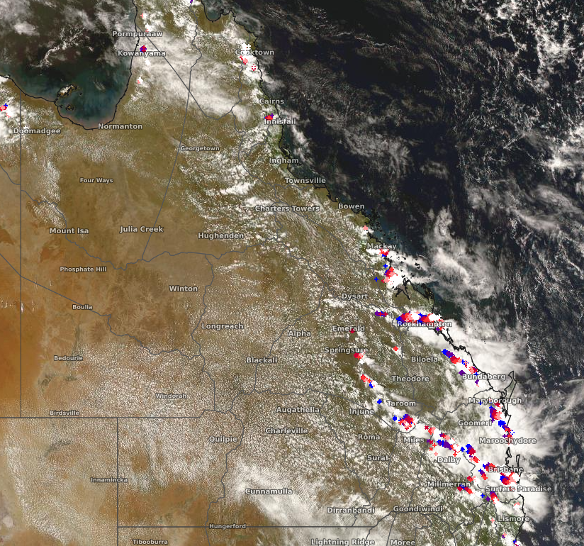
Image: Satellite imagery (Himawari-8) with lightning overlay at 3pm EDT Sunday
During Saturday afternoon and evening, clusters of thunderstorms developed near a line from the Gulf of Carpentaria down into southeast Queensland. Most notably, a band of slow moving thunderstorms moved over the Brisbane area, triggering localised heavy falls. Brisbane City recorded 37.6mm of rainfall, its wettest day since February of this year. Camp Hill, just southeast of Brisbane, had 97mm. RedCliffe (37mm) and Nambour (30mm) also saw healthy rainfalls, but more impressively, respectively saw 20mm and 10mm of this rain in just half an hour.
This afternoon, storms have developed again, with the most intense effects felt near the southeast and central coasts. Reports of hail ranging from 2 to 5cm in diameter have come from southwest Brisbane. Already many locations have received over 10mm of rain, with Mount Walsh recording 25mm. These storms may continue into the early morning on Monday. Thunderstorms could possibly redevelop and become severe along the coast and in northern parts of the state in the afternoon on Monday as a lingering trough combines with moist unstable air.