
Thunderstorms form over fires in NSW

An intense thunderstorm developed directly over the large Gospers Mountain bushfire in NSW on Friday afternoon.
A combination of relatively cool onshore winds interacting with much warmer air rising above the Gospers Mountain fire caused a large thunderstorm to develop on Friday afternoon.
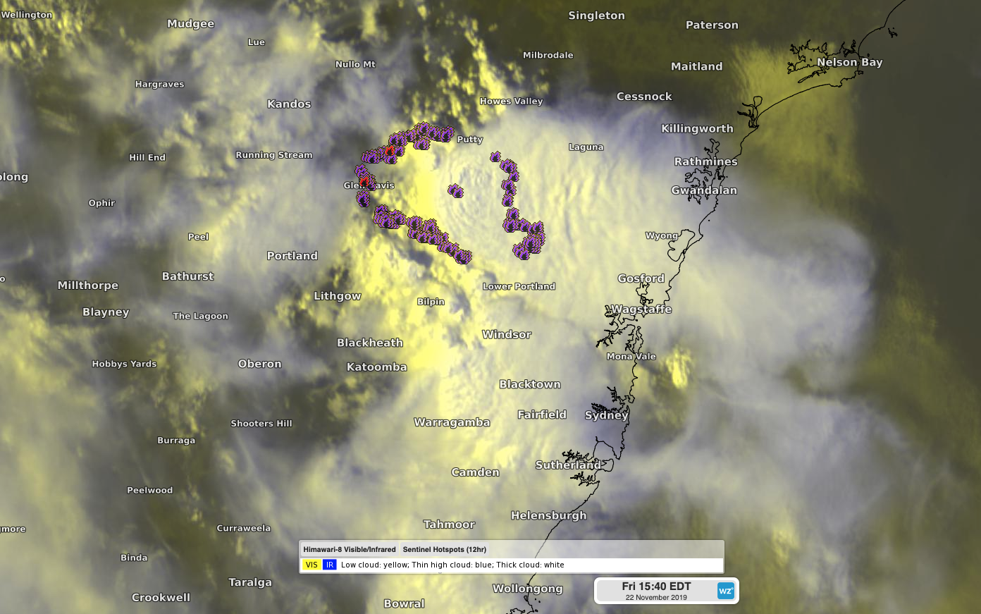
Image: Satellite image combined with bushfire hotspots shows a large thunderstorm over the Gospers Mountain fire in NSW on Friday afternoon.
The thunderstorm formed shortly after 1pm and rapidly developed into a large and dangerous storm. The assistance this thunderstorm received from the heat and ash being generated by the Gospers Mountain fire means it was classified as a rare pyrocumulonimbus cloud.
More than 10,000 lightning strikes were detected over the Gospers Mountain fire between 1:30pm and 3:30pm on Friday.
A large and potentially severe thunderstorm has developed over the Gospers Mountain fire in NSW this afternoon. pic.twitter.com/JQZtHdtdVO
— Weatherzone (@weatherzone) November 22, 2019
The storm also prompted a severe thunderstorm warning for large hail, heavy rain and damaging winds.
While any rain is welcome over the NSW firegrounds, powerful thunderstorms like this one typically cause more harm than good. Lightning can ignite new fires and blustery wind makes these fires more difficult to predict and control.
More thunderstorms are likely to develop over fire-affected parts of NSW during the next few days.
Visit https://www.weatherzone.com.au/warnings.jsp for the latest warnings and https://www.rfs.nsw.gov.au/fire-information/fires-near-me for updated information on bushfires.