
Three exceptionally dry months across Australia
The last three months have been much drier than average across large parts of Australia, with rainfall deficiencies appearing in an ever-growing area.
As the BoM’s rainfall deficiency chart for the three-month period from August to October shows, about half the country experienced serious rainfall deficiencies, severe deficiencies, or the lowest rainfall on record.
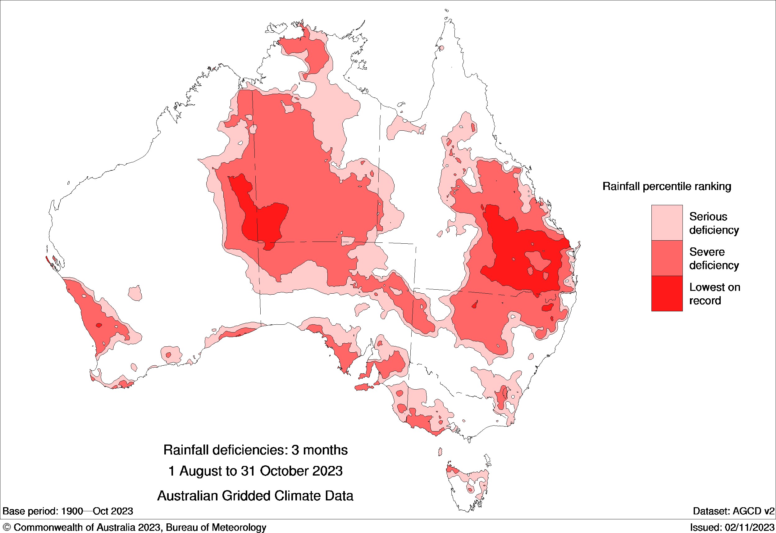
Image: For the record, serious deficiencies mean totals in the lowest 10% recorded since 1900, severe deficiencies mean the lowest 5%, while lowest on record is self-explanatory. Source: BoM.
Another way of looking at the info represented above is the rainfall anomaly chart below, which shows the actual amount of rain that fell over the Aug to Oct period compared to the long-term average.
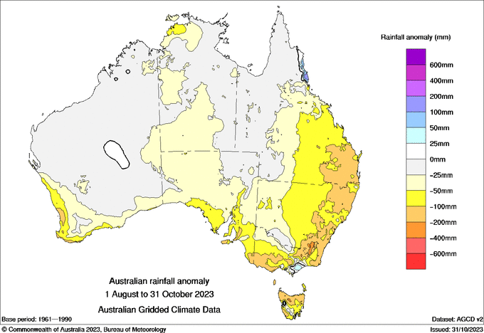
Source: BoM.
As you can see, many of Australias key agricultural areas have missed out on key late winter and spring rains.
- The southwest of WA and much of SA had a dry time of it
- Tasmania was largely dry by its relatively wet standards for that time of year
- Large parts of Qld and the NT were much drier than usual
- Rainfall in the south-east of the country, along and east of The Great Divide, was generally 100–200 mm below average for the three-month period.
The effects of the widespread dry three-month spell are illustrated well in yet another chart. This one shows soil moisture in October 2023, or sadly, the lack of it in many areas.
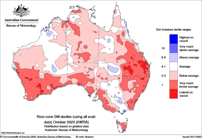
Source: BoM.
A few blue blobs here and there indicate heavy localised rainfall. For example, the day-long deluge in Gippsland and other parts of central Victoria in early October is reflected on the chart.
Soil moisture levels might have improved slightly in the first week of November, after welcome rainfall along Australia's east coast, with the chance of more to come in that region and indeed in every state and territory this week, as we explained on Monday.
But overall, the rainfall deficiency over the last three full calendar months is representative of what you'd expect during an El Niño combined with a positive Indian Ocean Dipole.
And indications for now are that November-to-January is likely to see below-average rainfall across much of western, southern and northern Australia, according to the BoM.