
Threat of more heavy rain for eastern Australia
More heavy rain and flooding could be on the horizon for parts of eastern Australia with a low pressure system set to develop over unusually warm waters in the Coral Sea, before approaching Australia.
It's been less than two weeks since a prolonged period of heavy and persistent rain caused widespread flooding in parts of NSW and southern Queensland. Some rivers are still flooded from this multi-day deluge and ground is saturated in many areas.
The landscape is primed for further flooding if any more substantial rain were to fall in the same catchments.
Unfortunately, this scenario is becoming possible from this weekend into the first half of next week.
A number of computer models suggest that a low pressure system may develop over the central Coral Sea on Friday or Saturday. The development of this low will be fueled by sea surface temperatures that are about 1ºC to 1.5ºC warmer than average for this time of year.
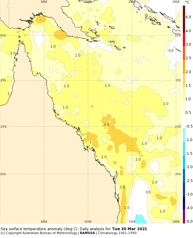
Image: Sea surface temperature anomalies in the Coral Sea on March 31. Source: Bureau of Meteorology
There's fairly good consensus between forecast models that this low will move in a southerly direction towards Queensland's central coast on Sunday, causing wind and rain to increase.
After Sunday, the movement of the low, and its likely impacts, become harder to predict.
Some models suggest the system will cause heavy rain and thunderstorms to spread along the coast and adjacent ranges in southeast Queensland and northeast NSW between Sunday and next Tuesday.
However, other models hint at the low tracking further inland and causing more widespread rain and storms between central Queensland and southern NSW from Easter Sunday until the middle of next week.
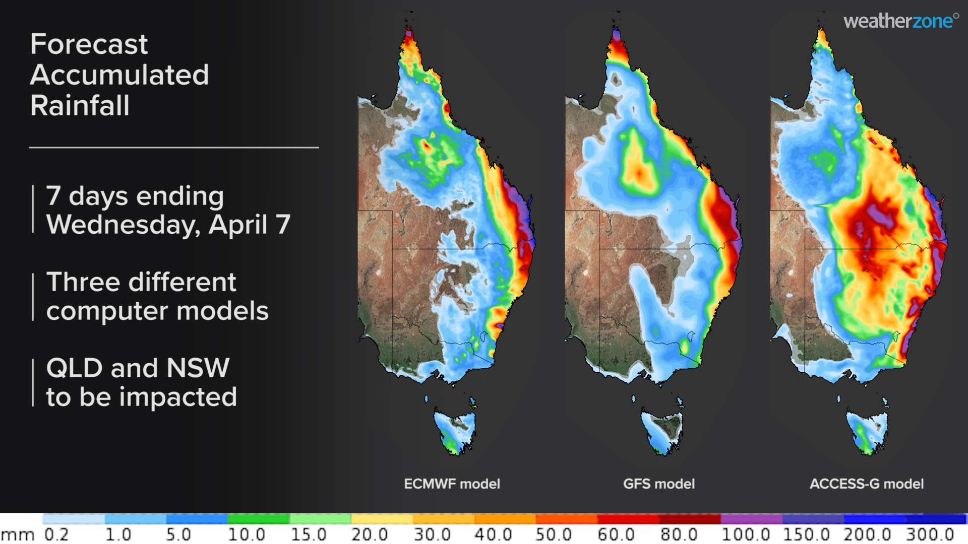
Image: Forecast accumulated rainfall during the first 7 days of April according to three different computer models.
It's too early to know exactly where and how much rain will fall from this dynamic low pressure system. But anyone living in NSW and southern or central Queensland should keep a close eye on the latest forecasts and warnings throughout the long weekend for more updates.
At this stage, the low is unlikely to become a tropical cyclone.