
This Murray-Darling Basin rainfall map says it all
Just look at all that purple and blue. If you match the colours to the bar at the right of the image, it shows how much more rain than average virtually all of the Muray-Darling Basin has seen this month.
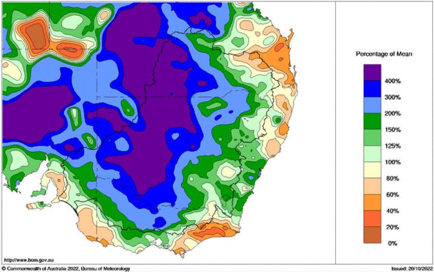
Image: Rainfall for October 2022 to date across the Murray-Darling basin. Source: BoM.
Expand the date range to the year to date, and you get a similar picture, albeit with no purple and much less blue.
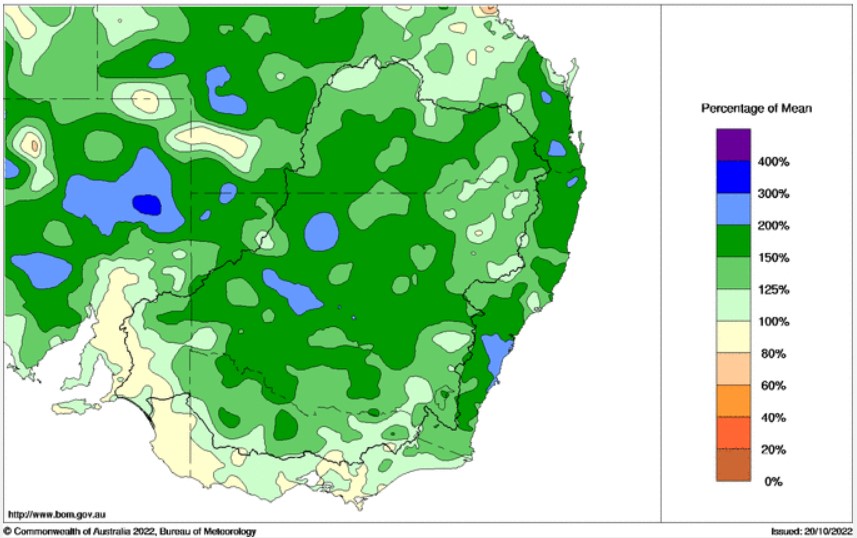
Image: Rainfall for the whole of 2022 to date across the Murray-Darling Basin. Source: BoM.
But the effect is the same. The Murray-Darling Basin (the area within the black line on both maps) is absolutely saturated across almost every one of its 1.06 million square kilometres.
That's why we're seeing widespread flooding in rivers right across the basin in NSW and Victoria. It's also why the Basin's largest dam is overflowing, and why engineers are now checking South Australian levees as the state prepares for potentially the highest Murray River flooding since 1956 in a couple of weeks time.
Meanwhile today's flood danger is centred on the NSW/Vic border towns of Echuca/Moama, where a 2.5-kilometre-long levee has been built to protect homes, lives and livelihoods from the rising Murray River, which is expected to reach levels not seen since at least 1993.
The kiosk and canoe sheds on the Murray River, Echuca. Pre-flooding…Tuesday this week…and today. #vicfloods pic.twitter.com/FEC2szeoZb
— Michael Rowland (@mjrowland68) October 20, 2022
Two types of flooding
- When we talk about Murray-Darling Basin flooding, we are talking mostly about riverine flooding, which can last for weeks or even months, as water slowly flows through flat country along our inland rivers. That's why the official flood warnings for the Murray already extend into November.
- The other type of flooding is flash flooding, which the BoM describes as flooding that occurs within six hours of rainfall. It tends to be more common in areas with steeper terrain.
Flash flooding is likely in some areas today, especially later this afternoon and into the early evening as potentially severe thunderstorms develop across a wide area (see this story we wrote this morning)
As ever, please check our warnings page for the latest flood and other severe weather info.