
This is what a 60 kilometre-long tornado trail looks like from space
In late April, a powerful tornado travelled across a rural area in eastern Texas. This destructive tornado left a scar on the landscape that stretched for roughly 60 kilometres. After the storm passed, a NASA satellite moved over Texas, capturing high-resolution images of the tornado's trail of damage from space.
The images captured by NASA's Landsat 8 satellite show the path of the tornado in incredible detail. You can see where it crossed forests and farms, traversing natural and man-made features without missing a beat.
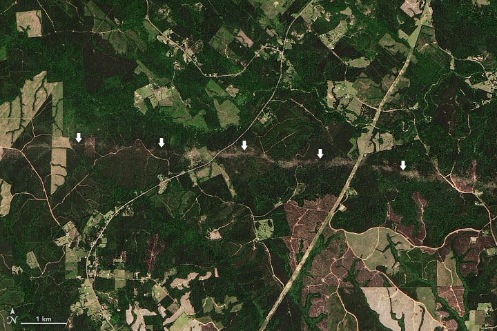
Image: Arrows point to a trail of damage left by a tornado that moved across eastern Texas on April 22nd. The image was captured on April 23rd by NASA's Landsat 8 satellite. Source: NASA Earth Observatory / Joshua Stevens.
According to the United States' National Weather Service, the tornado produced wind gusts of around 210km/h and reached a little over half a kilometre wide at its largest size.
NASA's satellite images are used frequently to help carry out damage assessments from tornadoes in the United States. They also give us a glimpse of the sheer destruction these systems can cause on the surface of our planet.
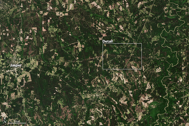
Image: A larger view of the trail left by a tornado in eastern Texas late last month. The white box shows the area that has been expanded in the first image of this article. Source: NASA Earth Observatory / Joshua Stevens.
According to preliminary figures, last month was the second-most active April on record in the United States based on the overall number of tornadoes reported.