
The story behind a stunning Aussie weather pic
A beach and snow-covered hills. The more you look at this image, the more remarkable it is.
We all know that mainland Australia sees regular snow – mostly in NSW, Vic and the ACT, and also occasionally in elevated parts of SA, WA, and even southern Qld. We also know that snowfalls can occur in autumn and spring in most of the areas mentioned.
It also goes without saying that Australia has plenty of beaches.
But when have you seen the two together in one image on mainland Australia?
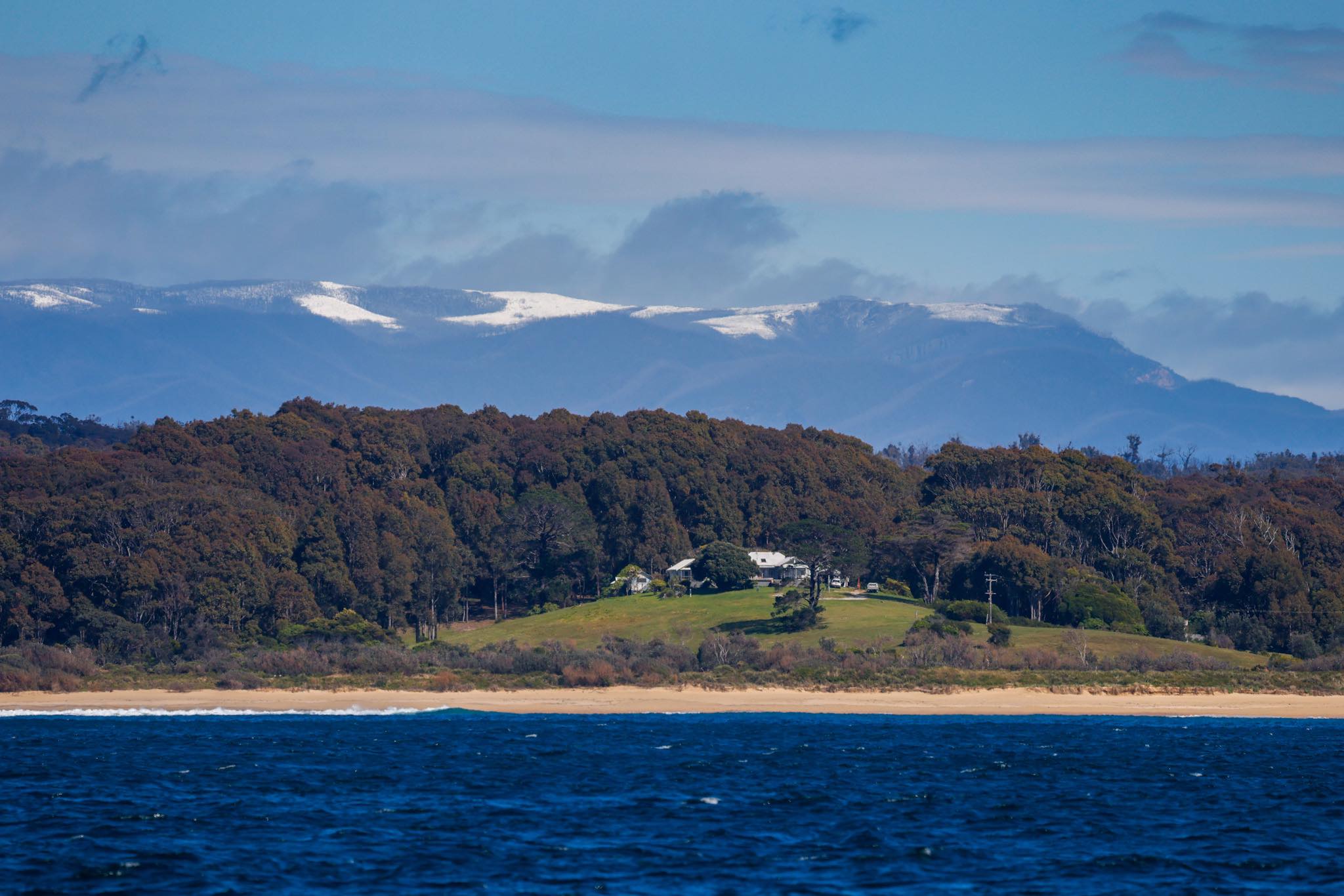
Image: Anyone for surfing and skiing? Source: David Rogers Photography.
Our snowiest mountains are generally a couple of hours inland, and well beyond viewing distance from the coast. So again we ask:
When have you ever seen snow and a beautiful Aussie beach in one image on the Australian mainland?
This obviously happens in Tasmania with great frequency. We've all seen that classic shot of boats at Hobart's Constitution Dock with a snowy kunanyi/Mt Wellington in the background, or similar shots from a Hobart beach.
But the image above, taken last weekend at Bermagui on the NSW far south coast, was something else.
The image was taken by South Coast photographer David Rogers, whose stunning portfolio you can view here. It shows Haywards Beach, just north of Bermagui, looking roughly westwards over nearby ranges up towards Wadbilliga National Park.
Wadbilliga has some high ground up over 1300 metres, but the snowy peaks in this shot aren't that high. Indeed, locals said the snow extended all the way down to about 700 metres.
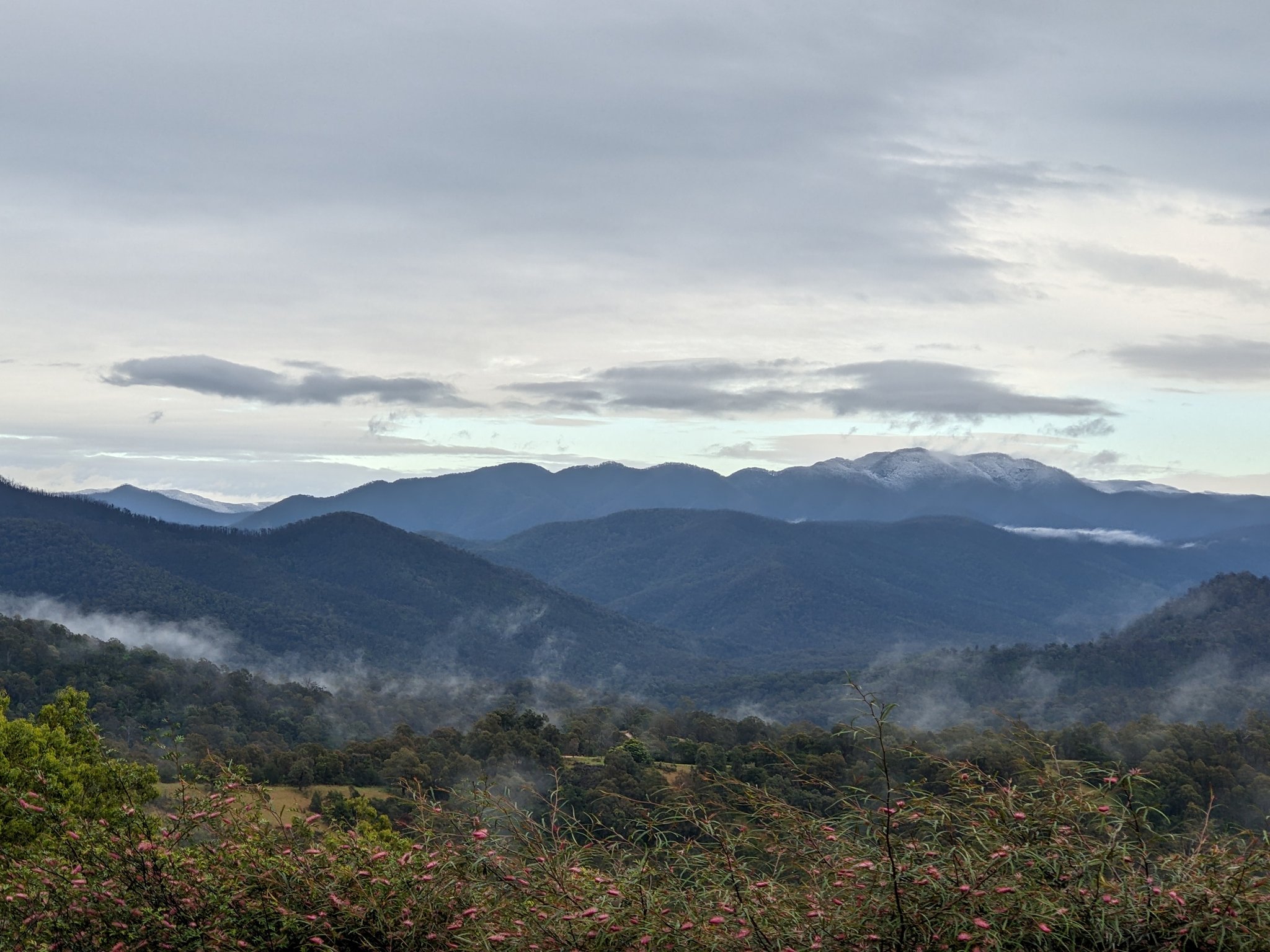
Image: The view to the nearby ranges from Rock Lily Bush Retreat. Source: Stephen Collins.
So what happened?
The coastal ranges of the NSW far south coast tend to miss snow in the classic winter systems which come from the west. After depositing most of their moisture on the Snowy Mountains, the systems are generally too dry by the time they reach the coast.
But as Weatherzone meteorologist James Rout explains, on Saturday night a low pressure system formed off the NSW coast. Along with a high pressure system sitting over Australia, it caused southerly winds to develop, which dragged a cold pool of air over the far southeast.
There was already a lot of moisture in the area from the weekend's wet weather, and with the "cooling effect”"(read more here) kicking in with heavy precipitation, the snow level dropped lower than usual.
Snow was on the ranges to the west / southwest of Cobargo - no snow on Gulaga. pic.twitter.com/GfVkVXN563
— Silver Dory (@thesilverdory) October 10, 2022
The result was very heavy snow for any month (but especially October) in the town of Nimmitabel, about 50 km inland and around 1070m above sea level.
And as stated above, we also saw snow to low levels in ranges that were close enough to view clearly from south coast beaches. If you went for a drive, you could literally have built a sand castle, then had a snowball fight, within about 45 minutes.
Meanwhile the NSW far south coast weather has since warmed up a little, with tops in the high teens and occasional showers in most places from Wednesday onwards.