
The rare phenomenon of thundersnow struck Australia this weekend
Crank up the AC/DC as you watch this video from the Victorian ski resort of Mt Buller on the weekend.
It's thundersnow. Yes, thundersnow, as in a thunderstorm and snowstorm all rolled into one magnificent mix of meteorological mayhem.
But how does thundersnow happen? Aren't thunderstorms usually associated with warm air masses?
Typically, yes. But as Weatherzone meteorologist Ben Domensino explains, it's not that simple.
"With most thunderstorms, you have relatively warm air sitting below cooler air, which creates an unstable atmosphere and causes the warmer air to rise.
"In snowy areas, there is generally only a small temperature contrast between the surface and upper levels, so there's usually not enough instability to create the uplift needed for thunderstorm development.
"But when you've got a very cold airmass (as we had over the Australian Alps this weekend), there can be enough of a temperature contrast between surface and upper level temperatures to make storms."
That may well be what occurred at Mt Buller at around 9:30 pm on Saturday night, at which time lightning flashes occurred which can clearly be seen in the video above. It was -1.9°C at the resort at the time.
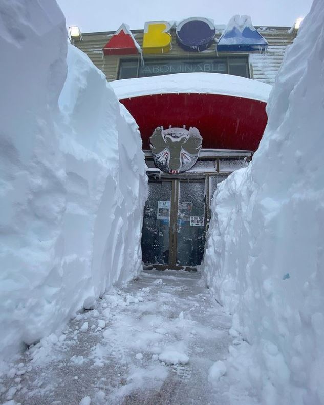
Image: Whoever dug that deserves the week off. Source: mt_buller Instagram.
Meanwhile, as you can see in the image above, Mt Buller has had a fair whack of snow this week. As in, a massive dump.
The resort's official accumulated snow depth is 94 cm, but a lot more than that has fallen, and with natural drifting of snow in the strong winds, plus snow clearing, you can end up with snow walls that are literally metres high.
Mt Buller, of course, wasn't the only resort to receive heavy snowfalls this week, and especially over the weekend. The NSW resorts of Perisher, Thredbo and Charlotte Pass – all of which are still open to regional NSW and ACT visitors despite the greater Sydney area lockdown – received in the vicinity of 65 to 85 cm each.
And if you think the Mt Buller people had some digging to do, spare a thought for the Perisher bus drivers!
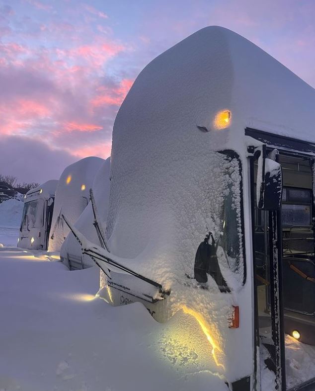
Image: It became a double-decker bus overnight. Source: perisher_resort on Instagram.
More snow is expected in the NSW and Victorian snowfields this week, especially on Wednesday, then potentially again on Sunday into Monday to celebrate the arrival of August.
There will be high winds and warm spells between the cold outbreaks, so it'll be one of those mixed bag kind of weather weeks for those fortunate few who are able to be there.
And remember, Weatherzone's snow page has everything you need to know about current and forecast conditions in the mountains.