
The Madden-Jullian Oscillation: what it is and how does it influence Australia?
One of the most important Australian Climate Influences is the Madden-Jullian Oscillation (MJO). You may have heard about MJO, but do you know what it is?
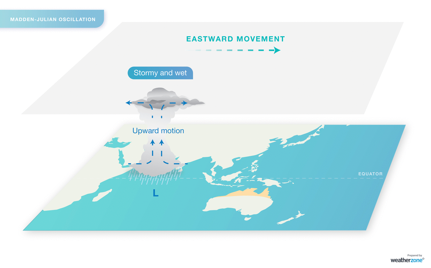
The Madden-Jullian Oscillation (MJO) is a global-scale feature of the tropical atmosphere which is characterised by an eastward moving “pulse” of cloud and rainfall near the equator. Generally, this pulse recurs every 30-60 days and can occur at any time. However, it influences Australia mostly between October and April.
Rainfall, wind, temperature, monsoon periods, and Tropical Cyclones are impacted by the MJO. During the summer months, the MJO has the greatest effect on the tropical areas of Australia. Such as:
- Enhanced rainfall across the tropics
- Affecting the timing and intensity of “active” monsoon periods in Australia
- Increased chances of Tropical Cyclone formation
The MJO can be described as either, active, inactive, or weak. Mathematical methods provide a measure of the strength and location of the MJO along the equator around the globe.
When MJO is close to Africa and in the Indian Ocean and is considered an inactive phase in Australia. As this pulse migrates eastward from the Indian Ocean towards the Maritime Continent, it indicates a transition, that may influence Western Australia. When this pulse is over the Maritime Continent, we have an active MJO phase. And when it's over the Western Pacific is an active area or a transition in Queensland.
The most recent Bureau of Meteorology update indicates that we are in an inactive phase. However, it’s forecasted that the signal should become more active between the 19th and 31st of December.
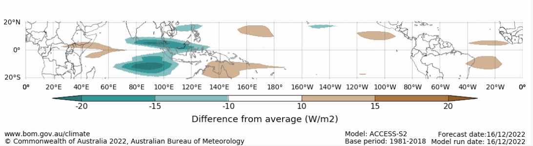
Last update 16 December 2022 Daily Madden-Julian Oscillation, source BOM.
What does it mean? There is a chance of a Tropical Low or even a Tropical Cyclone developing over Australia's north in the last days of 2022. However, this is just one of the signs we are monitoring. Stay tuned for Weatherzone weather forecast updates and Bureau of Meteorology alerts.