
The Indian Ocean Dipole plunges into negative IOD territory
The Indian Ocean Dipole (IOD) index has dropped below –0.4°C – the critical threshold for a negative IOD event if sustained. Could Australia see its first negative IOD event since 2022?
What is the Indian Ocean Dipole (IOD)?
The IOD is a measure of the difference in Sea Surface Temperatures (SST) across the equatorial Indian Ocean.
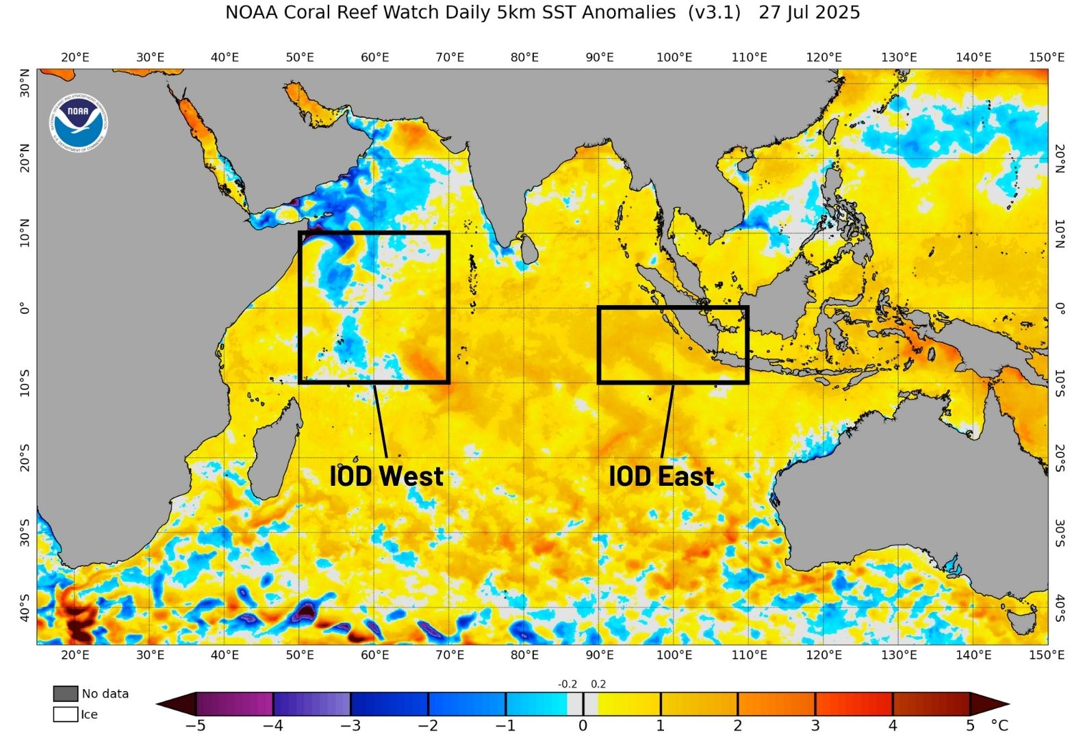
Image: Sea surface temperature anomalies across the Indian Ocean and the IOD monitoring regions on July 27, 2025. Source: NOAA
A negative IOD occurs when cooler-than-average water sits on the western side of the Indian Ocean, near the Horn of Africa, and warmer-than-average water lies on the eastern side of the Indian Ocean, near Indonesia. A positive IOD is the opposite of this pattern (cooler water in the east, warmer in the west).
Each phase of the IOD also influences atmospheric conditions above the Indian Ocean and surrounding countries. For Australia and Indonesia, a negative IOD typically increases the likelihood of above average rain over large areas, while also promoting cooler days in Australia’s south and east with increased cloud cover.
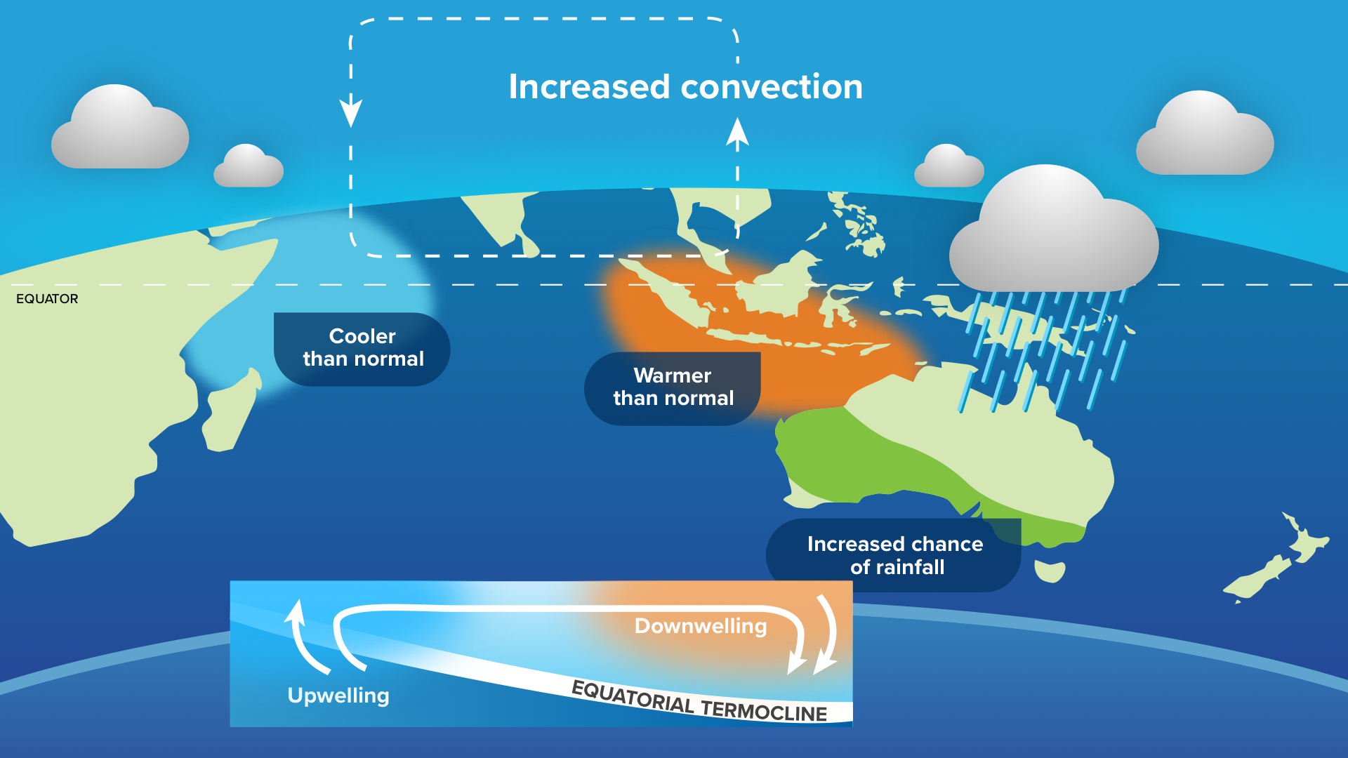
Image: Typical oceanic and atmospheric patterns during a negative IOD.
IOD events typically occur between May and November and break down when the Australian monsoon arrives in late spring or early summer.
Do we have a negative IOD event?
The short answer is: No, not yet.
For a negative IOD event to be declared, the IOD index typically needs to be sustained below –0.4°C for at least eight weeks. The latest weekly averaged value of –0.44°C in the week leading to July 27, 2025, could be the start of this eight-week period, but we’ll need the index to remain below this threshold and the atmosphere to respond accordingly.
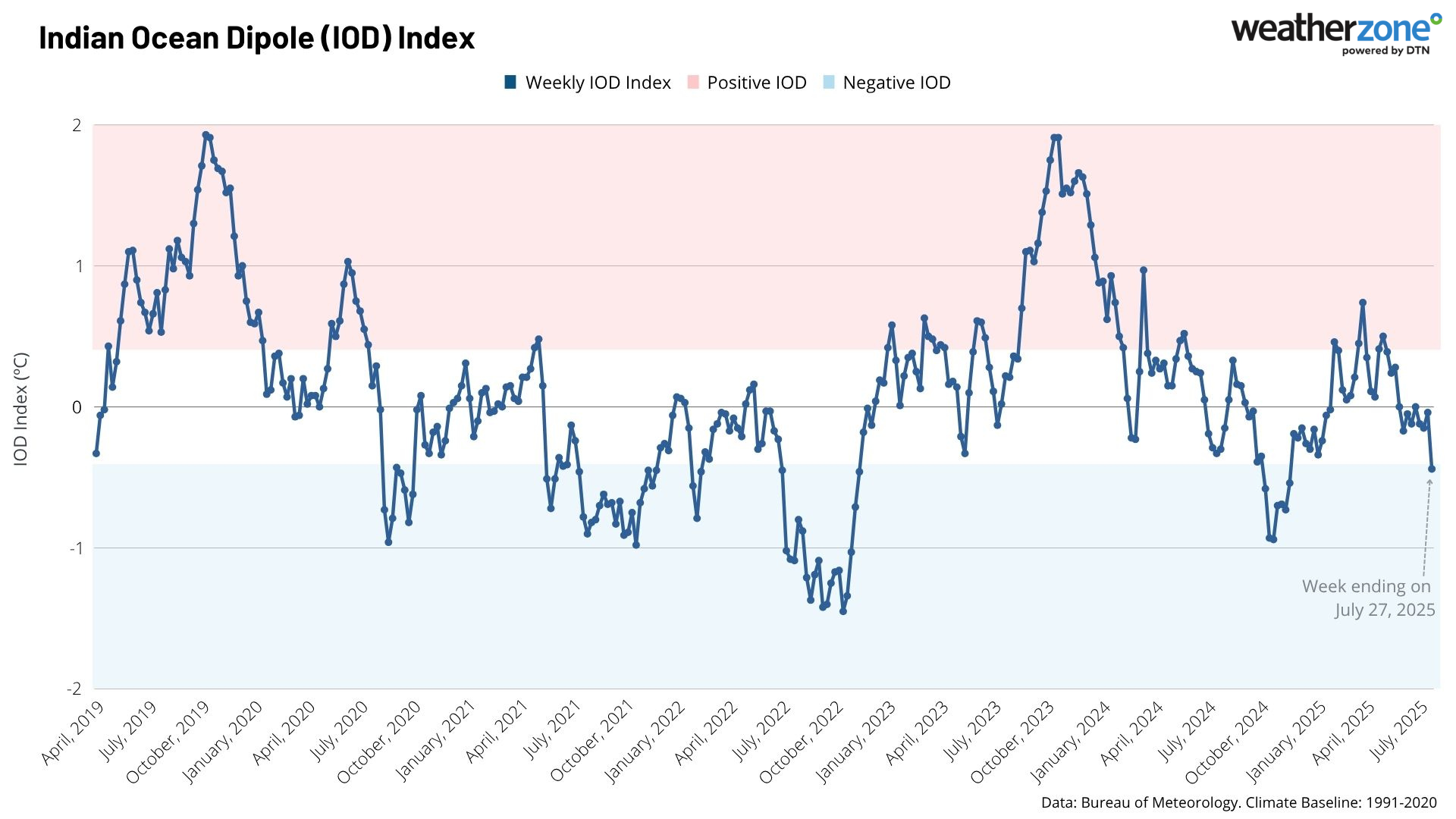
Image: IOD index between April 2019 and July 2025.
While the IOD index may bounce back up in the coming week or two, the SST gradient across the Indian Ocean is forecast to steepen towards into the negative values, reaching its peak in September.
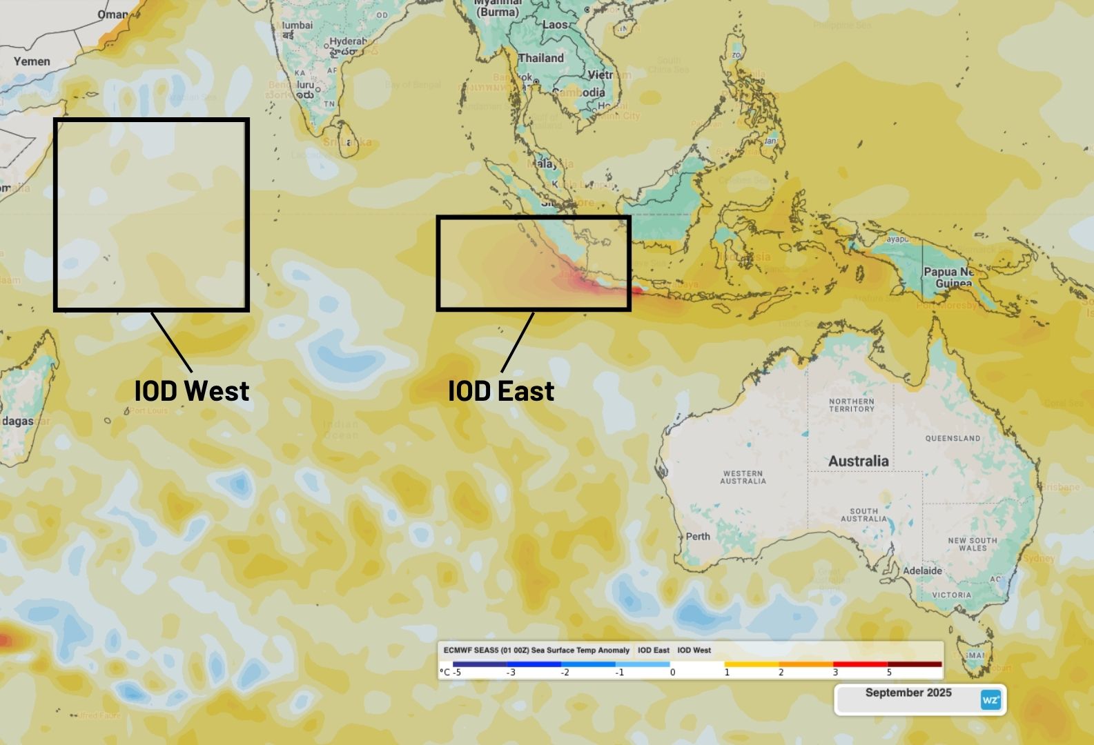
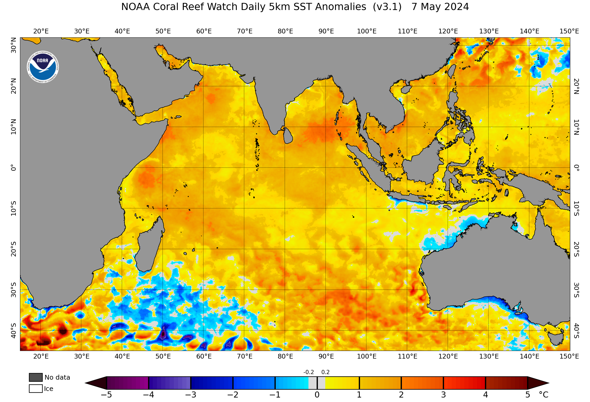
Image: Forecast SST anomalies across the Indian Ocean and IOD regions in September 2025 with very warm waters near Indonesia in the IOD East region.
The IOD index typically bounces back into neutral territory during November with the return of the northwest monsoon across the region. If the IOD index can remain in the negative IOD range over the coming 2-3 weeks, the likelihood of a negative IOD will be much greater as we head into the forecast peak warm SST during September.
How does this possible IOD compare to past negative IOD events?
Over the past 5 years, Australia has experienced 2 moderately strong negative IOD events in 2021 and 2022, with a positive event in 2023. In 2020 and 2024, weak negative IOD events were only 1-2 weeks off occurring, but then the index returned to neutral.
In terms of length and strength, this year's possible IOD is relatively late, so should fall somewhere between the 2020 and 2024 near events, and the stronger 2021 and 2022 negative IOD events.
Other climate drivers that have influenced the weather around Australia since 2020 include, the influences of La Niña events between 2020 and 2022, with an El Niño event in 2024. SST around Australia also ranged between 0.5 and 0.9°C above average, increasing the moisture content available.
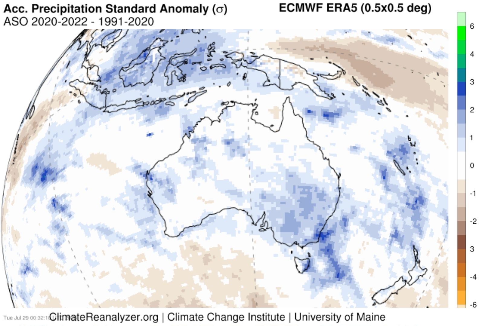
Image: Averaged accumulated precipitation anomaly across August, September and August during 2020, 2021 and 2022. Source: ClimateReanalyzer.org
Spring outlook for Australia and Indonesia
Even if a true negative IOD event is not declared, ample moisture will remain available with very warm SST near Indonesia, to the northwest of Australia. An increased likelihood of northwest cloudbands tapping into this moisture brings increased potential for rainfall, cloud cover and milder days stretching into central and southeastern Australia during spring.
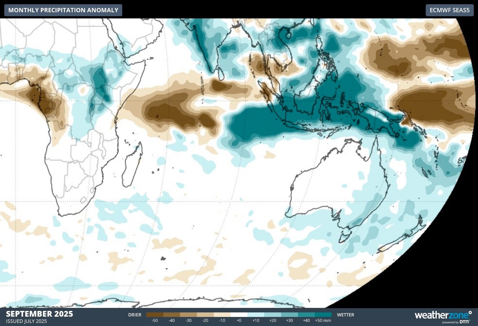
Image: Forecast monthly precipitation anomalies across the Indian Ocean, Indonesian and Australian regions in September 2025.
The warm waters near Indonesia should promote increased potential for heavy rainfall, flooding and landslides in the coming months. An intense and potentially early start to the wet season could also grip parts of Sumatra, Java, Borneo and Sulawesi.