
The cold front has arrived
A cold front is crossing southeast Australia Saturday morning, bringing predicted damaging winds, showers, storms and alpine snow.
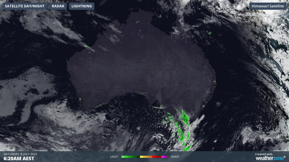
Image: Satellite loop showing a cold front crossing southeast SA and western VIC this morning with a deep low to the south.
The strongest winds so far have been measured closest to the front over South Australia and western alpine Victoria, with Neptune Island recording a 135 km/h westerly gust this morning–its strongest wind gust since July 2016. Mt Buller clocked a 109km/h north-northwesterly gust before dawn and winds there and over the larger alpine area are going to increase during the afternoon as snow also increases.
Blizzards should develop by late afternoon with alpine wind gusts peaking above 110km/h this afternoon and tonight. Snow amounts of over half a metre are expected between now and Sunday evening for upper parts of the NSW Snowy Mountains. Victorian alpine areas are slightly less favoured by the northwesterly winds but should still see 20-40cm. Many Victorian peaks have already seen 5-10cm in the last 24 hours in cold southwesterly winds behind the last front that crossed on Thursday.
Elsewhere, broad areas of SA, VIC, NSW/ACT and Tas will see gusts in excess of 90km/h on Saturday and Sunday. Damaging wind warnings are in place across the four states with the current area demarcated by the dashed orange line in the header image. Winds will be strongest for most areas on Saturday afternoon but will extend through the night and into early morning over alpine areas and eastern VIC and NSW, including the Illawarra south of Sydney.
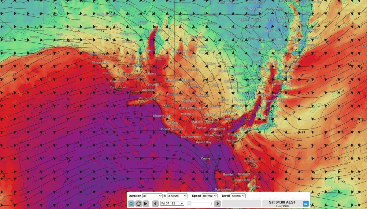
Image: EC model forecast wind gusts between Saturday morning and Sunday afternoon.
Another weaker cold front will skim the southern parts of southeast Australia on Monday, maintaining some gusty winds and further alpine snow showers (another few centimetres), before conditions ease by Tuesday.