
Tasmanian deluge tops 200mm
Tropical moisture has made its way all the way south to Tasmania, delivering some of the state’s heaviest daily rainfall totals on record for May.
In the 24 hours to 9am Thursday, notable readings included:
- 222mm was recorded at the rural locality of Gray, a few kilometres inland from the state’s east coast near the town of St Marys. This was the 4th-wettest May day on record at any Tasmanian site.
- 134.6mm was recorded at kunanyi/Mt Wellington above Hobart, with heavy rain falling steadily throughout the 24-hour period.
- 124.2mm fell at St Patricks Head, just north of Gray.
- 122.6mm collected in the rain gauge at Longley, a rural locality on the southern flank of kunanyi/Mt Wellington.
Hobart also didn’t miss out, with 25.6mm in the Tasmanian capital. While this was considerably less than many other Tasmanian locations, it was still the city’s heaviest daily rainfall total in 10 months.
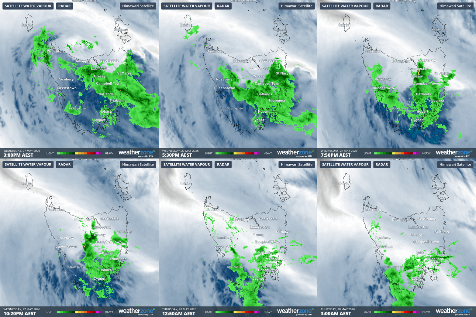
Image: 12-hour radar and atmospheric water vapour loop over Tasmania to 3am on Thursday, May 28, 2026 (AEST). Source: Weatherzone.
Why such heavy rainfall in Tasmania?
As Weatherzone meteorologist Ben Domensino wrote on Wednesday, moisture streaming in from the Tasman Sea was heading directly towards Tasmania from the northeast, in a meteorological phenomenon known as an "atmospheric river".
While the most intense phase of this event was relatively short lived, the moisture influx was still extreme enough to generate huge rainfall totals.
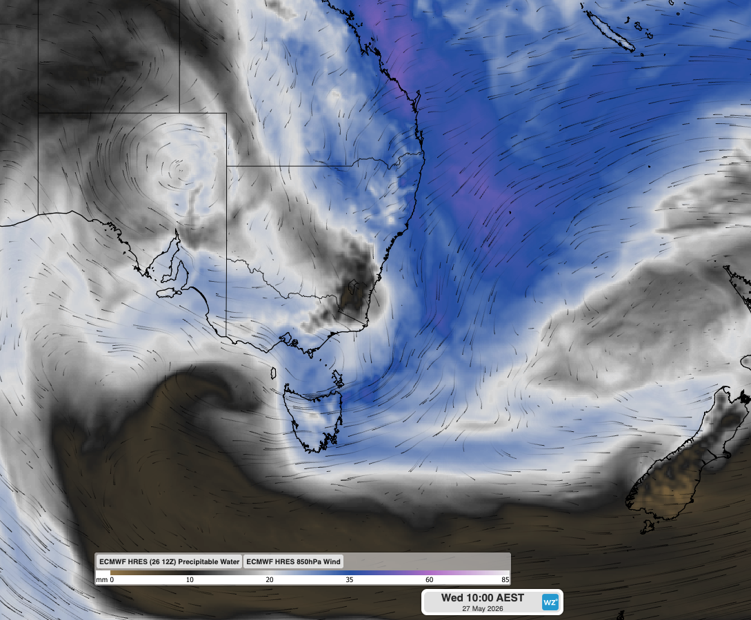
Image: Modelled precipitable water (a measure of atmospheric moisture) and 850 hPa winds at 10 am AEST on Wednesday, May 28, showing the moisture-laden air from the northeast that inundated eastern Tasmania overnight. Source: Weatherzone.
A moderate flood warning is currently in place for Tasmania's South Esk River. The river empties into the sea near Launceston and is famous for being Tasmania’s longest river (at 252km, just beating the Derwent, which empties into the sea at Hobart).
While Launceston itself saw only 10mm in the 24 hours to 9am Thursday, the South Esk rises in the elevated terrain of the Ben Lomond Plateau, close to the east coast weather stations which saw rainfall totals of well over 100mm overnight – hence the current elevated river level.
Why did kunanyi/Mt Wellington receive so much more rain than Hobart city?
The 25.6mm that fell in downtown Hobart was only 19% of the 134.6mm that fell up on the mountain.
The discrepancy was due to the orographic effect, where air rises and cools as prevailing winds drive it into a mountain or mountain range. This cooling typically causes heavy precipitation, as cool air can’t hold as much moisture as warmer air.
It is of course very common for kunanyi/Mt Wellington to receive much more rainfall than Hobart city. Usually, that happens in westerly systems, when only light showers fall in Hobart as the air dries out on the leeward side of the mountain.
On this occasion, the system came from the east and northeast, so while Hobart got a very handy soaking, the mountain got a much bigger one.
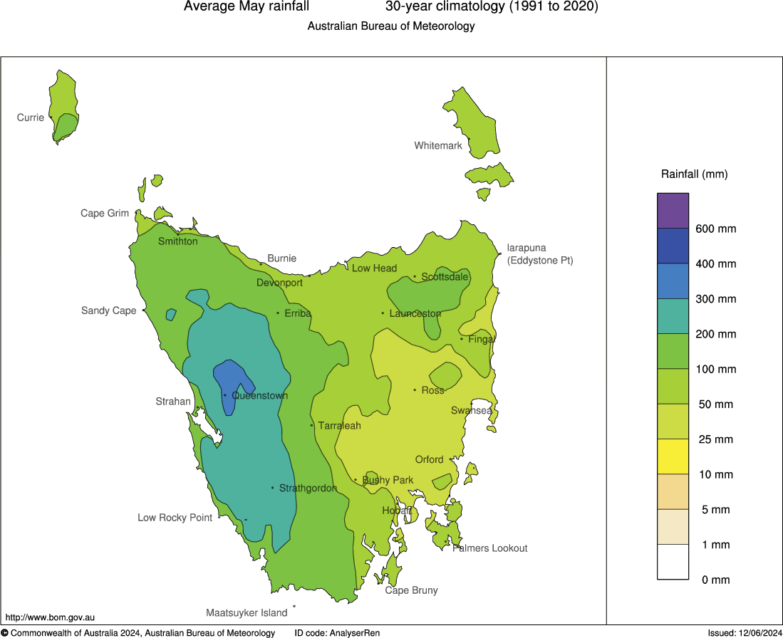
Image: Average Tasmanian rainfall for May, showing how eastern areas are usually much drier than the rest of the state. Source: BoM.
What next for Hobart?
While easterly showers continue on Thursday morning in Hobart with a further 1.6mm in the gauge between 9am and 11am, only a light shower or two is expected in coming days, as winds swing to cooler westerlies more typical of the season as the weekend progresses.