
Tasmania braces for powerful winds
A strong cold front will pass over Tasmania today, bringing with it intense north to northwesterly winds as well as rain and isolated thunderstorms. The Bureau of Meteorology has issued a Severe Weather Warning for Damaging winds across Tasmania today. The system is expected to sweep across the state, reaching western areas in the early afternoon, central regions in the mid-afternoon, and moving east by evening. As the front passes, winds will shift to a more westerly direction and gradually subside.
Damaging wind gusts have already been observed in elevated locations, including gusts of 107km/h at Scotts Peak and 113km/h at Mount Wellington this morning. Furthermore, a gust of 98km/h at Maria Island at noon was the strongest gusts observed at that location in more than 9 months.
High-elevation areas such as the Central Plateau and Mount Wellington will continue to face the most severe threat this afternoon. Here, damaging winds may average 70 to 80 km/h, with isolated gusts possibly exceeding 120km/h within heavy showers and thunderstorms.
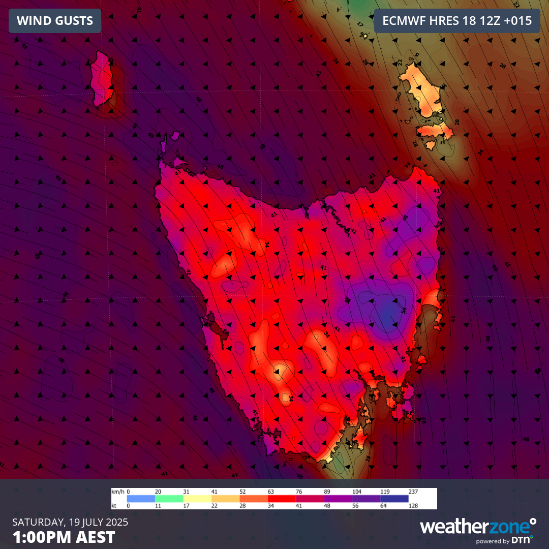
Image: Forecast wind gusts at 1:00pm AEST Saturday afternoon from the ECMWF model.
Rain is expected to tend to snow in higher elevations this afternoon and evening as temperatures tumble in the wake of the cold front. Peak snowfall accumulations of 5-15cm will be possible above 1,000m by midnight.
Be sure to check the latest warnings as this situation unfolds.