
Sydney's wettest August in 9 years to get even wetter this weekend
There has only been one completely dry day in Sydney so far this month and the city will see more wet weather this weekend, continuing its wettest August in 9 years.
In an average August, Sydney would typically receive about 80 mm of rain during the entire month. But this August has already exceeded this long-term average, with 98 mm of rain accumulating in the city during the eight days ending at 9am on Friday, August 8.
Despite only being 8 days into the month, this is already Sydney’s wettest August since 2016. It has also been the city’s 11th wettest start to August in 168 years of records.
Unfortunately for Sydneysiders who prefer dry days and uninterrupted weekend sport, more rain is likely to soak Sydney and surrounding areas on Saturday and Sunday.
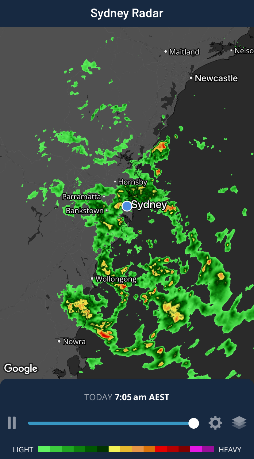
Image: Radar on the Weatherzone app showing rain over Sydney and surrounding areas on Saturday morning.
Moisture-laden onshore winds will cause showers to stream over eastern NSW from Friday night into the weekend. These showers will cause intermittent periods of wet and dry weather throughout the weekend.
Abnormally warm sea surface temperatures in the Tasman Sea will help provide moisture in the atmosphere for this weekend’s showers. Water off the southern half of the NSW coast is currently 2 to 3°C warmer than average, which is in the top 10% of historical records for early August. Warmer water causes more evaporation, which provides fuel for rainfall.
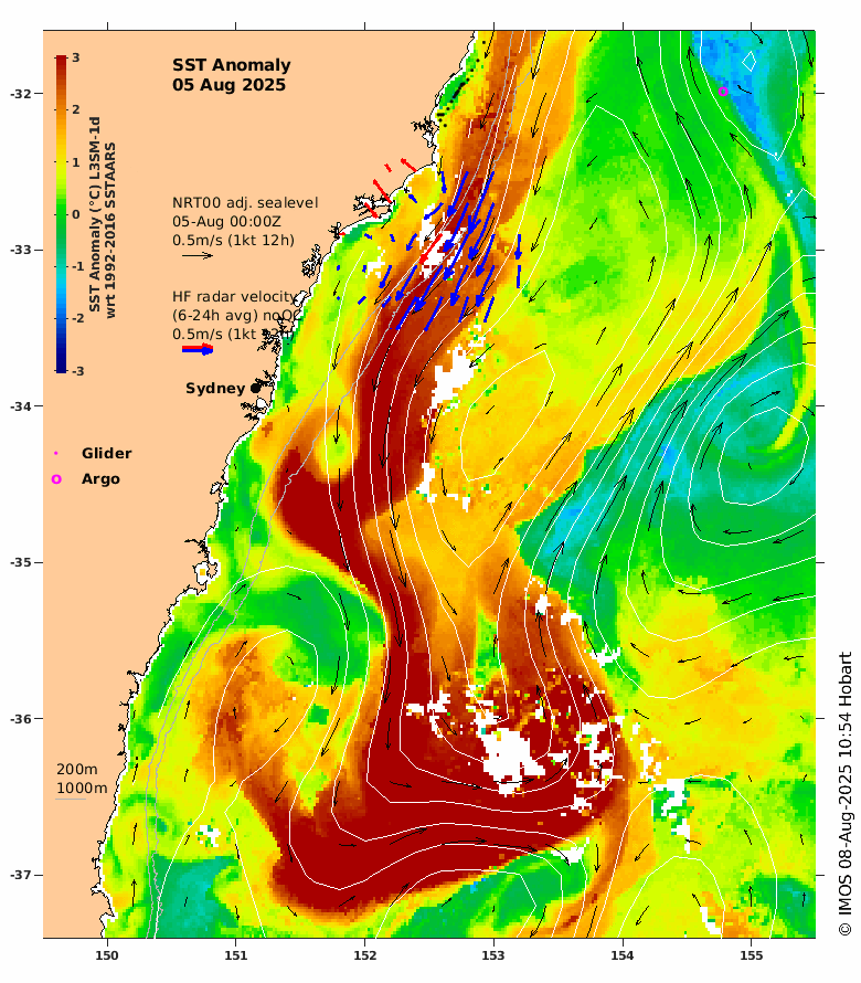
Image: Sea surface temperature anomalies near central NSW on August 5, showing an abnormally warm tongue of water sitting off the coast. Source: IMOS
Coastal areas of Sydney should see about 5 to 15 mm of rain on Saturday and a bit less on Sunday. Falls will be lighter as the showers move inland towards the ranges. Similar rainfall rates will also occur for most other areas in eastern NSW this weekend.
Showers should ease in Sydney early next week as a high pressure ridge weakens over eastern NSW.