
Sydney's foggy start
Much of the Sydney Basin awoke to a thick blanket of fog this morning.
A cooling south to southeasterly wind pushed moisture into the Sydney basin throughout yesterday afternoon, increasing humidity. Aided by light winds, cooling overnight temperatures led to the high water content in the air condensing into a thick veil of fog early this morning across western suburbs of Sydney.
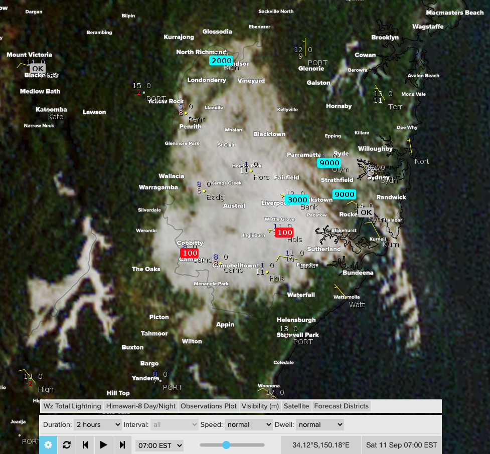
Image: Satellite imagery showing a broad coverage of fog over Sydney’s western and eastern suburbs at 7am this morning. Visibility observations dropped to 100m in Camden and Holsworthy (as well as Canterbury and Richmond earlier).
Light W/NW winds helped move this thick fog into eastern suburbs, including the Sydney Harbour around sunrise. This thick veil brought a Road Weather Alert for reduced visibility in fog for all Sydney suburbs. Webcam imagery below shows this impressive movement of fog into the Harbour around 7am this morning, courtesy of https://webcamsydney.com/.
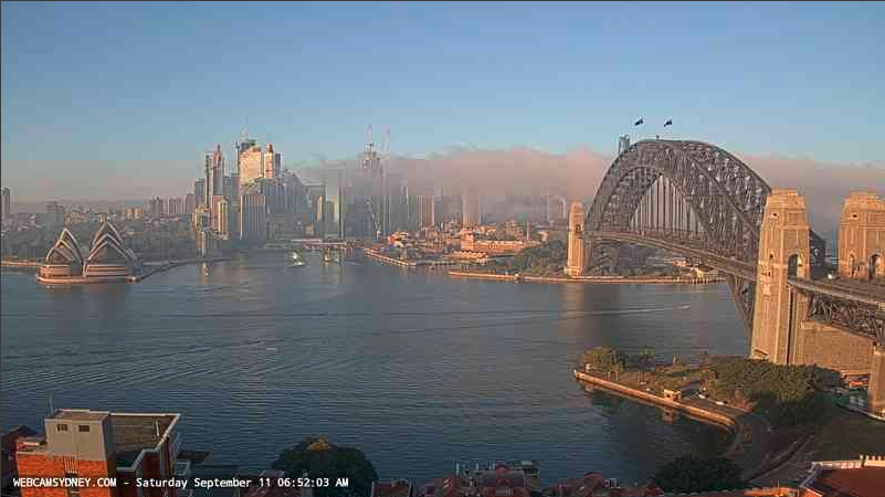
Image: Here it comes! (https://webcamsydney.com/)
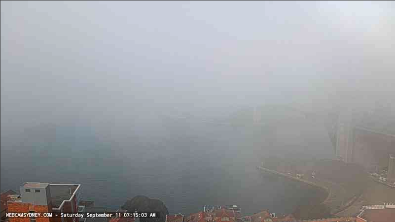
Image: Less than 30 minutes later. Where did that glorious summery morning go?? (https://webcamsydney.com/)
This fog is now constrained to the western suburbs, but is quickly being burnt off by the rising sun and will soon give way to a very warm and sunny day across the Sydney Basin. A drier airmass and stronger winds tonight will reduce the risk of any fog tomorrow morning.