
Sydney's coldest start to winter since 1989
Bob Hawke was Australia’s prime minister when Sydney last experienced an opening week of winter this cold.
The temperature at Sydney’s Observatory Hill failed to reach 18.5ºC during the first six days of June and is expected to top out at around 17ºC today.
While these maximum temperatures are close to the city’s long-term June average of 17ºC, it’s rare to see a run of days this cold at the start of winter in the modern climate.
The last time the first seven days of June stayed below 18.5ºC at the Observatory Hill weather station was in 1989. Prior to that year, such a feat was more common.
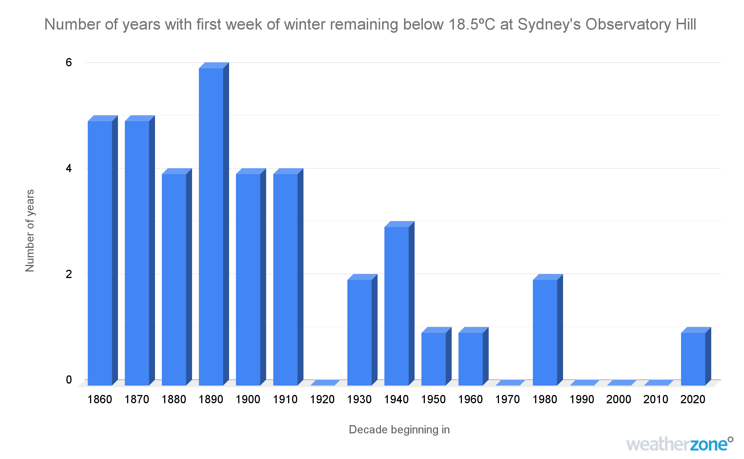
Image: Number of years per decade where Sydney’s Observatory Hill weather station failed to reach 18.5ºC during the first week of winter.
So, what caused such a cold start to winter this year?
Sydney and the rest of southeastern Australia has been hit by a flurry of cold fronts over the past week. This stagnant wintry weather pattern has caused a sustained stream of cold air to flow over Australia’s southeastern states.
This week is a good example of how cold periods of weather can still occur in a warming climate. But as the graph above shows, such cold spells are happening less frequently as the background climate continues to get warmer.
Australia’s average maximum temperature during winter has warmed by around 1.5ºC since 1910.